The
Orienteering and GPS Course at Louise Moore Park
Description and Purpose
Description and Purpose
This orienteering course will be used to
help scouts complete the First Class orienteering requirement. It
can also be used by anyone
interested in orienteering or anyone who wants to test a GPS unit.
This course was designed and constructed as part of John Salter's Eagle Project. Constructed and maintained by Troop 317, Beth Twsp, PA.
Directions to Louise Moore Park
From William Penn Highway, Beth Twsp:
Turn left at St John's Church onto Church Road, follow Church Road northeast to Country Club Road.
Turn left (north) on Country Club Road. Louise Moore Park is 0.9 miles from the intersection. Turn left into the west side of the park.
From Route 33:
Take the Hecktown Road West exit. Follow Hecktown Road to Country Club Road, and then turn left (south) onto Country Club Road.
Louise Moore Park is 0.3 miles from the intersection. Turn right into the west side of the park.
interested in orienteering or anyone who wants to test a GPS unit.
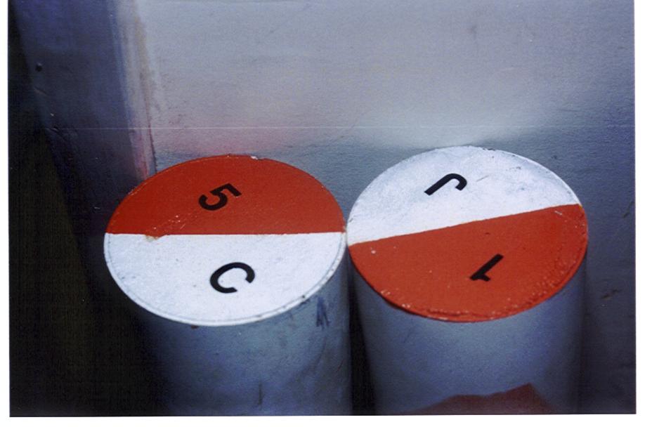
The markers are 20 lb. concrete
cylinders. They are buried so that the top is level with the
ground, so that mowers may drive
over the markers without the possibility of hitting them. As a result, these control points make for a challengeing course as they
are not visible from long distances. Scout leaders who wish to make the course easier for their scouts can place flags near each
control point to make them easier to locate.
This course was designed and constructed as part of John Salter's Eagle Project. Constructed and maintained by Troop 317, Beth Twsp, PA.
Directions to Louise Moore Park
From William Penn Highway, Beth Twsp:
Turn left at St John's Church onto Church Road, follow Church Road northeast to Country Club Road.
Turn left (north) on Country Club Road. Louise Moore Park is 0.9 miles from the intersection. Turn left into the west side of the park.
From Route 33:
Take the Hecktown Road West exit. Follow Hecktown Road to Country Club Road, and then turn left (south) onto Country Club Road.
Louise Moore Park is 0.3 miles from the intersection. Turn right into the west side of the park.