
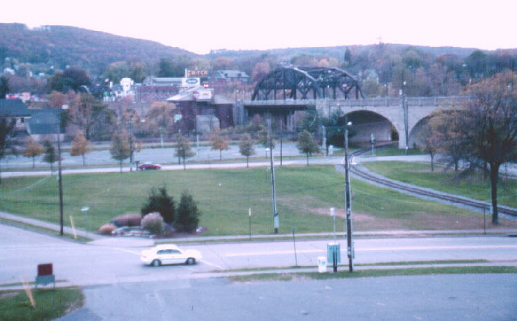
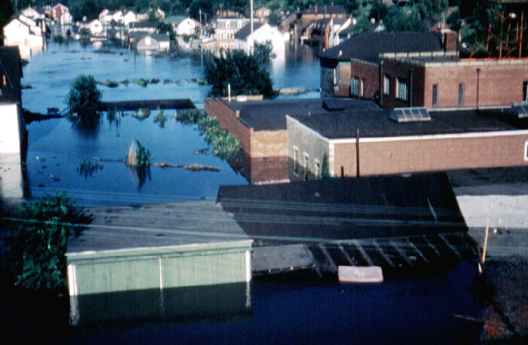
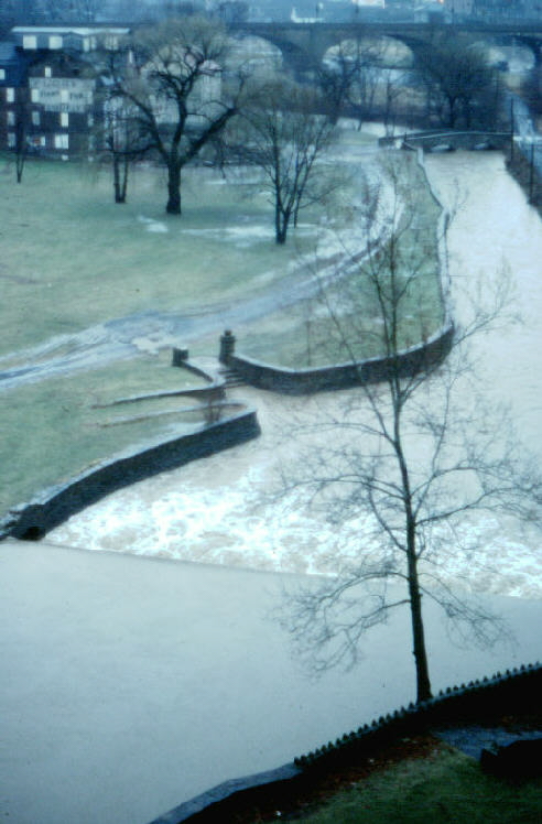
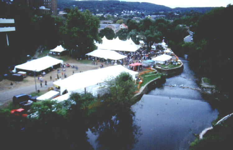
1955 View South from the Hill-to-Hill Bridge 2000
The Bethlehem Flood of 1955
On 19 August 1955, the Lehigh River in Bethlehem reached its highest recorded flood crest: 25.9 feet. The flooding occurred because Hurricane Diane deposited heavy rainfall on the city and in the drainage basin of the Lehigh River, as well as on many other river basins of Central and Eastern Pennsylvania. Just a few days previous to Hurricane Diane, Hurricane Connie tracked across the region and soaked the soil. The additional watery burden from Diane had no place to go except directly to the local streams, which quickly swelled and expanded to inundate their floodplains. The official death toll from this pair of storms reached almost 70. The property damage was particularly severe at the confluence of the Lehigh and Delaware Rivers, near Easton, PA and Phillipsburg, NJ. The scenes which follow show the flooding that occurred in Bethlehem on that date, as well as some of the flooding aftermath. More current views from the same vantage points are provided to show the contrast between now and then. See the note at the end of this page for information about the source of the 1955 photographs.
All photographs which follow are shown as large "thumbnails," so clicking on any of them will enlarge the scene.
1955
View South from the Hill-to-Hill
Bridge
2000
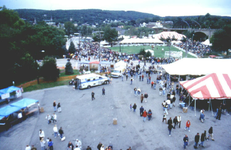
View South from Hill-to-Hill Bridge, 2001
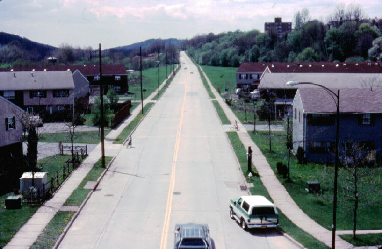
The views above are taken from the Hill-to-Hill Bridge toward South Mountain. The notch in the mountain is the slight depression through which PA Route 378 passes. The floodplains of the Lehigh River and the Monocacy River were urbanized prior to 1955, but with the reconstruction after the historic flood, portions of the floodplains were left in park land. The 2001 view above shows the festivities that occur in the park for the annual Celtic Festival.
The views below show the area beneath the Hill-to-Hill Bridge at the base of Spring Street, looking east.
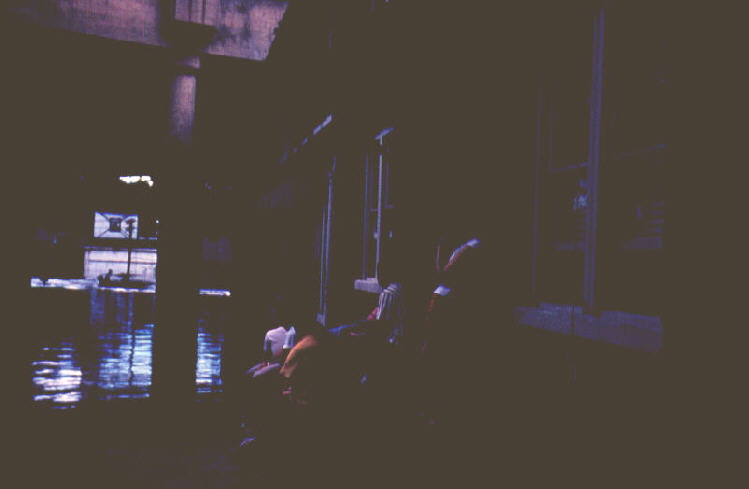
1955 View from Spring Street
beneath the Hill-to-Hill Bridge, looking east. 2001
The views below are from the Hill-to-Hill Bridge, looking west along Lehigh Street. South Mountain is to the left, and the Lehigh River runs toward you, from west to east, at the base of the mountain.
1955 View from Hill-to-Hill Bridge,
looking West 1984
The views below are from the West side of Bethlehem, looking southwest. The flank of South Mountain is to the left. The foreground area of the photograph is now developed, so the scene cannot be reproduced from the 1984 view shown. The road shown is Lehigh Street.
1955 View to Southwest
from West Bethlehem 1984
Homes that were flooded were subsequently emptied and razed. This home was located on Conestoga Street, beneath what is now PA Route 378.
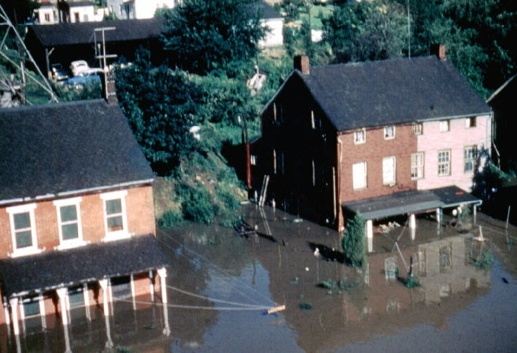
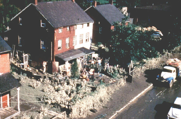
1955 Flood and
Flood Cleanup 1955

Site of above home, 2000
Conestoga Street is in the foreground.
The building below was located close to a graphite mill, which was removed after the 1984 photograph was taken.
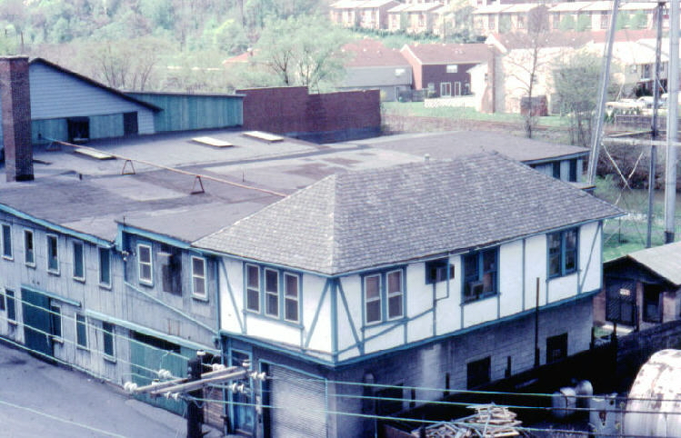
1955 Building
near Hill-to-Hill Bridge, view to
West 1984
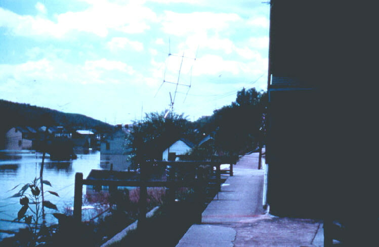
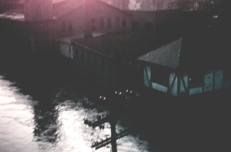
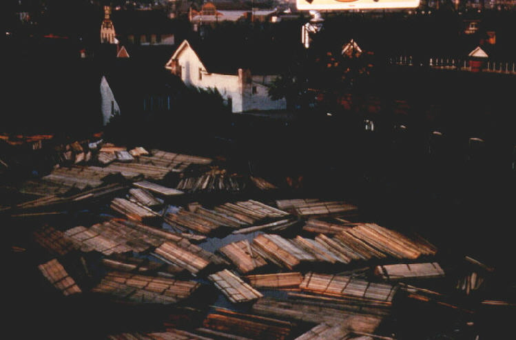
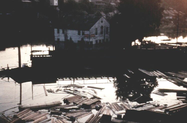
The locations of the two scenes below have not been identified, so no modern view is presented. The floating lumber is the stock of the Brown-Borhek lumber yard which was located on the floodplain.
1955 Unknown Bethlehem
Locations 1955
The area was cleaned up after the flood. The view below is from the Hill-to-Hill Bridge, looking toward the northwest. The armory building on Second Avenue in West Bethlehem is near the horizon, just left of the center of both photographs.
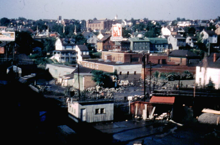
1955 View from
Hill-to-Hill Bridge, looking
northwest 2000
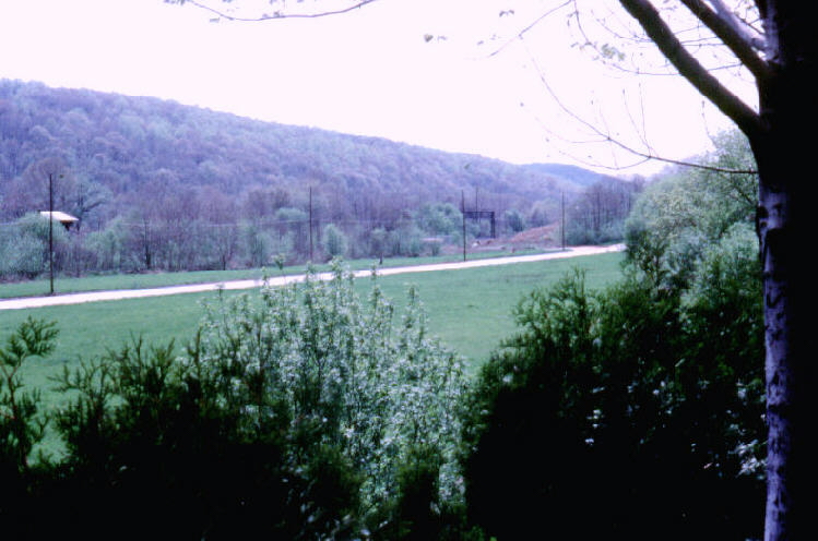
The floodplain of the Monocacy River was the site of the original Moravian settlement in Bethlehem. Several historic buildings are located on the floodplain and can be seen in the background on the photographs below. During the Great Depression, stone walls were installed along the Monocacy as part of the WPA program. Prior to 1955, the area on the floodplain near the Hill-to-Hill Bridge, which can be seen in the distance, was the site of a large junk yard. After 1955, the junk yard was removed and the area was returned to park land. Subsequently, several historic buildings have been restored. The area, however, is very poorly drained and remains prone to flooding. Today it is the site of local festivities, including Musikfest and the Celtic Festival.
Rainstorm almost flooding Monocacy
floodplain, 1976
Photo from Broad Street Bridge, looking south
Site of Celtic Festival, 2001
Photo from Broad Street Bridge, looking south
Following the flood of 1955, both housing and businesses were removed from the floodplain and the area was appropriated to recreational usage. This was a wise decision for government to make because it provided recreational land central to the urban area and, thus, encouraged the development of future communal activities. As park land, the cleanup of the floodplain following any future flooding is both inexpensive and non-disruptive.
The photographs above show the city during the flood of 1955, as taken on slide film by the late Miss Luckenbach, who was, I believe, employed by the Bethlehem Area School District at the time. In 1984, when the theme of the Moravian College yearbook was to be "Moravian: Then and Now," I went through the photographic archives of Historic Bethlehem seeking slides of the 1955 flood so I could show the students in my Geology class the appearance of Bethlehem when flooded, versus the contemporary city that they knew. Although the archives did not contain any flood slides from 1955, the personnel at Historic Bethlehem directed me to Miss Lukenbach as a possible source of flood slides, and she graciously granted me permission to reproduce them and use them in my work and with my students. I reproduced them, and then attempted to rephotograph the scenes from the same vantage point. I supplied Miss Lukenbach with copy slides of the new views that I took in 1984. Because the city continuously grows and changes, I also rephotographed some of the scenes during the years 2000 and 2001. The photographs above show the same views as they appeared in 1955, 1984, or even more recently.
Joe Gerencher