Herculaneum, Italy
History Preserved by a Volcanic Eruption in AD 79
Editorial note: My wife, Jane, and I participated in a two-week Road Scholar tour, entitled "Beyond the View: The Amalfi Coast and Sorrento," during the summer of 2018. As an integral part of this tour, we spent a day in each of the following locations: Pompeii, Herculaneum, Paestum, and the Naples Archaeological Museum. All the photographs that follow were either taken by myself or by Jane on this trip. However, in 1971 we had briefly visited the Pompeii site, but not any of the other locations.
Some useful geological context: The present volcano we see in the photographs is named Mt. Vesuvius. It is located in a caldera (a large crater) that was formed when a previous volcano at the same site, named Mt. Somma, erupted with sufficient force to destroy itself and form the caldera. Volcanoes at this location have had this kind of major eruption about once every 2,000 years. It was called Mt. Somma before the AD 79 eruption that buried Herculaneum and Pompeii and formed the present caldera in which the current Mt. Vesuvius has been growing through episodic smaller eruptions. But the record of the surrounding rocks reveals that before Mt. Somma, an even bigger eruption occurred at about 1,780 BCE, and there were other previous major eruptions in the same location at about 6,000 BCE, 9,400 BCE, 13,000 BCE 15,000 BCE, 20,500 BCE and 23,000 BCE. Thus, there might be some ambiguity in what name we should use for the volcano, depending on whether it is before and/or after the AD 79 eruption.
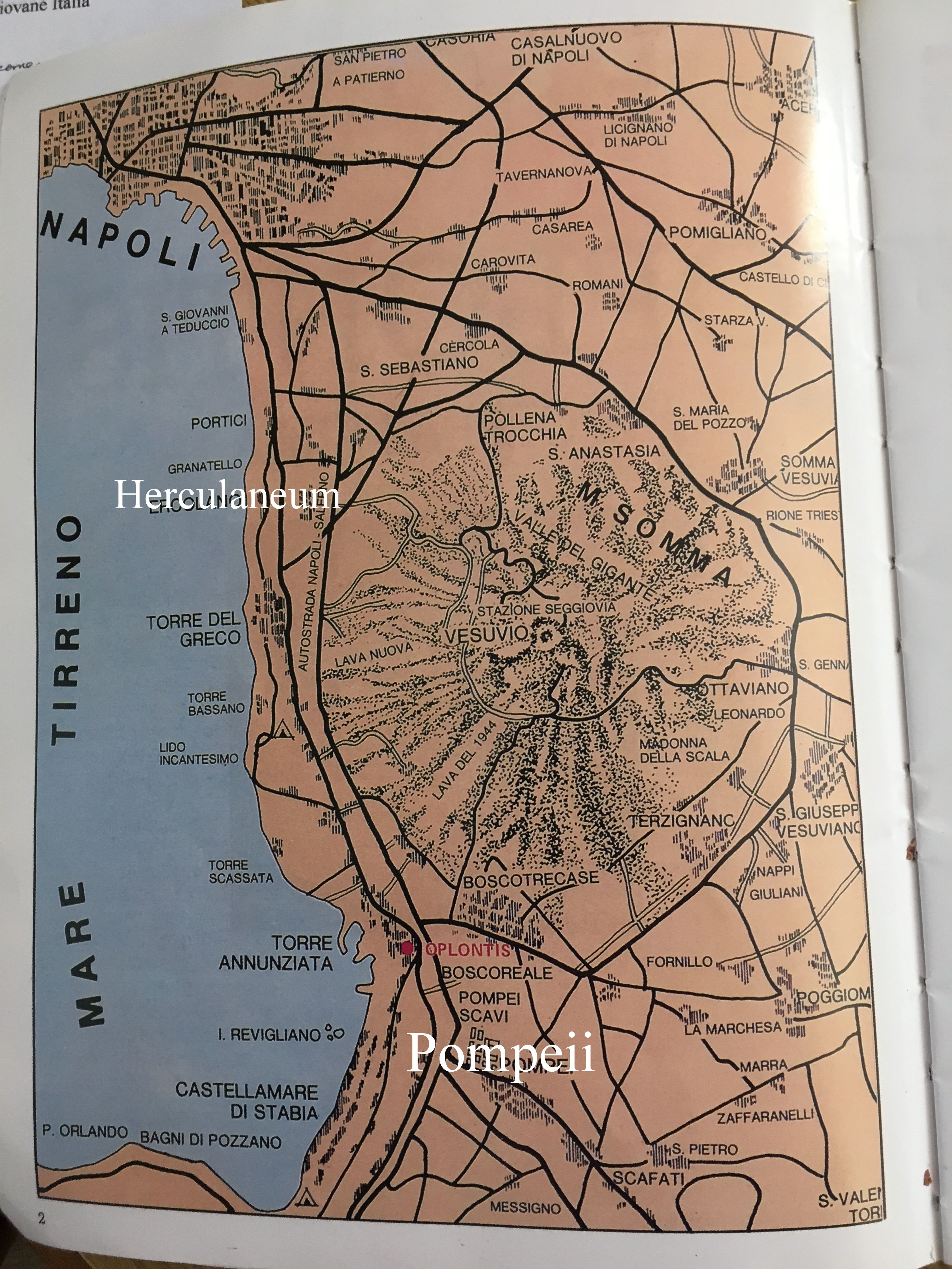
The map below shows the locations of Pompeii and Herculaneum (Ercolano in Italian), in white text for emphasis, relative to Mt. Vesuvius and Naples, as well as other ancient communities.
In 1709, while digging a well, a portion of an ancient theater wall was encountered, and soon additional tunnels were dug to find, remove, and sell ancient artifacts. Unlike Pompeii, Herculaneum was, and remains, within the greater Naples urbanized area.
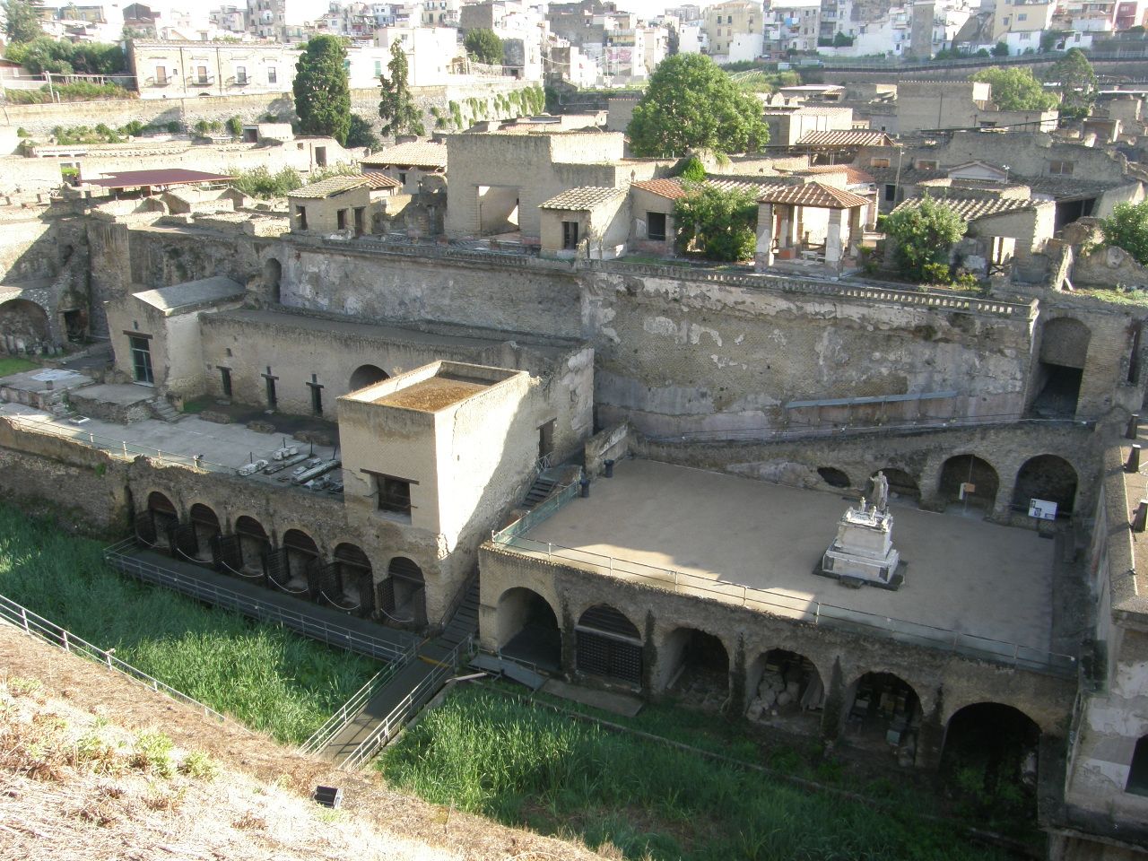
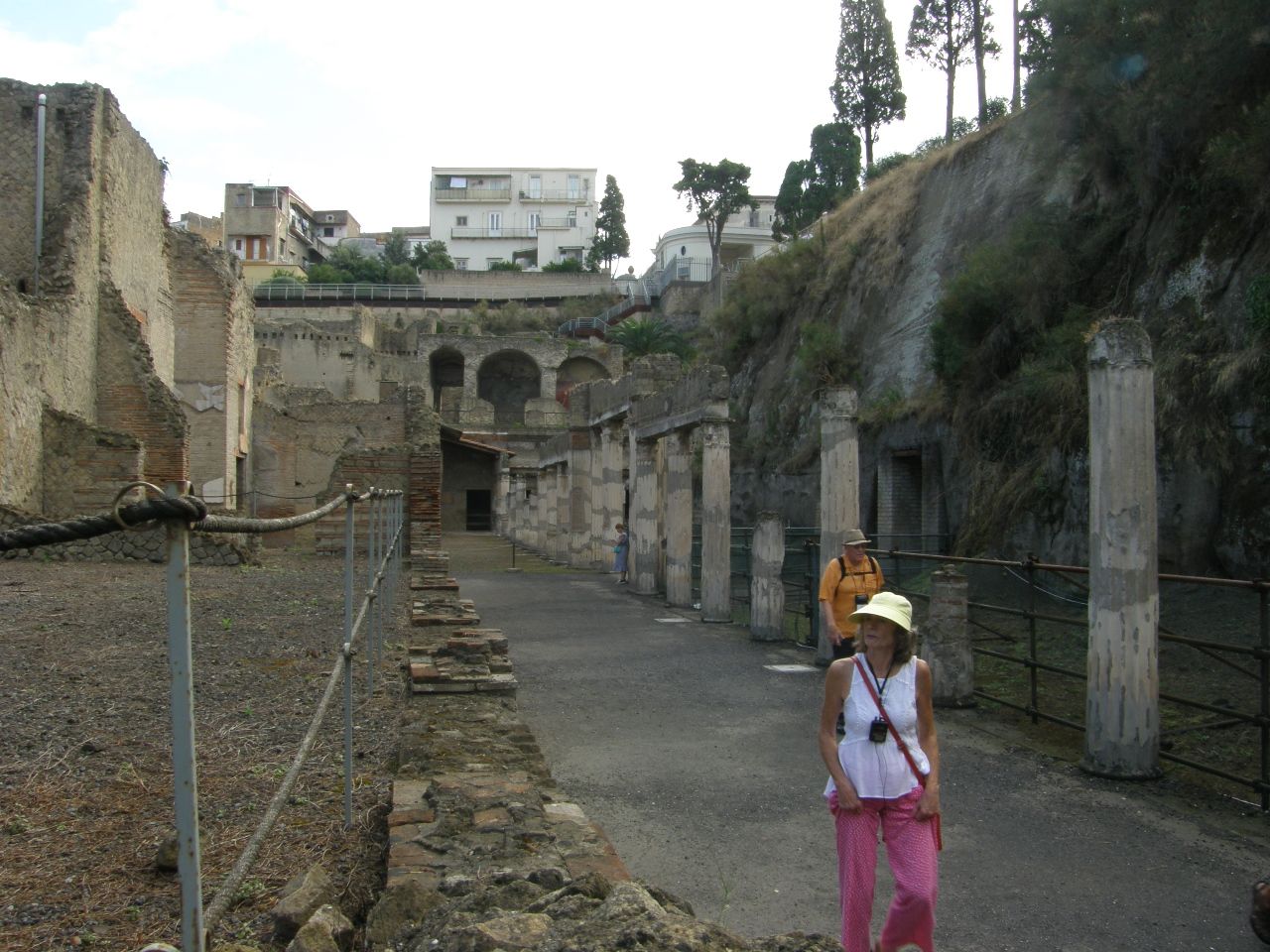
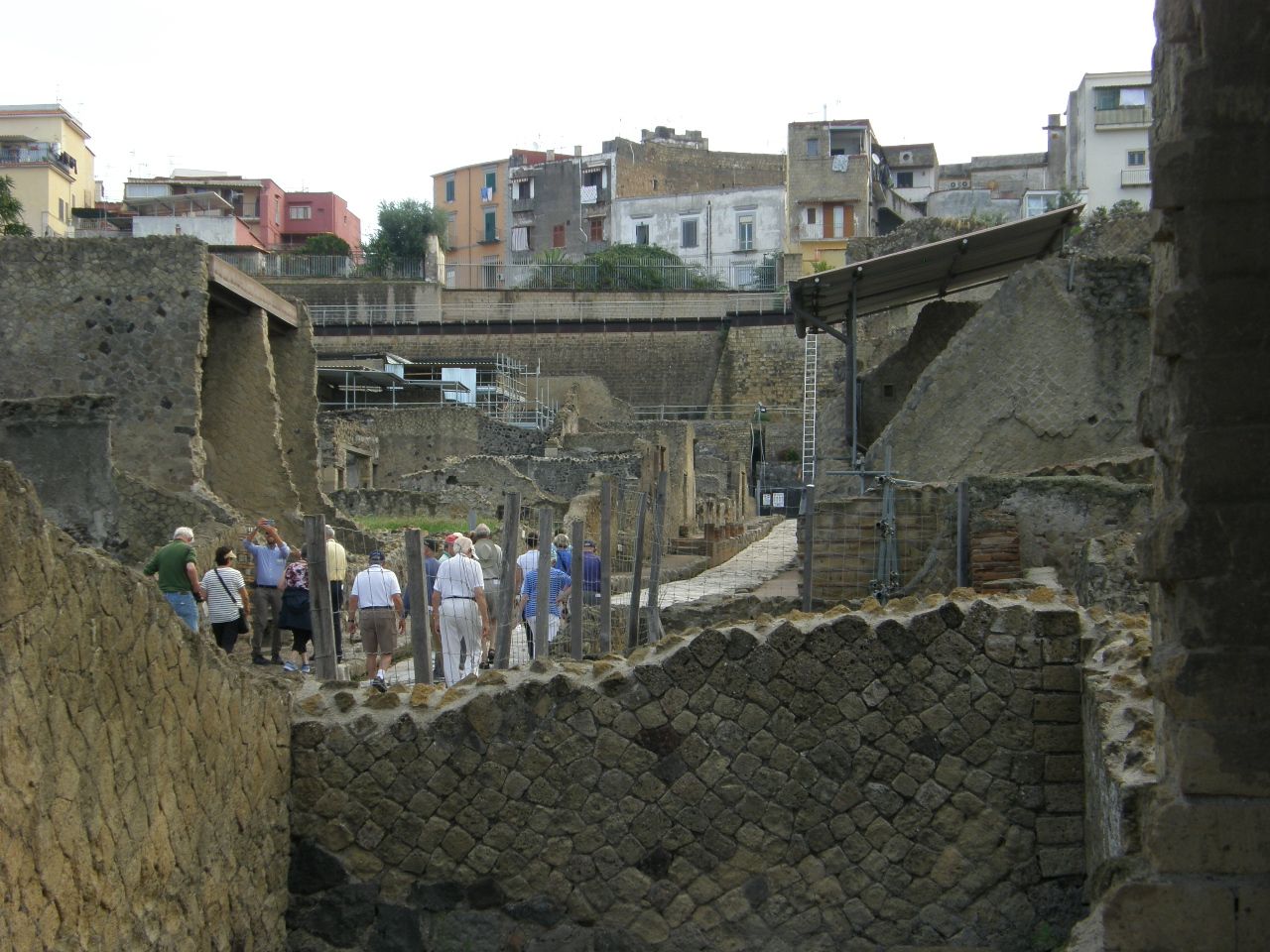
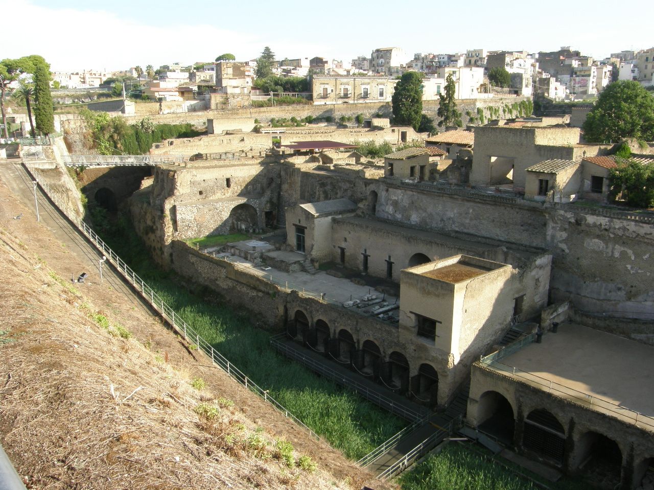
The photo-mosaic (below) shows the excavated Herculaneum site, as well as the housing in the current urban neighborhood that now surrounds it on the present, higher, ground level. The eruption of the former Mt. Somma in AD 79 produced several pyroclastic flows, separated by a few hours, that raced down the steep slopes of the Mt. Somma volcano and overran and buried all of the ancient city. The very first of these proclastic flows instantly killed all of the inhabitants who had not yet fled.
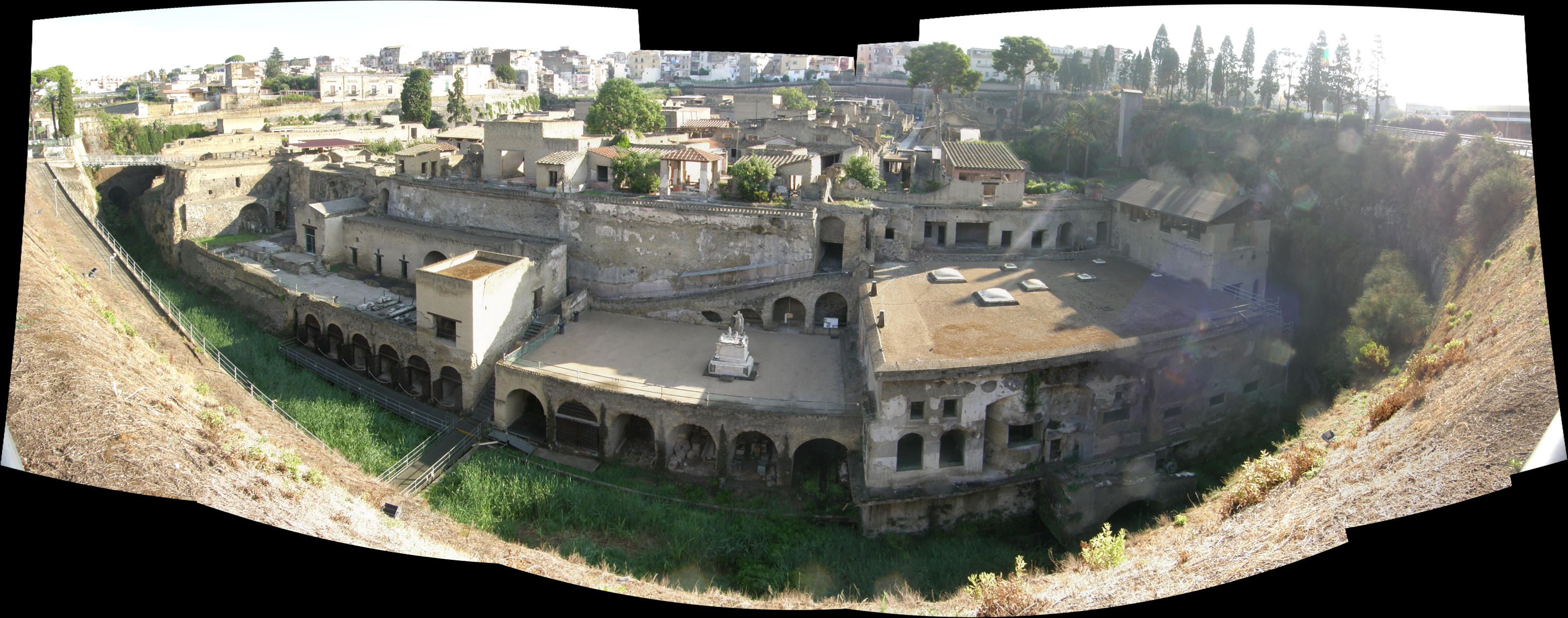
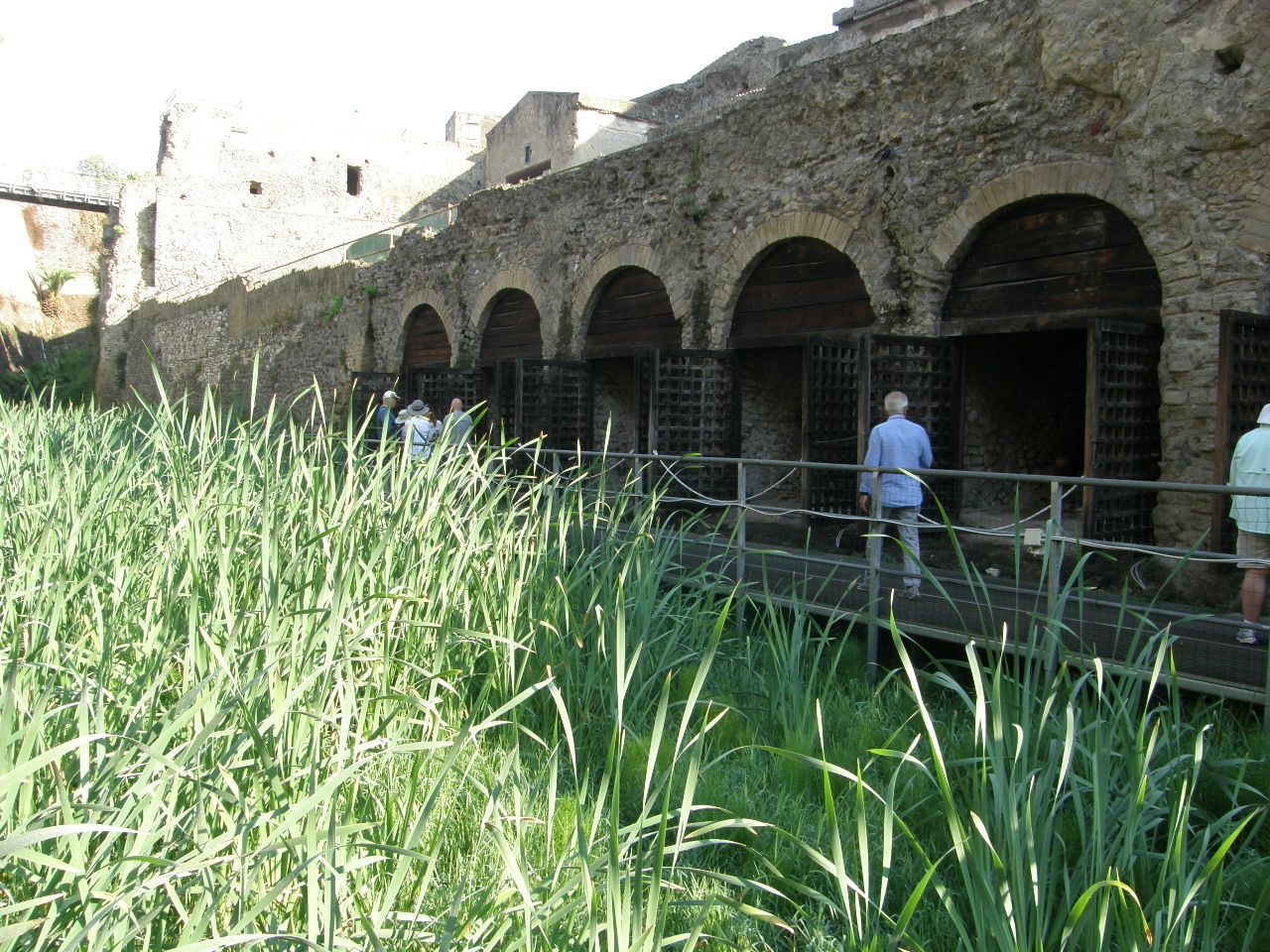
Although Herculaneum is now about 500 yards inland from the present coast, before the AD 79 eruption it was a coastal community, right on the beach, with shoreline facilities for tending boats and shipping and storing goods. These boat and storage facilities are distinctive on this image because they have large doorways with an upper semi-circular arch.
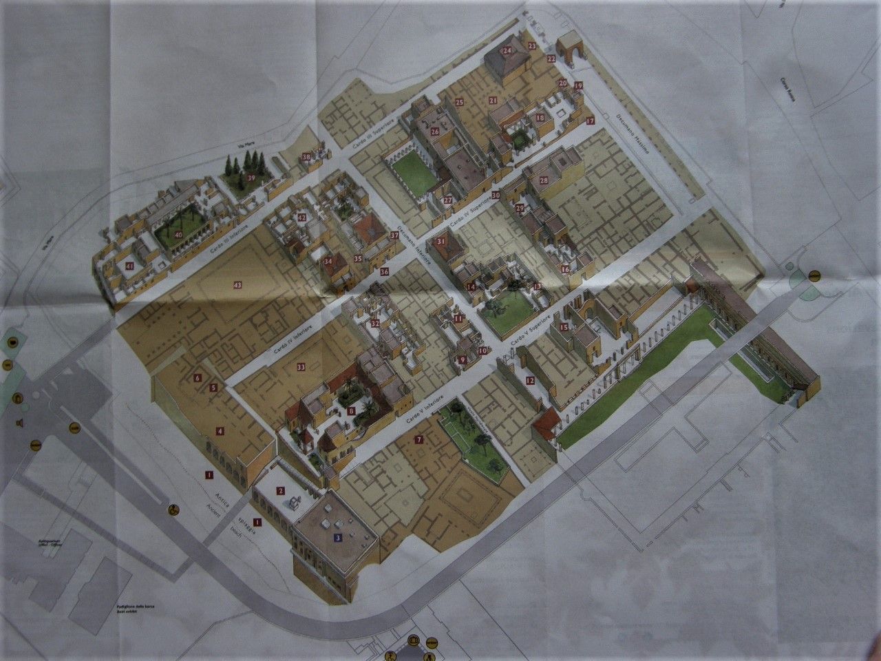
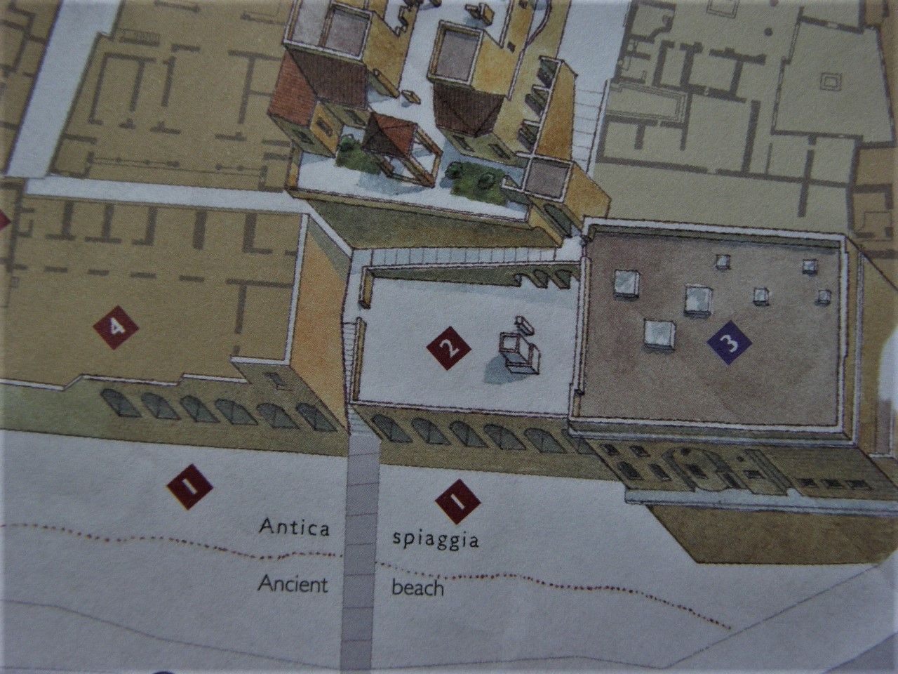
The site maps (above) clearly show the facilities near the beach.
Shown below are boat and cargo storage facilities that were at the edge of the beach.
Shown below are the skeletons of many persons who were left behind when the city was quickly evacuated during the early stages of the eruption. Seeking shelter, they hid in the cargo facilities until some boats could return to evacuate them too. They died by both the extremely high temperatures and the toxic gasses of the pyroclastic flows. There are remains of 273 persons in Herculaneum, although early excavations removed some others.
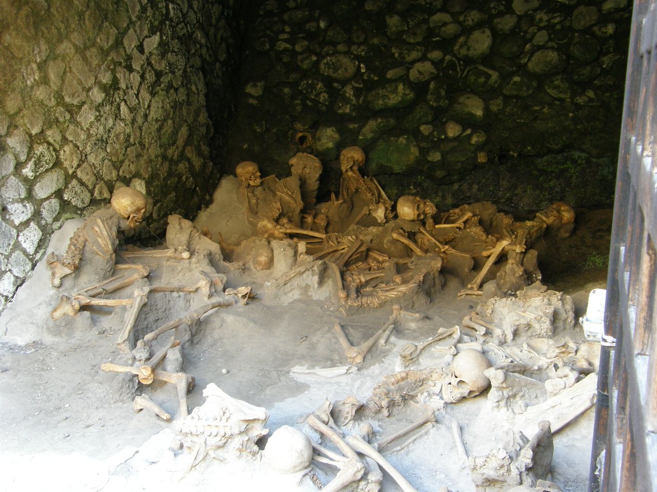
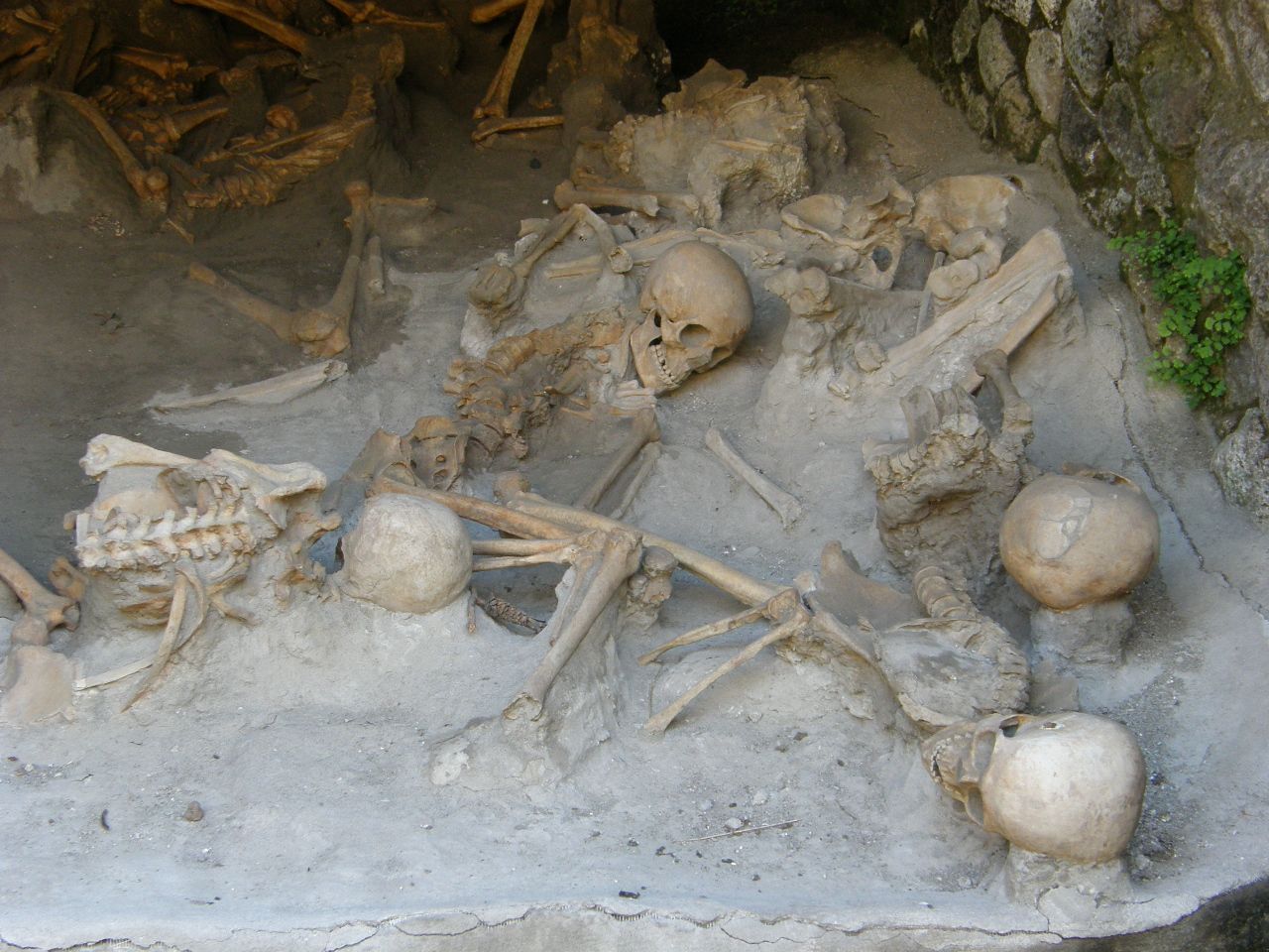
Most of the skeletons in the pictures above are of women and children. They were probably all slaves.
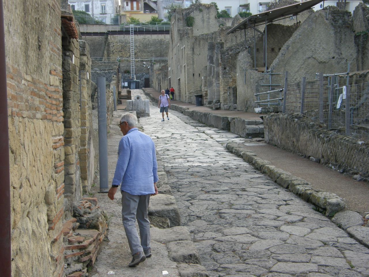
The picture below shows a view of a main street in the excavation. Notice the ancient structures at the lower level and the modern home above. Notice also the unexcavated volcanic deposits seen on the right side of the photograph.
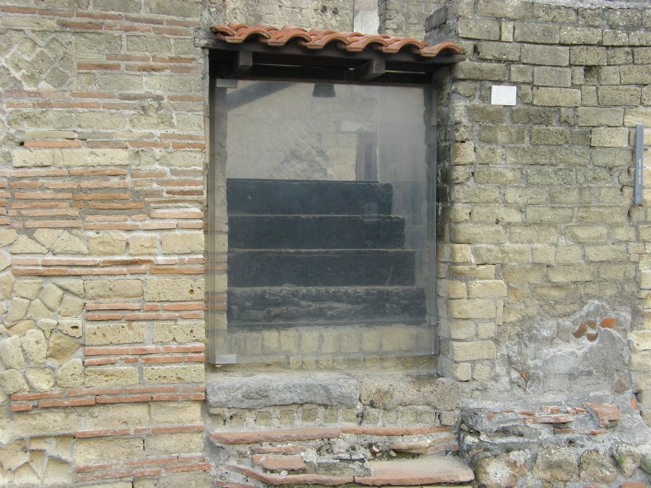
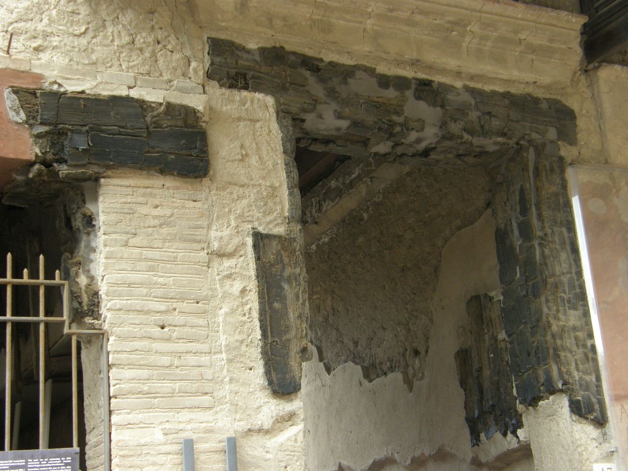
The first of the two pictures below show a charred wood staircase to an upper floor, which is no longer there. The second picture shows door lintels, also charred. This is evidence of the very high temperatures within the pyroclastic flows that destroyed and buried this wealthy and fashionable ocean-side city.
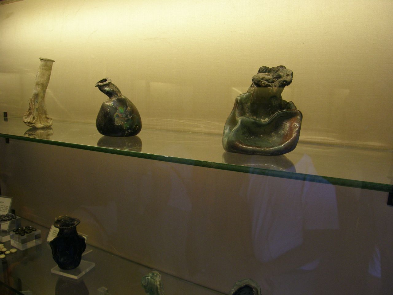
The image below shows glass objects that were melted by the high temperatures of the pyroclastic flows.
The image below shows a bathhouse that has a vaulted ceiling which was strong enough to withstand the weight of the hot volcanic deposits that buried and, ultimately, preserved it. Notice the shelf on which clothes and other objects can be placed.
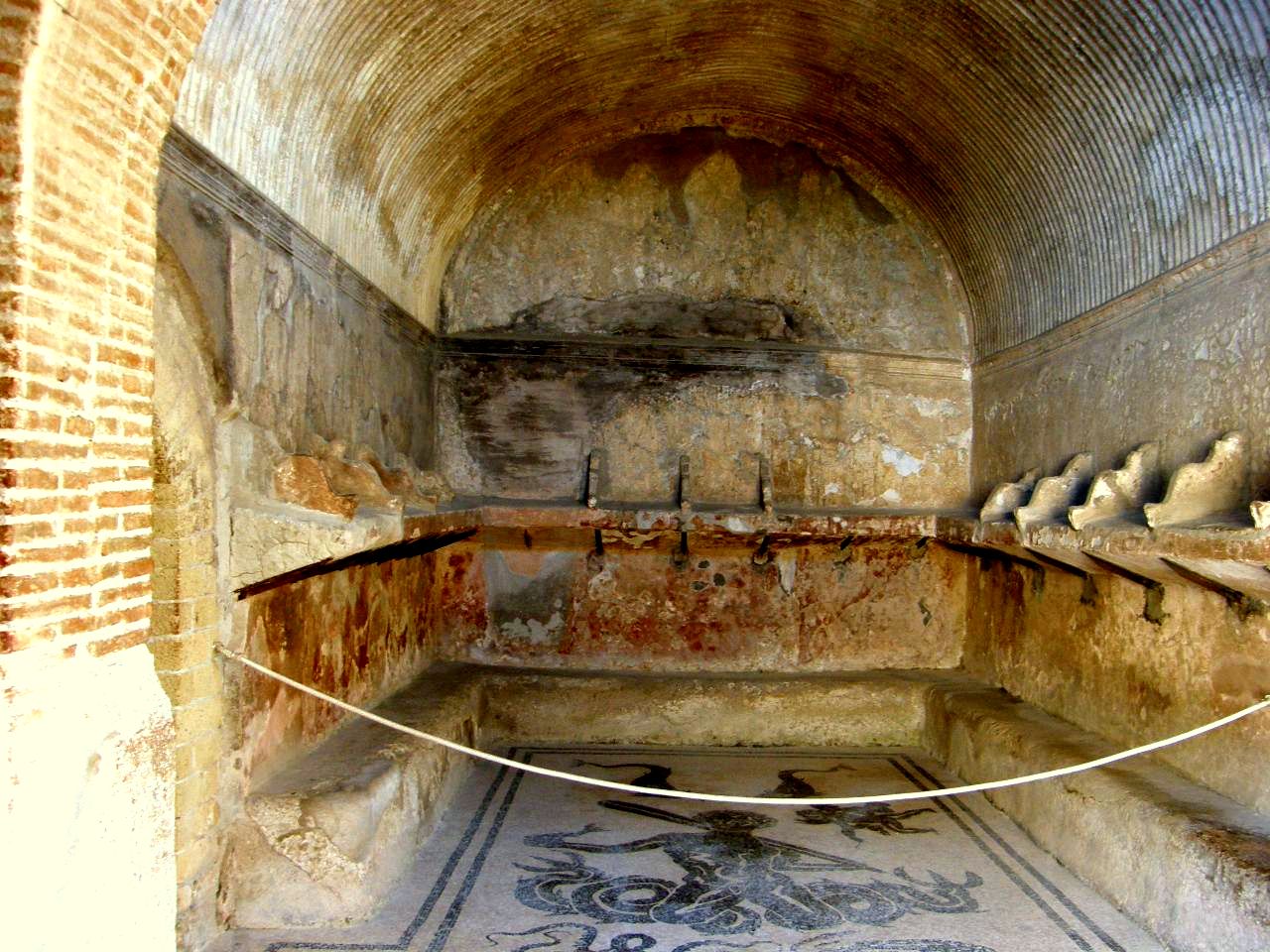
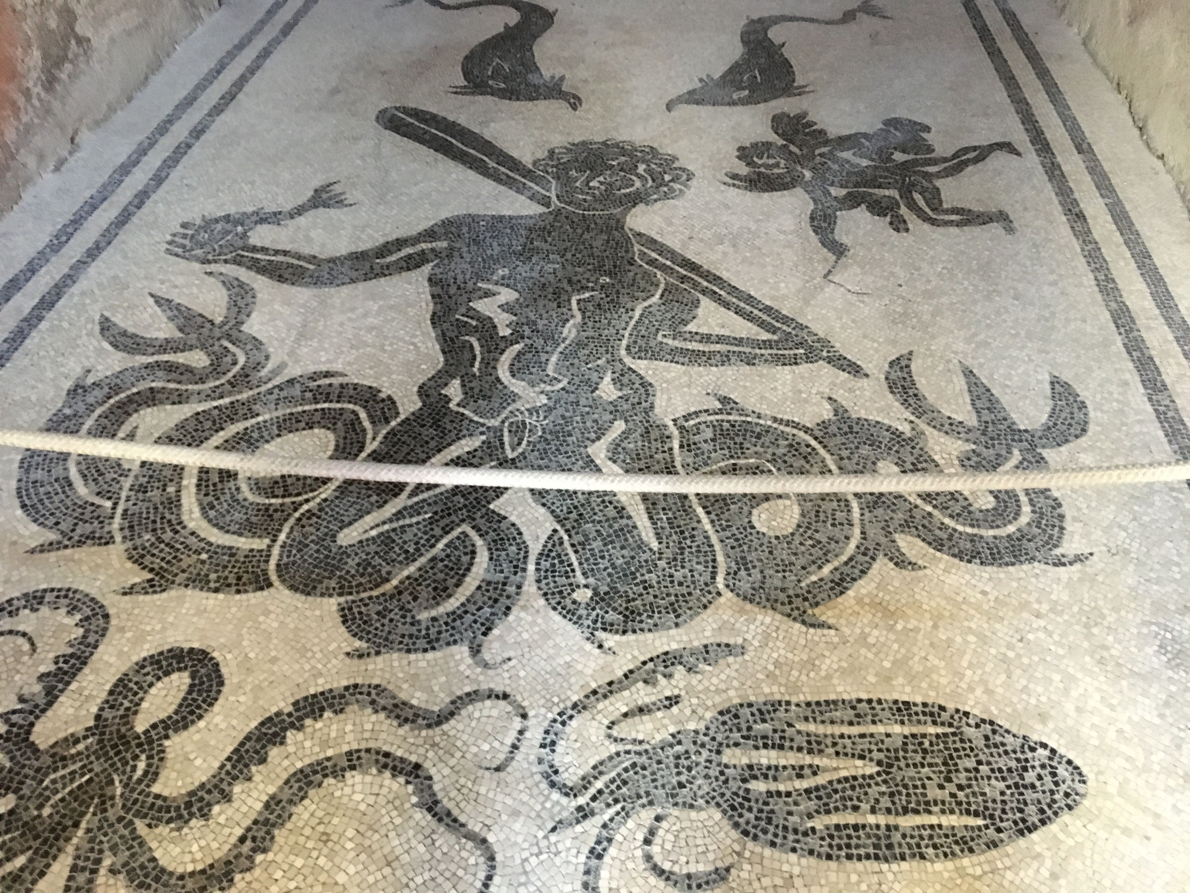
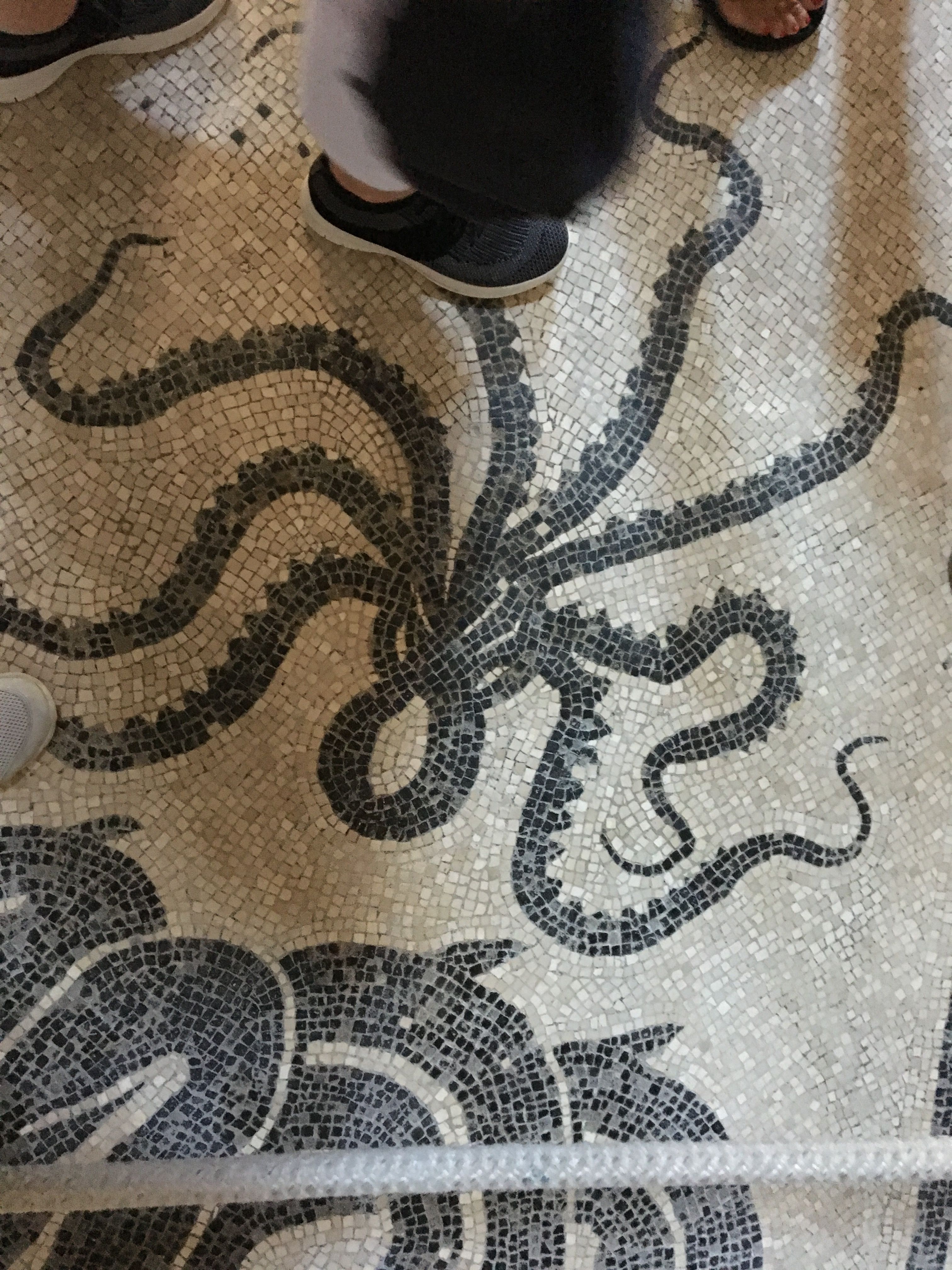
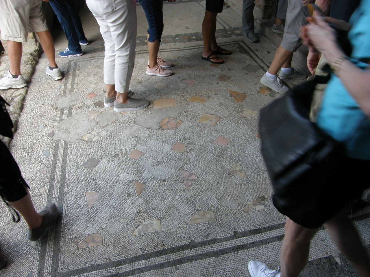
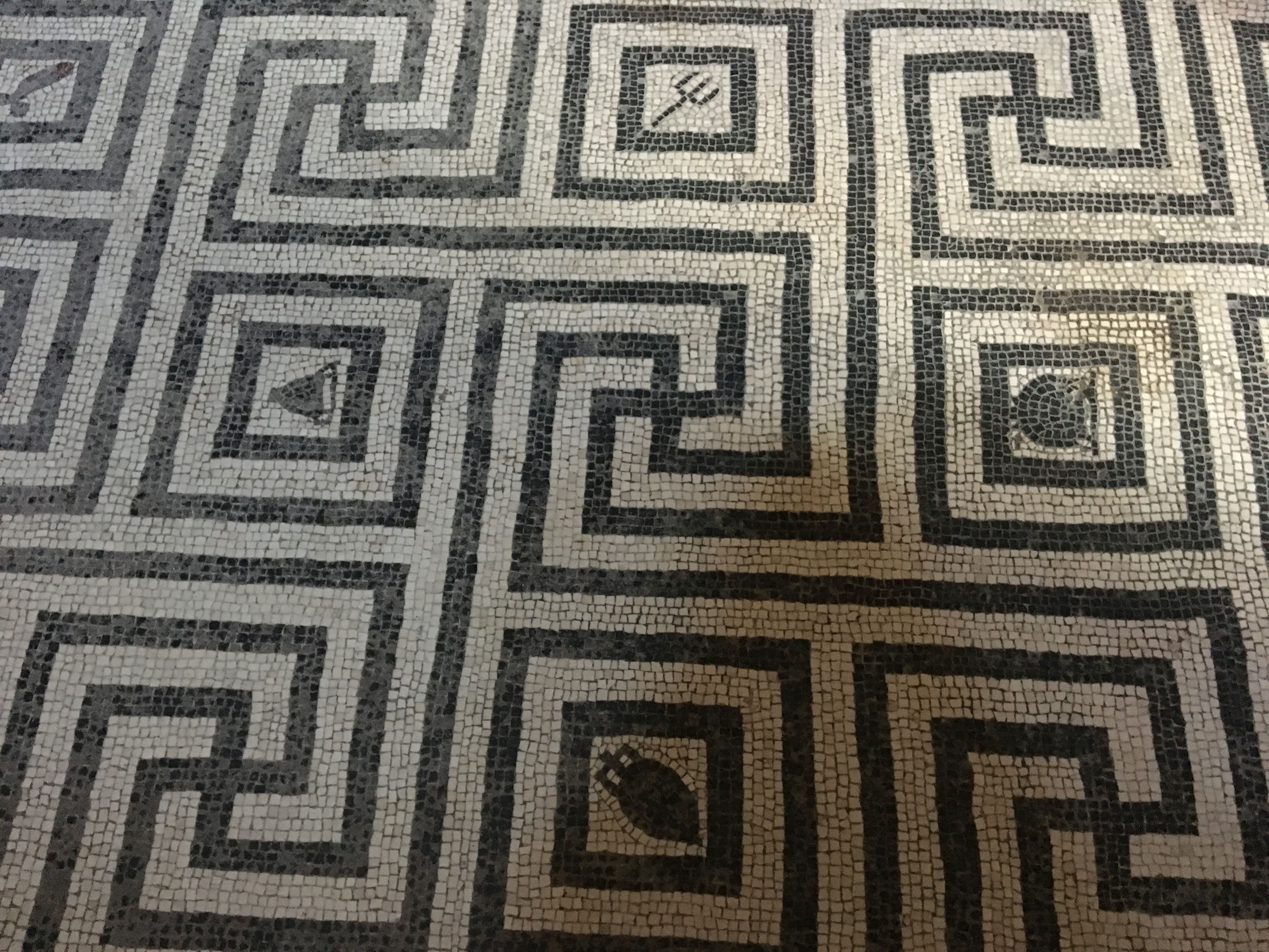
This is a beautiful mosaic on the floor of the bathhouse. One of the differences between visiting the ruins of Pompeii and Herculaneum is the fact that in Herculaneum, with its more intimate size, you actually walk on the many Roman mosaic floors.
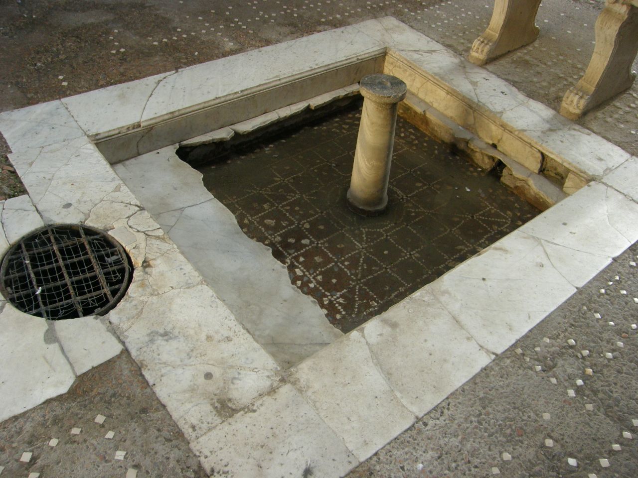
The two views below show a reconstructed roof and ceiling that covered an enclosed courtyard of a Roman mansion, and a shallow pool in the floor directly below the roof opening.
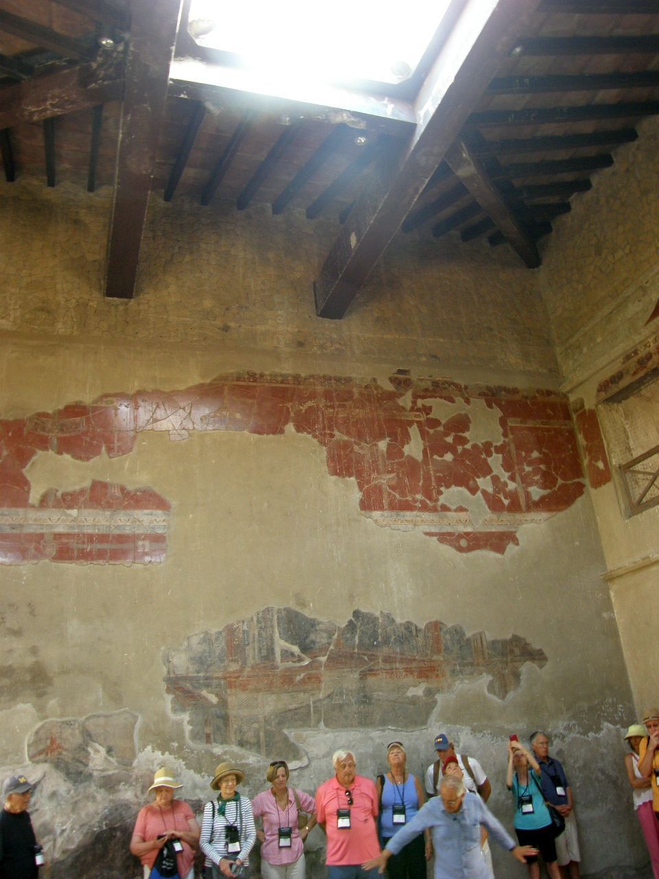
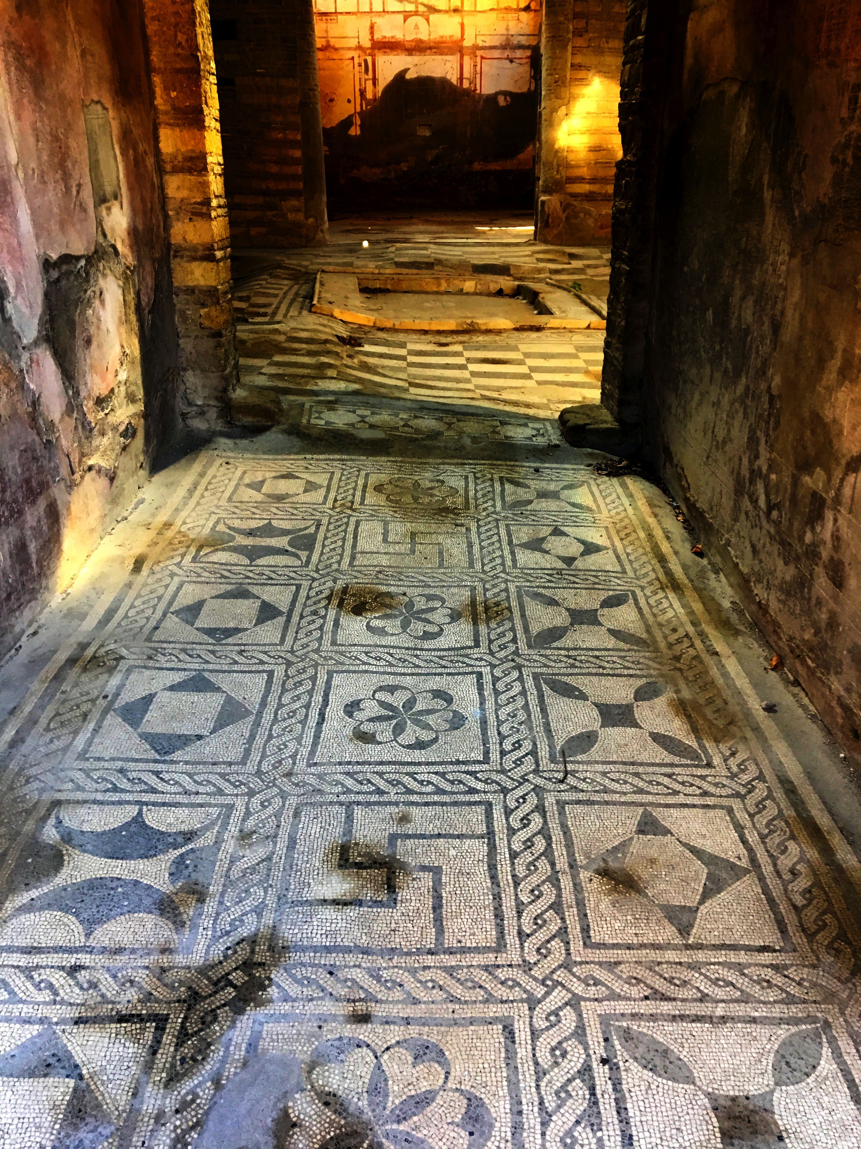
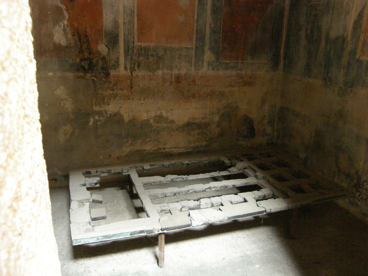
Below is a charred wooden bedframe in a painted bedroom and a beautiful mosaic floor from one of the mansions.
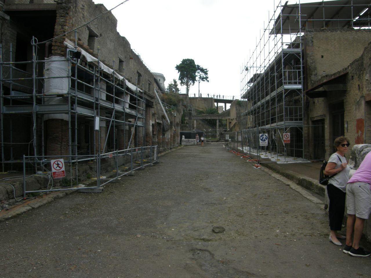
Below are some street scenes which show the excavation work is still progressing.
The view below shows the depth of the pyroclastic deposits that buried the city, with a modern access ramp and a modern access tunnel. The deposits are about 60 feet thick. Pumps continually remove groundwater from the excavation; otherwise it would flood (remember, the ruins were discovered by someone digging a well). These deposits extend another 500 yards or so seaward, showing that the eruption added land upward and outward onto what would, only about 150 years ago, become the modern political nation-state of Italy.
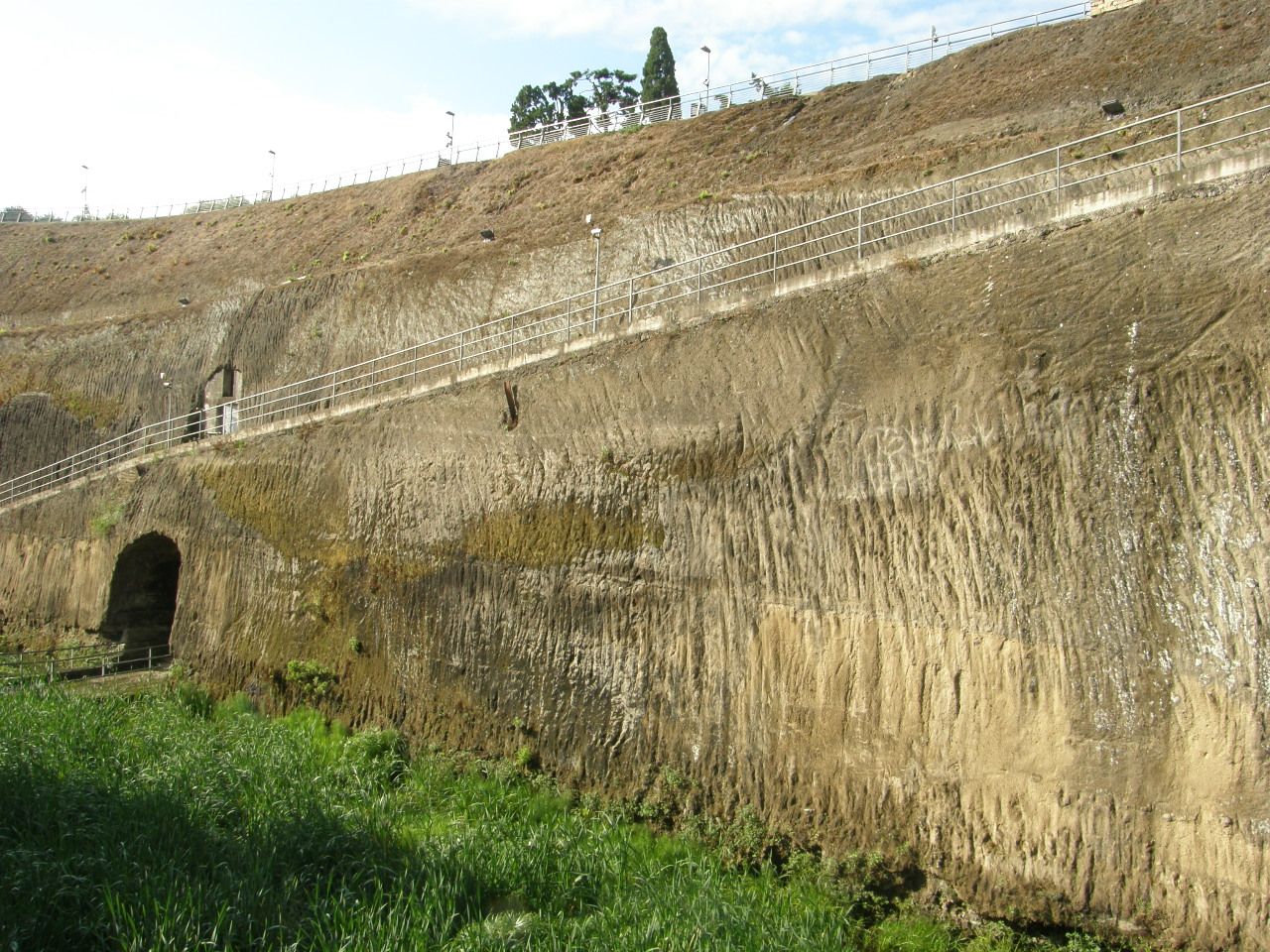
Looking down from the cliff edge of the former picture, the wetness of the lowest portion of the excavation is evident by the dark green grasses. The modern urban area occupies the surface of the higher area.
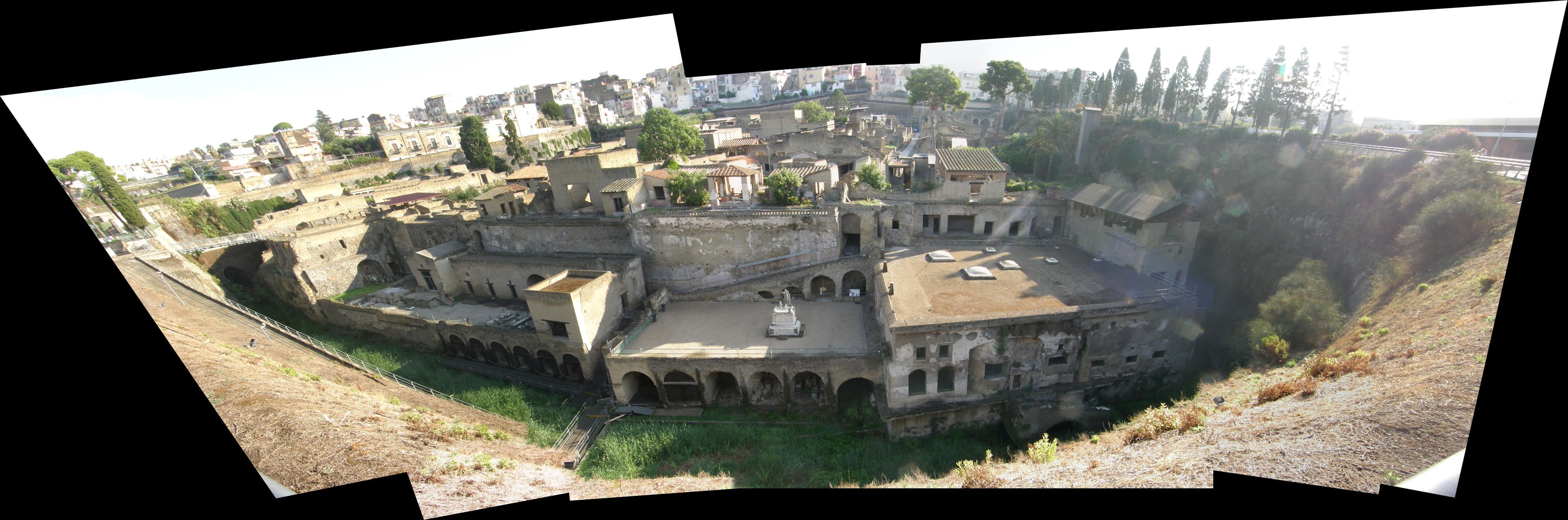
The photomosaic below captures the intimacy of the site.
About 70 percent of Herculaneum remains unexcavated.
For additional information about the geology of this region and details about the volcanic eruptions of Mt. Somma / Mt. Vesuvius, see the following:
(below) Somma Vesuvius: the Volcano and the Observatory. Field trip guidebook.
(below) Pyroclastic flow hazard assessment at Summa - Vesuvius based on the geologic record.
(below) Pompeii and Herculaneum and eruptions of Vesuvius.
(below) Transport and deposition of pyroclastic density currents over an inhabited area: the deposits of the AD eruption of Vesuvius at Herculaneum, Italy.
(below) Herculaneum victims of Vesuvius in AD 79.