Paestum, Italy
Three intact 2,500 year-old Greek temples: abandoned, ignored, and forgotten. Why?
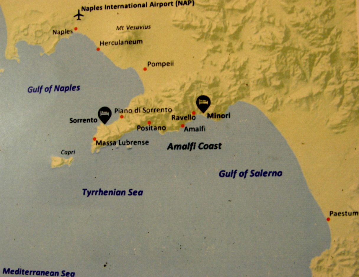
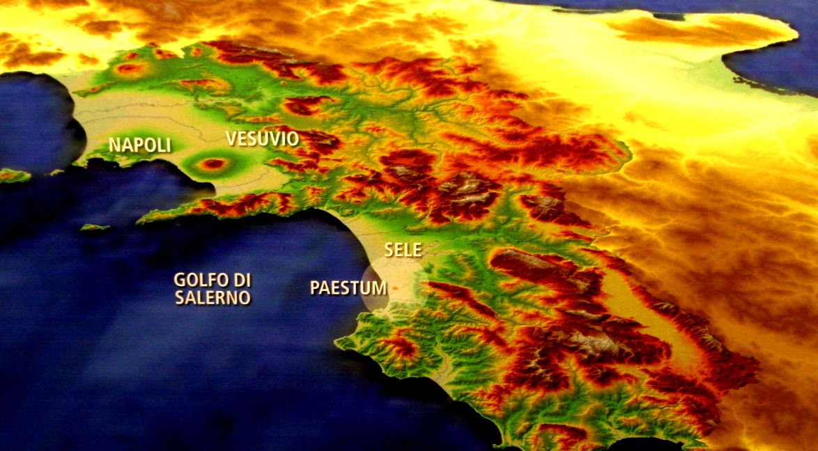
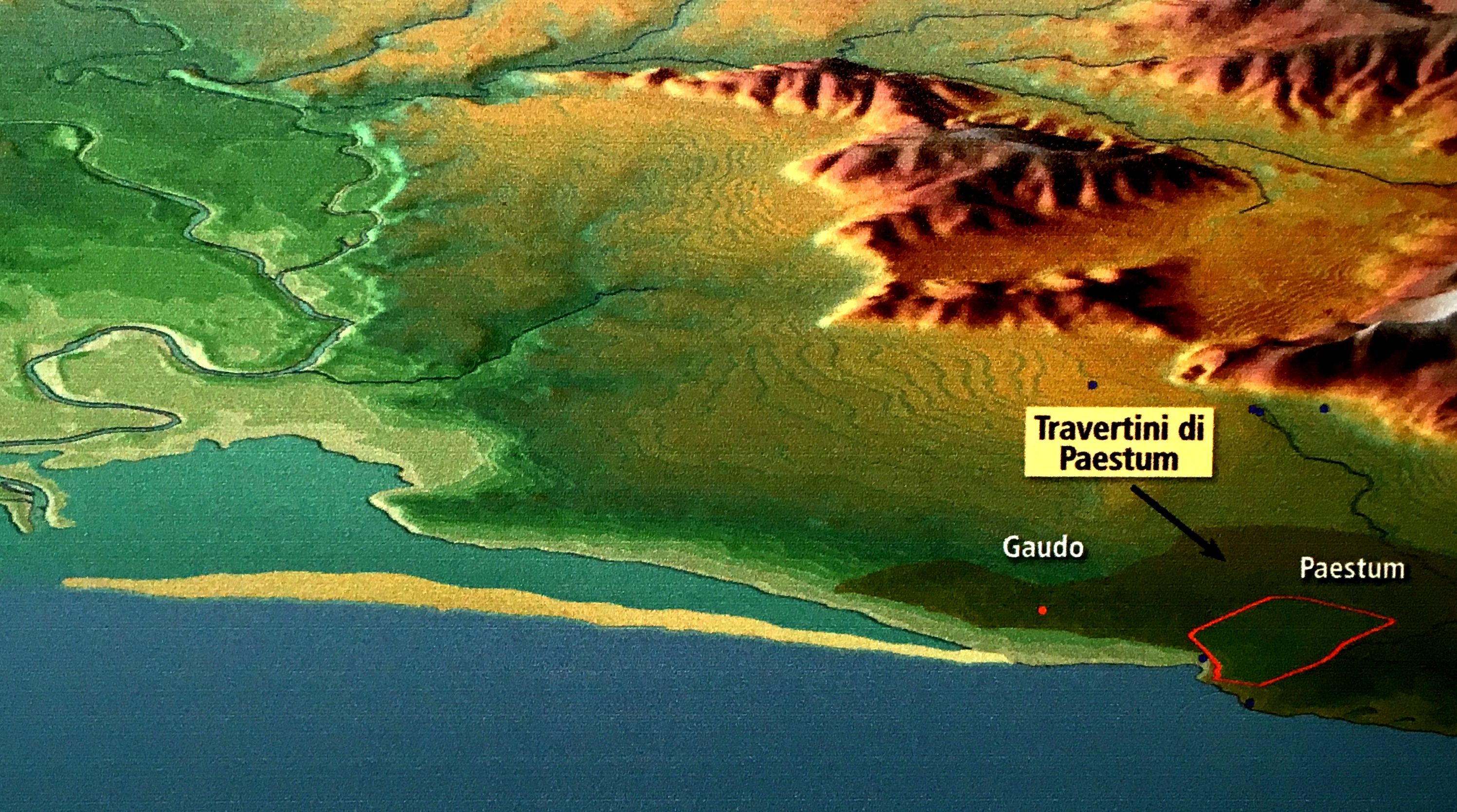
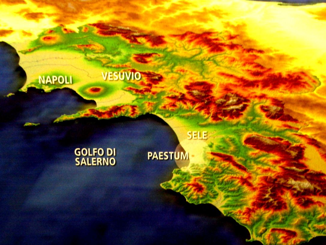
The two maps below show the location of Paestum, which is only about 50 miles south of Naples, Italy. We visited most the the places mentioned on the map during the summer 2018 Road Scholar trip, "Beyond the View: The Amalfi Coast and Sorrento." The two dark symbols on the first map indicate the locations of our hotels. Note that the southern-most named location on the maps is Paestum, and that the land on which Paestum is sited has little relief and is very near sea level.
The walled city of Paestum was established about 600 BCE as a coastal port community. Today, because of sedimentation of the Sele River and the formation of beach sand ridges, it is located about a mile inland. At its zenith, the city of Paestum had about 13,000 inhabitants. Only about 1/5 of the city has been excavated. Within the city there are three ancient Greek temples that have stood for about 2,500 years. They were built in 550, 510, and 460 BCE, all to honor the wives of the Greek gods. In 237 BCE the Romans took control of the city, razing the homes of the Greeks and building their own homes, shops, and civic buildings from the pillaged stone materials, but leaving the Greek temples standing.
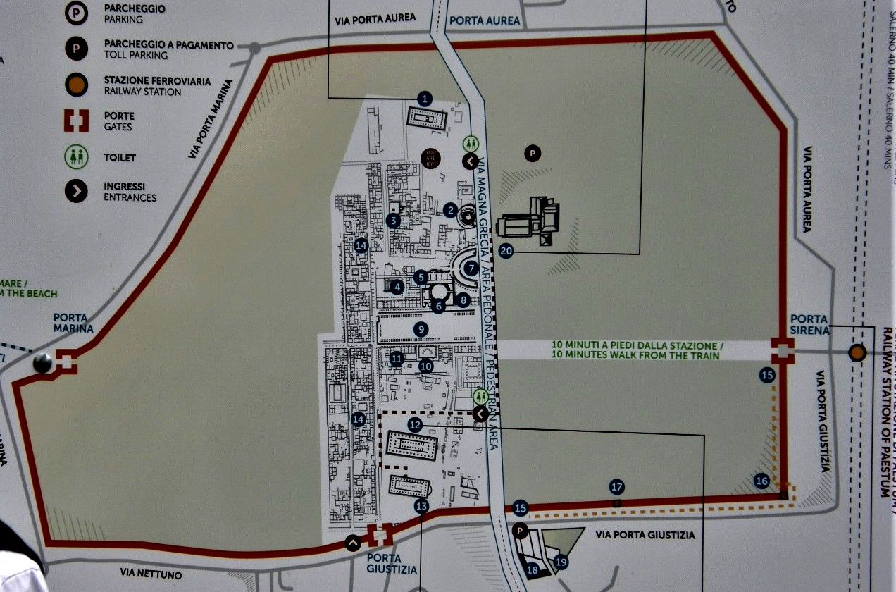
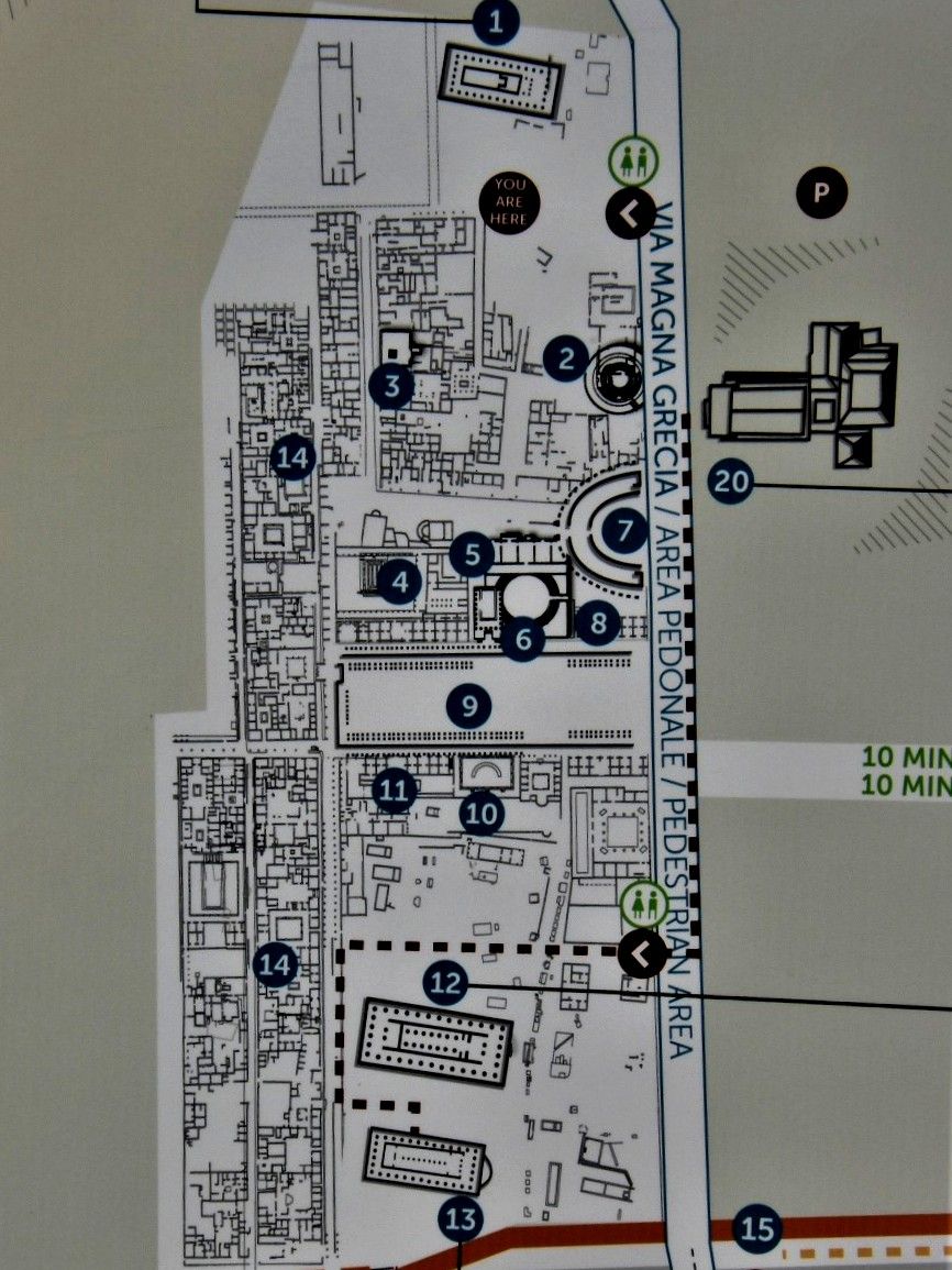
The temples are located on the far ends of the restored area and are at an elevation of about 50 to 60 feet above sea level. On the second map, which is an enlargement of the first map, the temples are located at the following labeled locations: 1, 12, and 13.
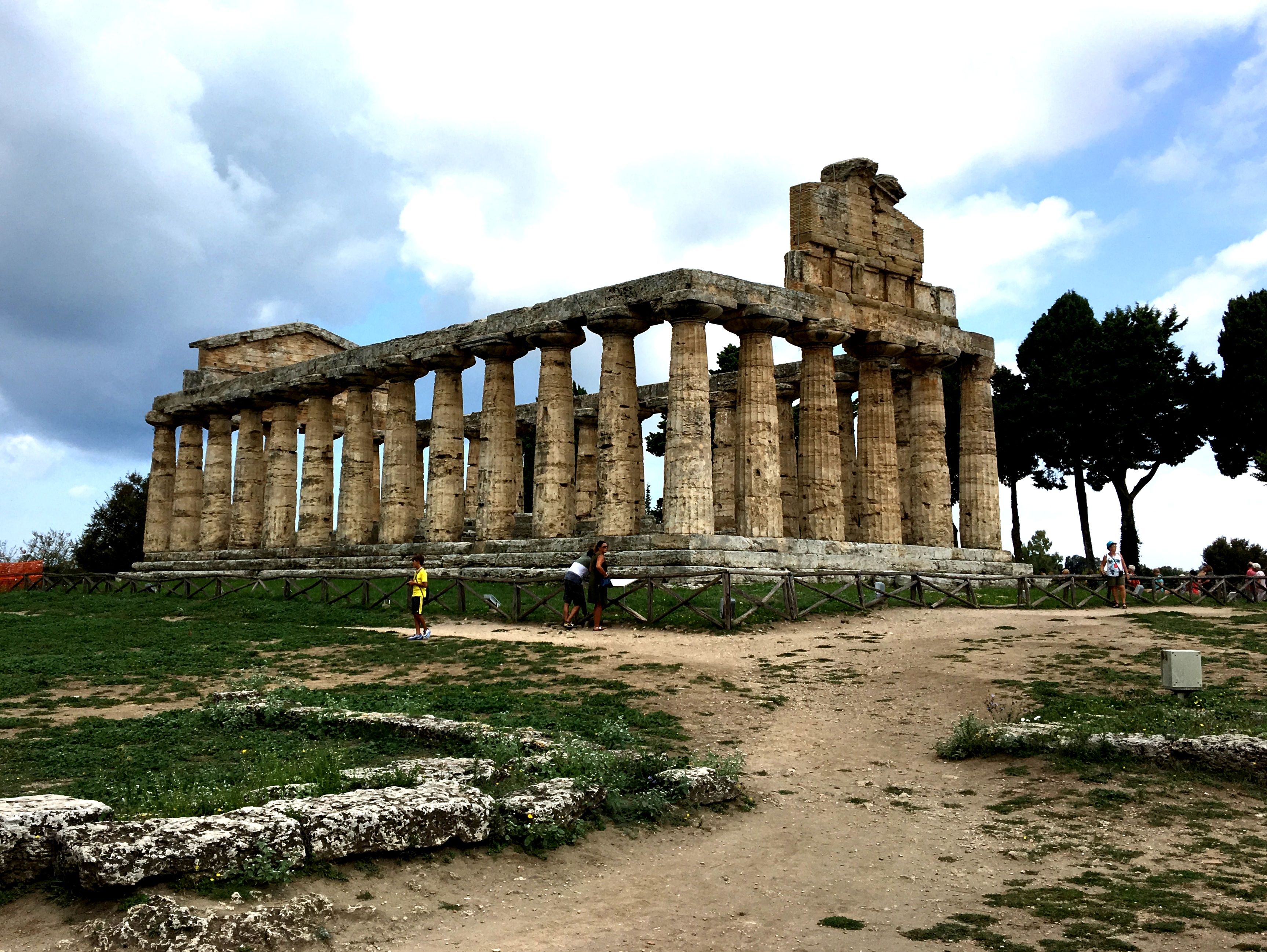
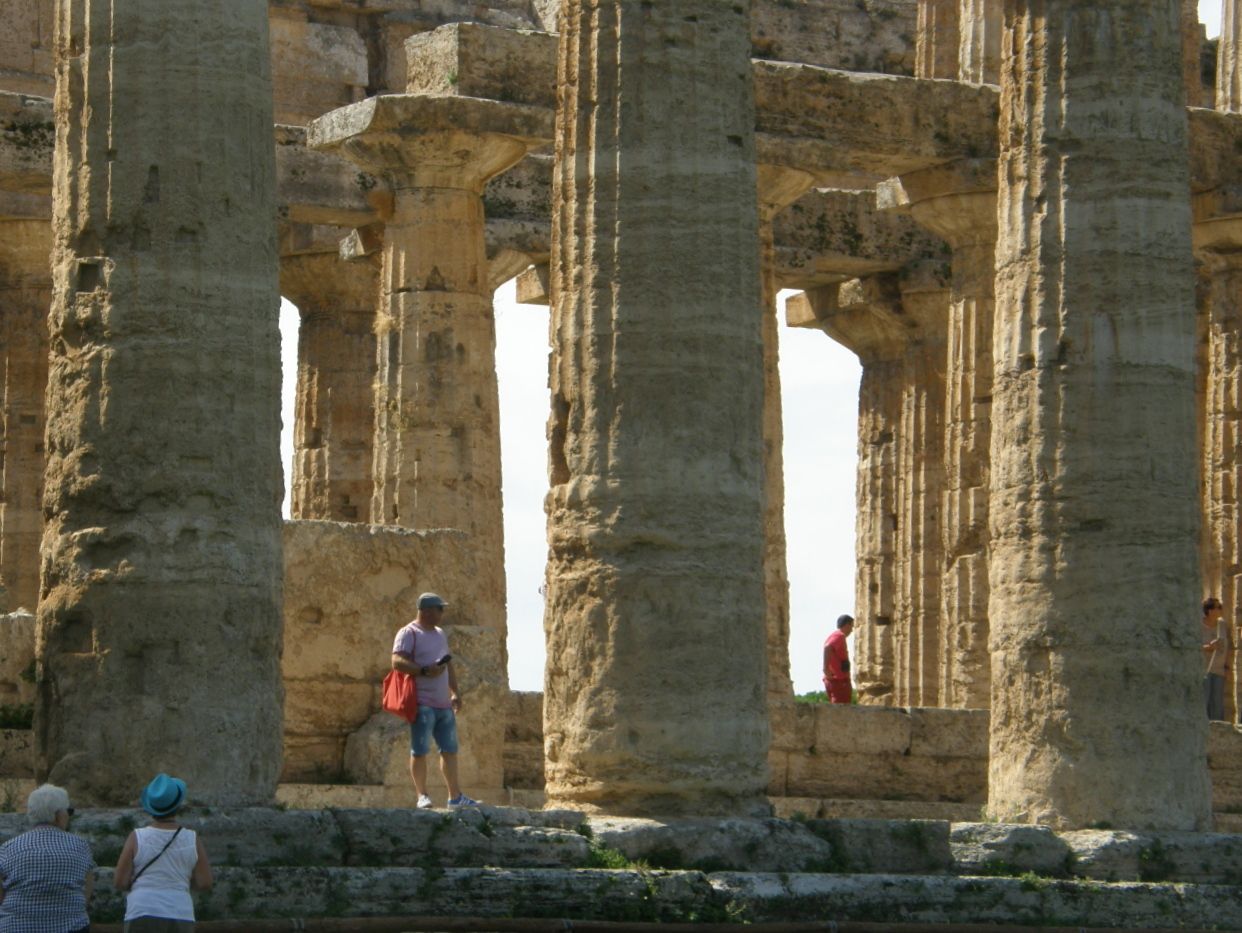
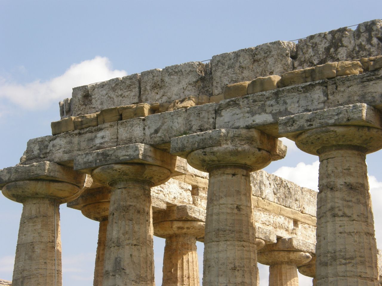
The temple shown below is located at the number "1" site on the previous map. Like the other two temples, it is made of travertine, which forms the bedrock under all of the city and was mined locally.
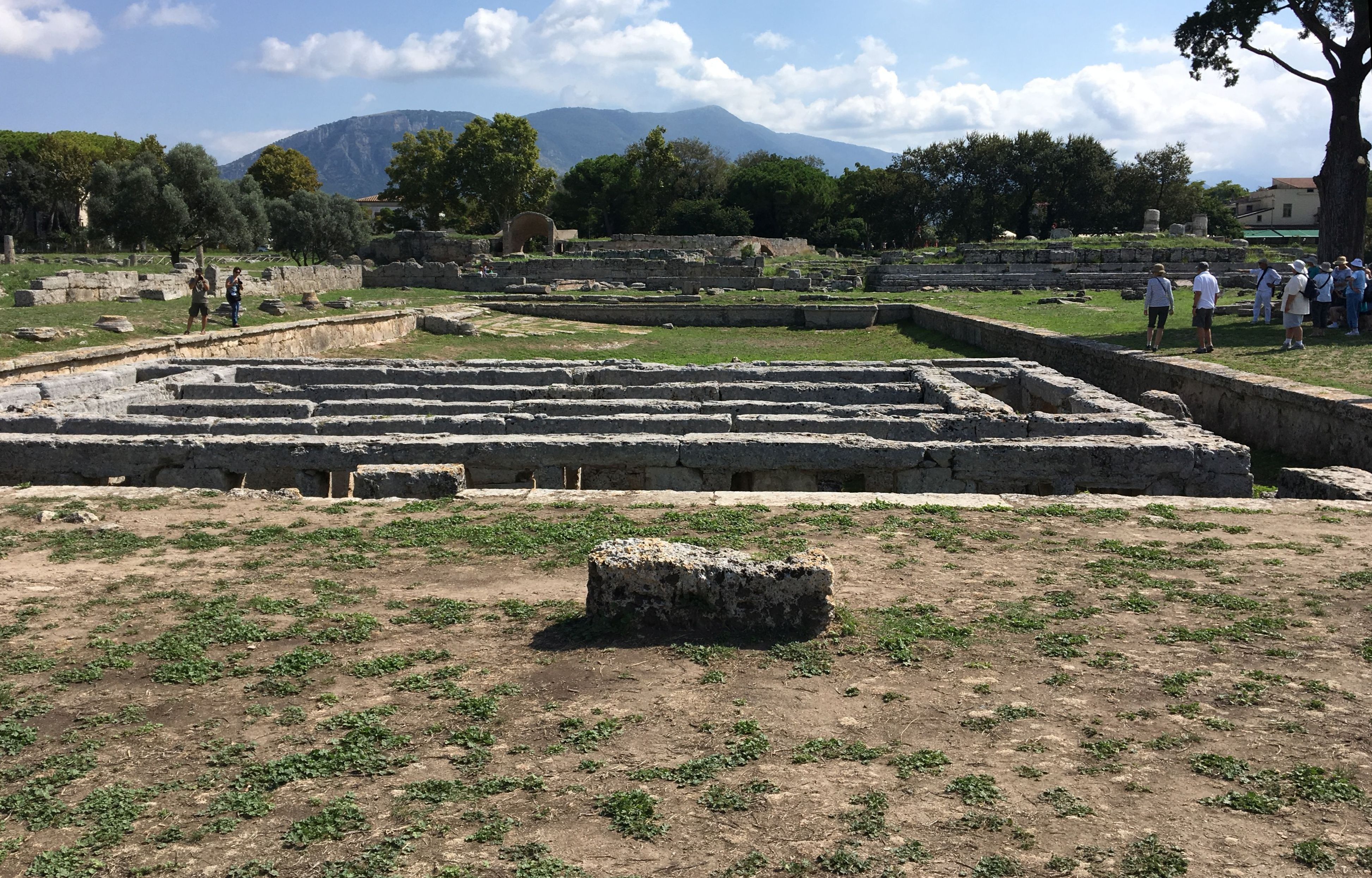
As seen below, the road between the temple at "1" and the other two temples, at 12 and 13, takes you past the foundations of the homes and shops laid out in the Roman city plan. That plan has roads on a grid running N-S and E-W.
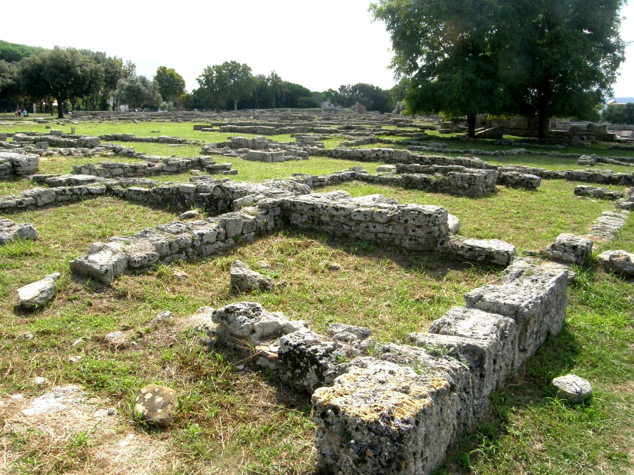
The Roman city plan also provided impressive municiple facilities, like the large swimming pool seen in the image below.
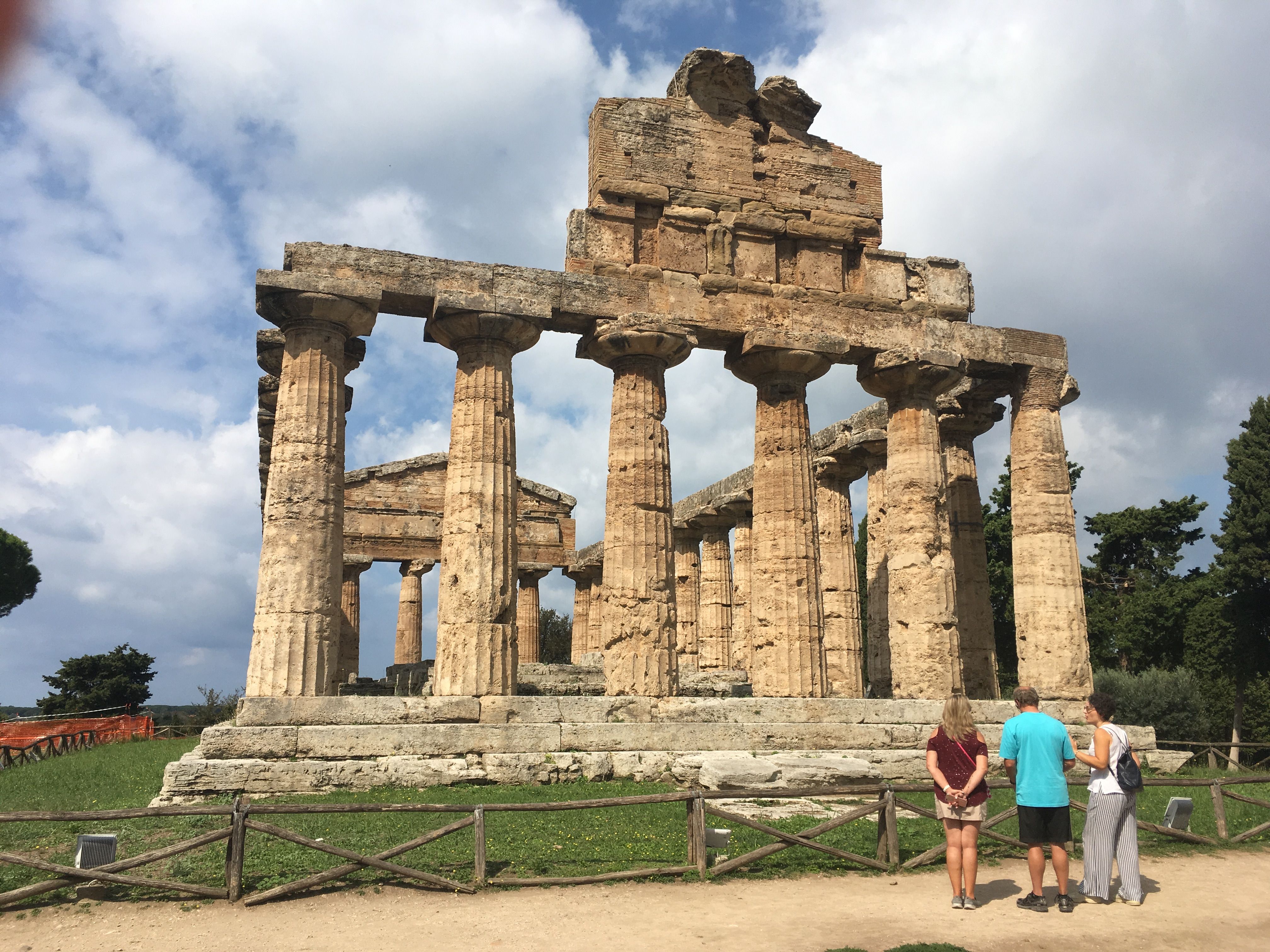
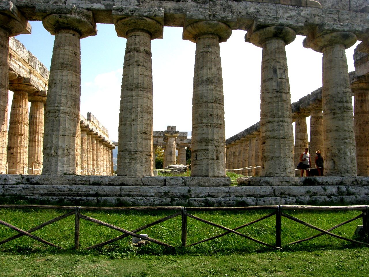
As seen in the image below, as we continued the walk to the far end of the central avenue, the two large Greek temples, which are side-by-side, came into view.
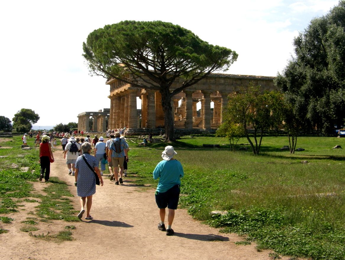
The temple at 12 was the first one built, in 460 BCE, which is only 30 years before the Parthenon was constructed in Athens.
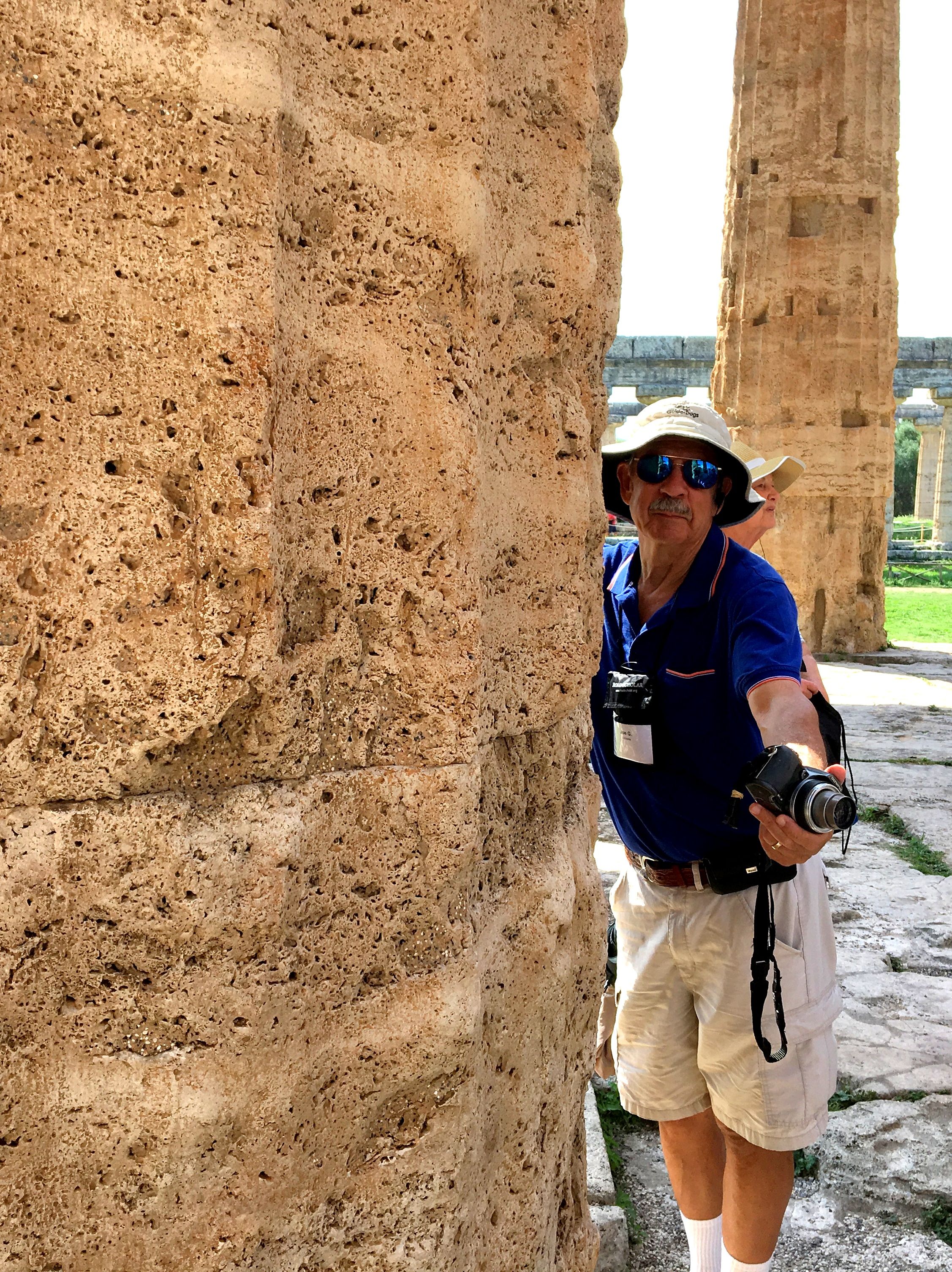
The temple is made of travertine, which is the bedrock in this location. The travertine was and is being deposited in this location by the Capodiflume River, which is supersaturated in calcium carbonate in its headwaters, and has been depositing the calcium carbonate as the rock travertine in and near the stream bed and the springs in this location. Travertine is a relatively soft rock with many voids, called vugs, and can be relatively easily cut and fashioned into structural shapes, such as the pillar I appear to be hugging. I have travertine floors throughout my home.
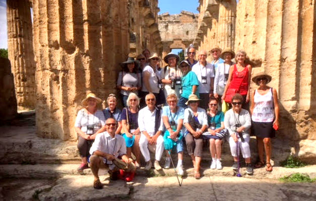
Our Road Scholar tour group poses for its only group photograph at the entrance step to this temple.
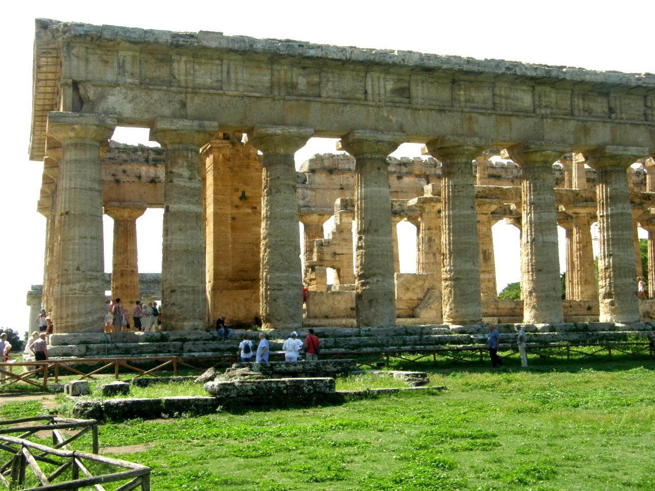
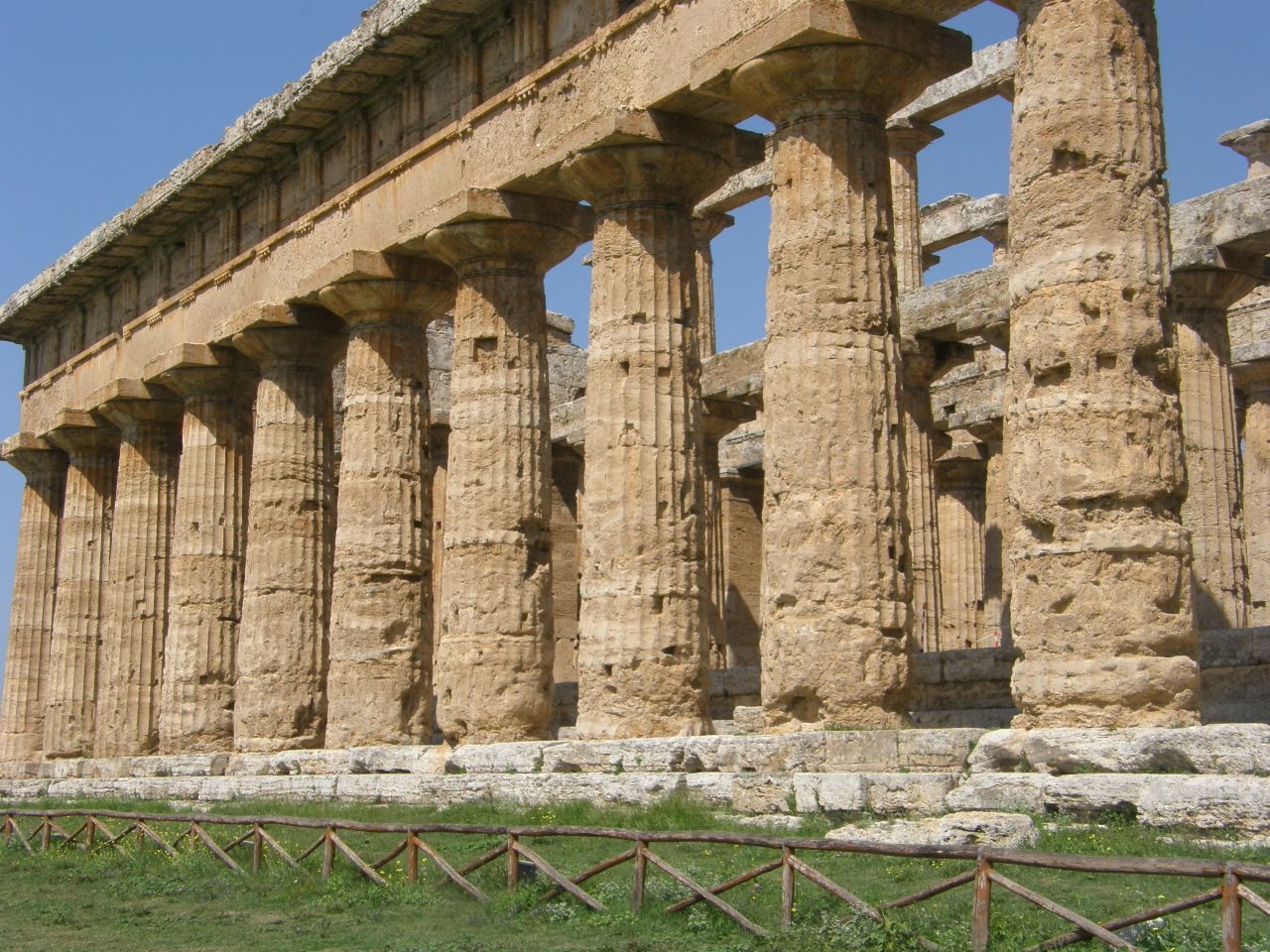
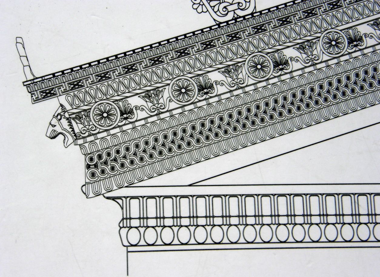
The travertine upper portions of the temples had been carved into impressive artistic designs. Some of these carved stone pieces had fallen over the ages and are now easily seen in the museum that has been built at this site. The travertine at the temple displays a coarse texture that has has many voids, so it is probably not a surprise that these voids had been filled with a finer plaster that was, in turn, painted. Some hints of paint remain in locations that are less exposed to the agents of weathering.
The last of the three temples we visited has dark sandstone in its upper areas. There are several sandstone ridges that are incorporated in the delta of the Sara River, each of which formed as a shoreline that had been left behind as the Sara River delta grew progressively seaward during the interval of the Pleistocene (the Ice Age) to the present.
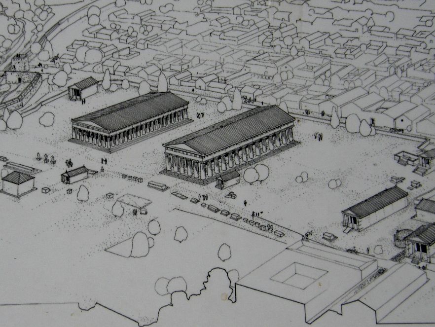
The figure below shows an artistic reconstruction of the site and situation of Paestum when it was at its zenith during Greek and Roman times. Notice it occupies a travertine terrace that is a slight topographic high (40 to 70 feet above sea level) and is relatively well drained. It is also near the fertile deltaic deposits of the Sele River, which would be available for local agriculture.
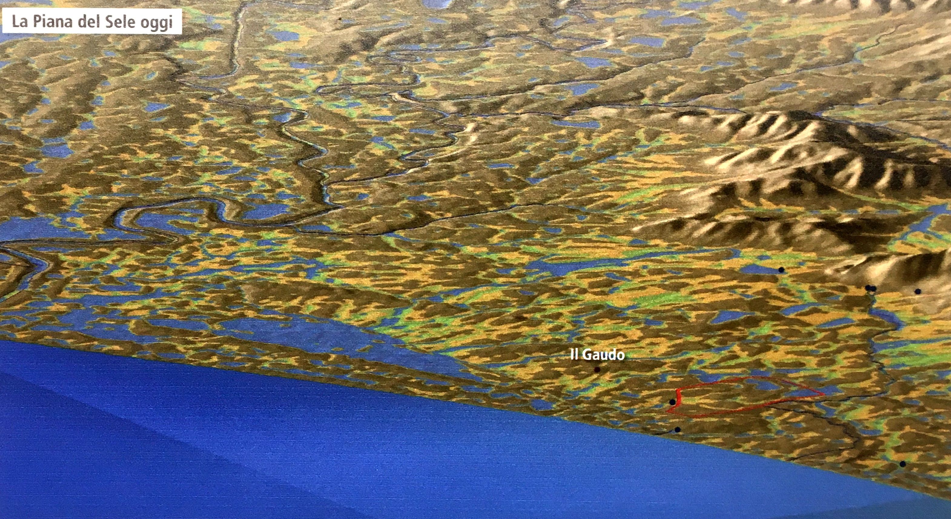
The figure above shows an artistic reconstruction of the physical situation that caused the decline and eventual total abandonment of Paestum: the transformation of a former well-drained floodplain of the Sele River to a floodplain that lacked integrated drainage and, consequently, became swampy. The swampy conditions favored the breeding of mosquitos, and that, in turn, created a malarial environnment. Thus the whole floodplain area of the Sele River was abandoned and the city and its temples were overgrown by vines and trees and plants of almost every kind. The area was generally avoided for the next 1000 years.
Why did the hydrology of the Sele River floodplain change from well-drained to swampy? Earthquakes, which are common in the area, may change the flow of groundwater and may cause adjustments to the height of the land. Also, the social fabric that controls the digging of drainage canals and the amount of logging, and debris from the logging and agriculture, may have interferred with the disgorgement of fresh and brackish waters to the sea. Logging and/or overgrazing may have stripped the upstream land allowing enhanced soil erosion of the steeper slopes which provided additional sediment to the headwater streams of the Sele River, and these sediments may have been deposited in aggrading stream channels on the low-gradient floodplain. It could be that the elevation of this floodplain area may have been lowered tectonically because the whole area is tectonically active and the floodplain is on a down-faulted geologic structure called a "graben." There were also several social events that may have been consequential: the esposed sea-side position of the city may have made it vulnerable to pirates and slavers; and Rome completed a major inland road that bypassed Paestum. It could be that several of these possibilities occurred somewhat simultaneously and the combination yielded the poor drainage conditions and abandonment which spawned the mosquitoes and they, in turn, produced the malaria which drove most people away and kept them away.
With modern massive earth-moving equipment, the drainage of the floodplain has been improved and modern pesticides keep any remaining mosquito population at bay. The area is now richly farmed and grazed. Some farms now even have water buffalo whose milk is used for making specialty cheeses.
Paestum and its temples were rediscovered in the 18th centruy, shortly after the discovery of Pompeii and Herculaneum by an engineer who had been commissioned to build a road through the Sele floodplain parallel to the coast. During the construction, his crews encountered some of the city ruins, hidden by overgrowth, as the new road bisected the ancient city.
During WW II the allies landed a large force from the Gulf of Salerno on the beaches of the Sele River in spite of the resistance offered by the German troops who occupied this region. It took eight days to displace them from the floodplain and then the allies pushed them progressively farther and farther north, up the "boot" of Italy. The allies established field hospital stations during the invasion at the Paestum temples because both sides in the conflict agreed to avoid harming these impressive and irreplaceable structures. Thus, 2,500 years of human history didn't disappear during one anomalous 8-day period in recent human history.
For additional information about the geology of the Paestum site, see the following:
(below) Geomorphology and geoarchaeology of the Paestum area: modifications of the physical environment in historic times.
(below) Geological Setting of the Gulf of Salerno Graben where the archaeological site of Paestum - fig 2. AND Geophysical prospecting in archaeology: investigations in Santa Venera, south suburb of Poseidonia-Paestum, Campania, southern Italy.
For information about travertine, which is very important in the Paestum area and at the Paestum site, see the following: https://sefastone.com/travertine-hot-springs-formation-location-and-extraction/