Superstition Mountains
A thing of beauty is a joy forever.
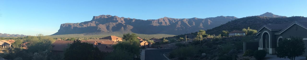
Daybreak, as seen from our driveway. The view looks north, so east is to the right, and the rising sun illuminates the scene from the right. The shadows become shorter as the sun rises higher in the morning sky, giving a changing texture to the scene.
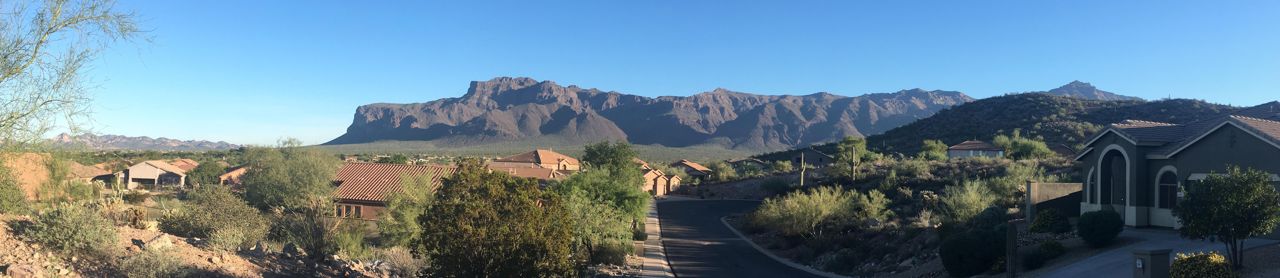
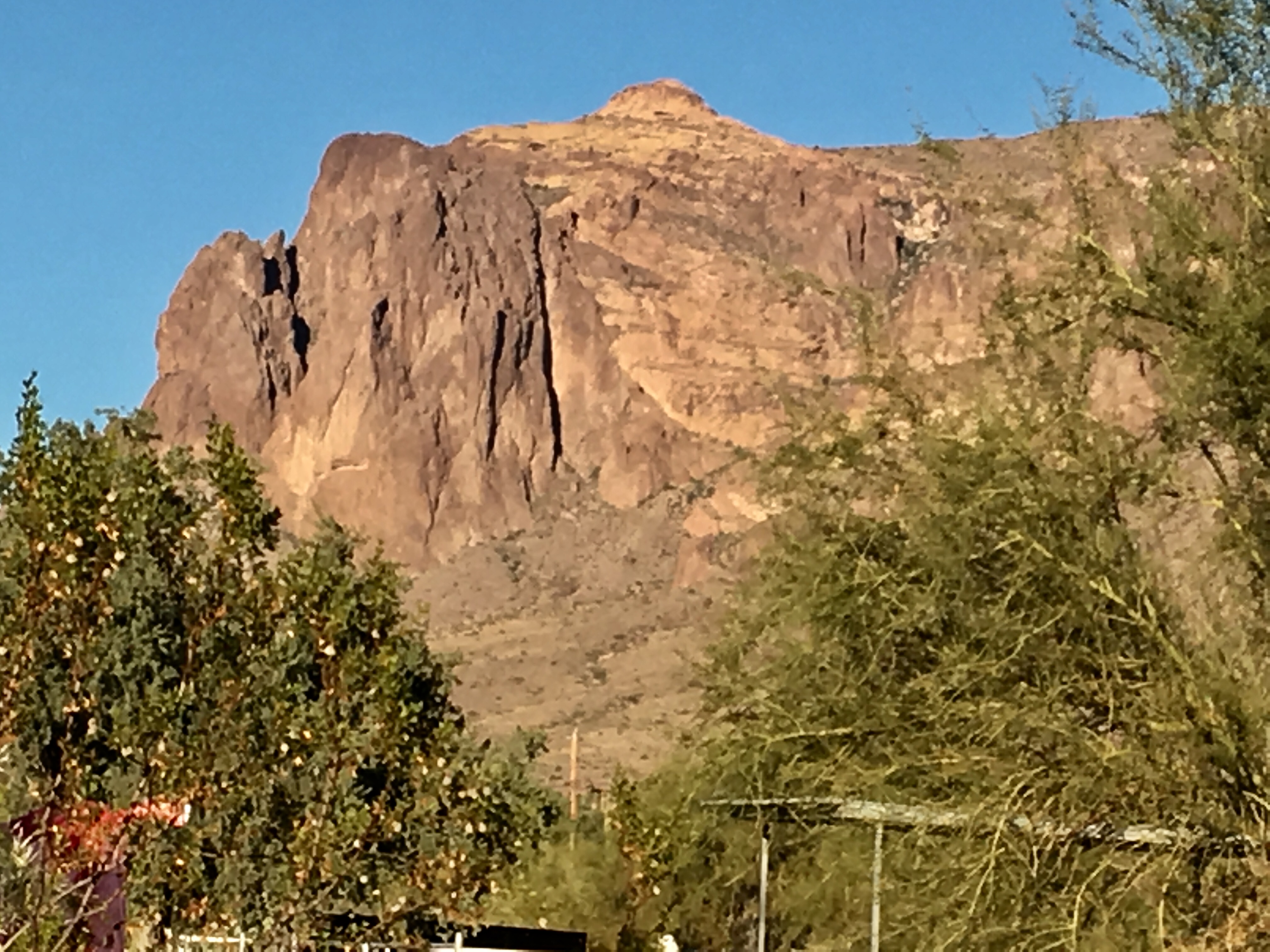
The evening view, as seen from our driveway. West is to the left. Thew illumination of the scene is from the left.
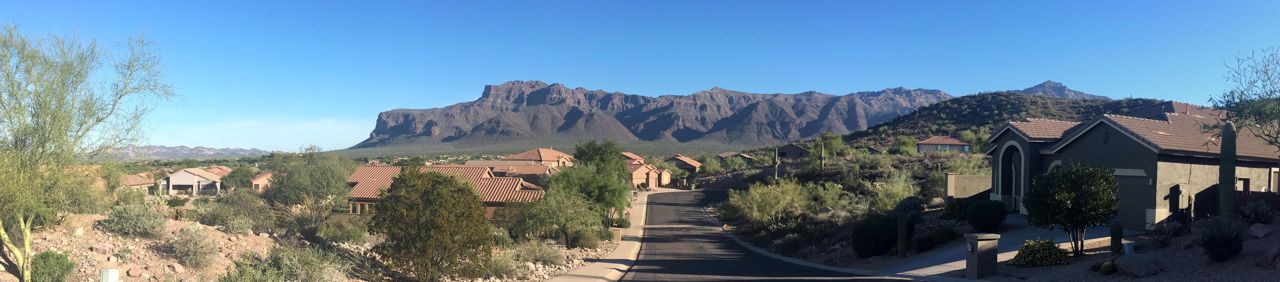
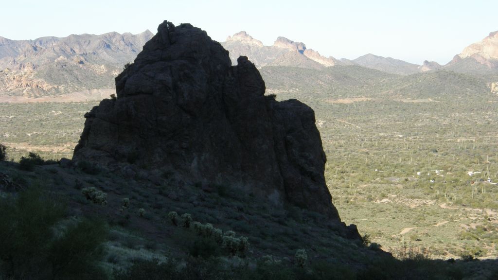
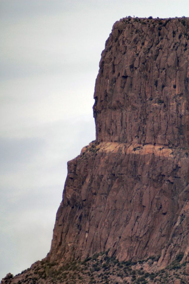
The view below shows the evening view as seen from our driveway. The bright vertical surfaces are fault planes.
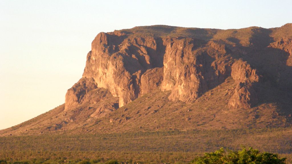
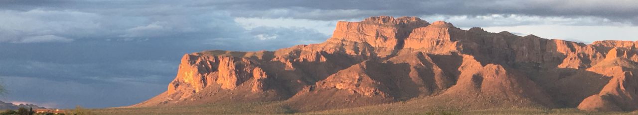
The image below is a view of a near-vertical faultnear the edge of Superstition Mountain. It is the dark, shadowed, near-vertical recess on the image.
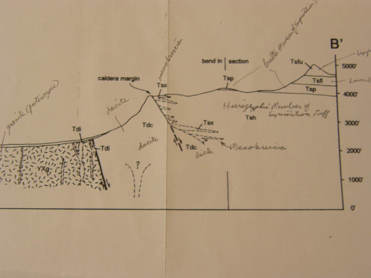
Superstition Mountain is a resurgent caldera, which formed as a volcanic collapse feature that filled with volcanic ash and lava flows in a series of violent eruptions between about 25 million and about 18 million yeara ago. Following the end of the eruption phase, the filled caldera was pushed vertically upward along vertical boundary faults. The prominent shadowed vertical "slice" in the image above is one of the resurgent caldera boundary faults. Some of the shear cliff faces are formed by others. See the cross section diagram from the Arizona Geological Survey Open File Report 95-9 by Skotnicki and Ferguson.
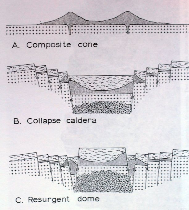
The diagram below shows the formation of the Superstition Mountains in three stages: A) formation of volcanoes and volcanic domes; B) caldera collapse with formation of tuffs and welded tuffs; and C) resurgence of central dome and intrusion of ring dikes. This image, and the one that follows, were taken from Bulletin 184: Geologic Guidebook 4 - Highways of Arizona by Chester F. Royce, Michael F. Sheridan, and H. Wesley Peirce, 1971.
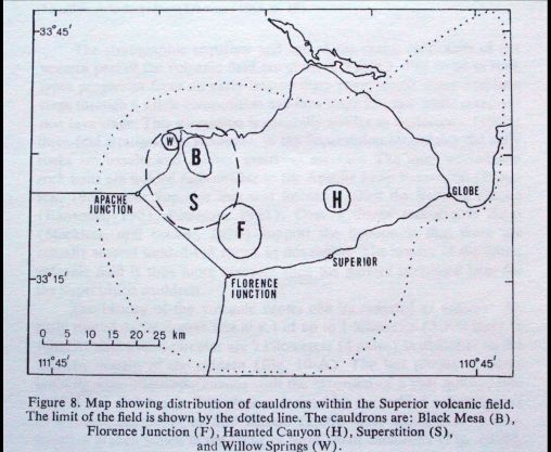
The map above shows the distribution of calderas within the Superior volcanic field, with the limit of the field shown by the dotted line.
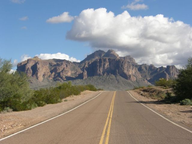
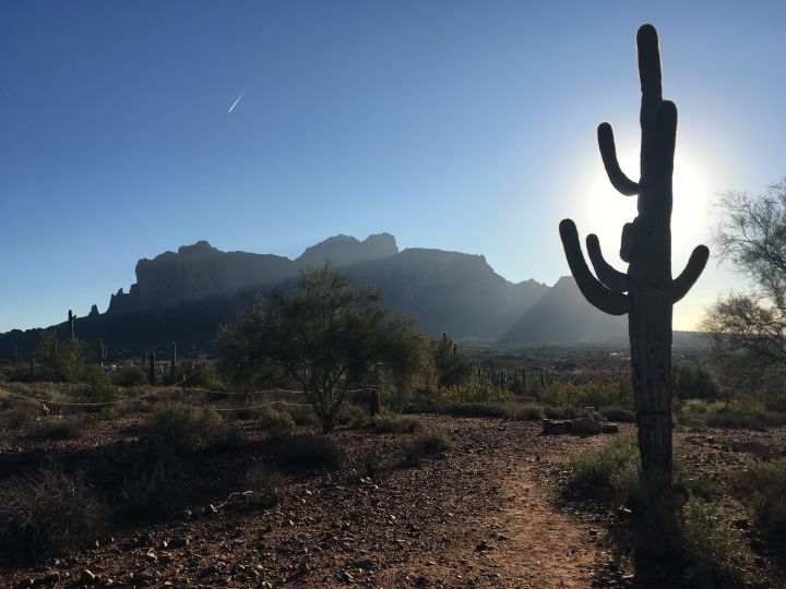
Superstition Mountain, as seen from a nearby highway.
A view of the Superstitions from nearby.
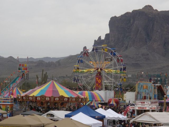
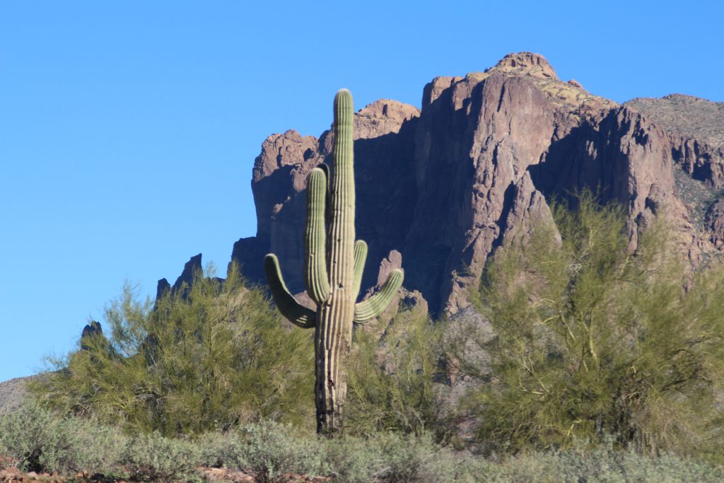
It is the dramatic backdrop for community activities in the nearby town of Apache Junction, which is adjacent to Gold Canyon, where I live.
This is the view as seen partway up to the summit of the mountain. The flat area on the summit is called the "Flatiron."
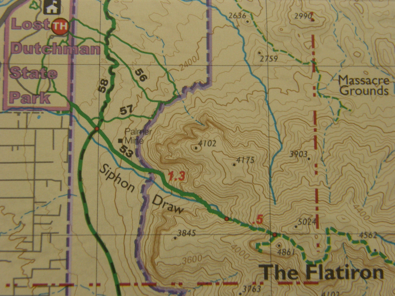
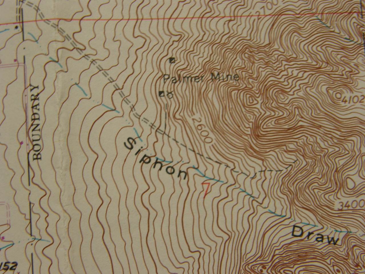
The direct trail from Lost Dutchman State Park, where there are bathrooms and parking lots, to the Flatiron is called Siphon Draw Trail. In a distance of 3.1 miles you ascend slightly less than 3,000 feet. The Flatiron is about 5,000 feet in elevation.
The first half of the ascent is walking up the well maintained path on the large alluvial fan that formed at the base of the mountain stream valley, which is an easier hike than ascending the second half of the distance over the bedrock of the mountain and/or the boulders that are in the bed of the stream valley that you follow to the Flatiron.
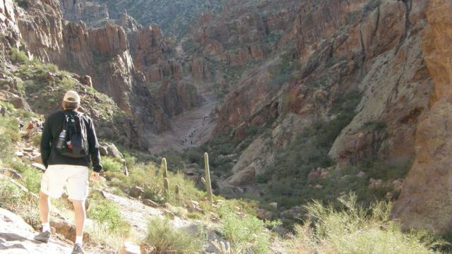
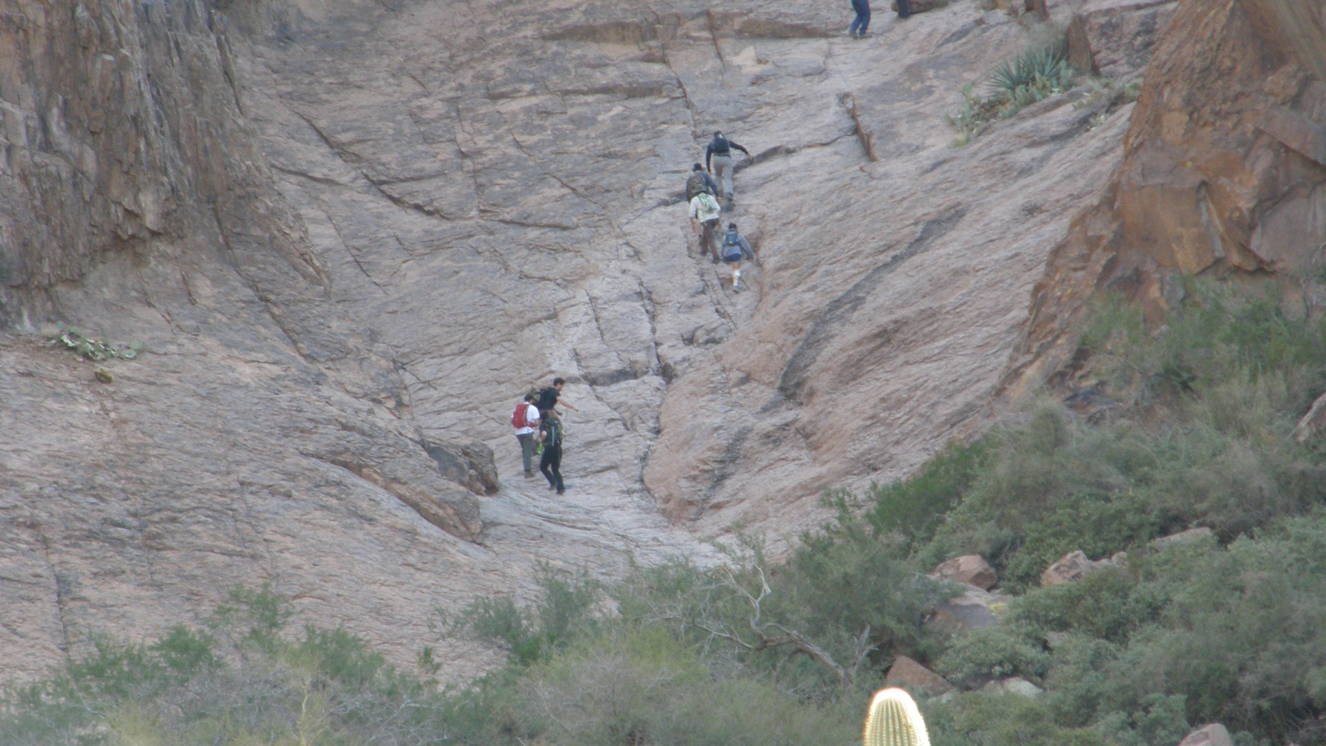
The half-way point on trail to the summit is where you transition from the alluvial fan to bedrock. Notice the climbers ascending the steep bedrock trail.
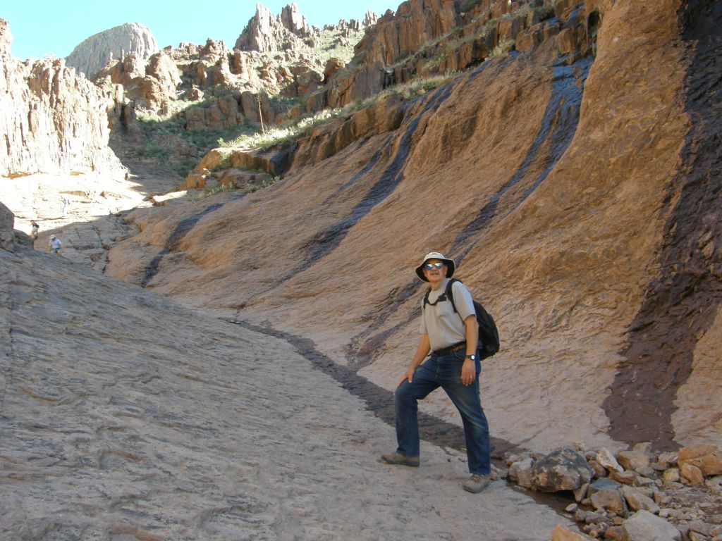
This is me about half way toward the summit. All the rocks in this image are rhyolites and dacites that were deposited as pyroclastic flows in eruptions that occurred about 18 to 25 millions years ago. Notice the wet areas due to some springs that occur farther up the slope.
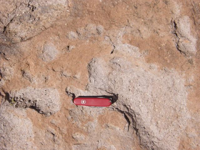
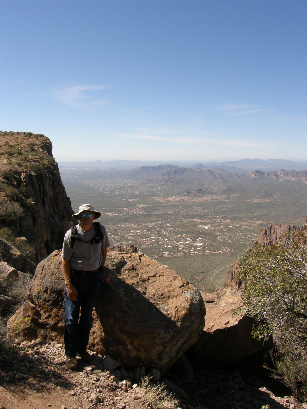
The rhyolites and dacites are tuffs, welded tuffs, and volcanic breccias. This is an example of a volcanic breccia that is exposed along Siphon Draw. Also, here is an image of me on the Flatiron.
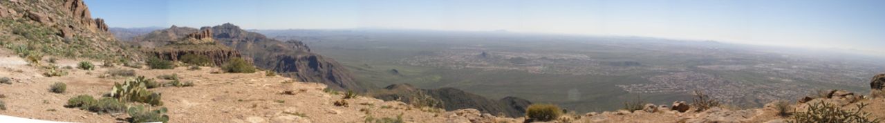
This is a panoramic image of the view from the Flatiron, looking directly toward my home in the community of Gold Canyon.
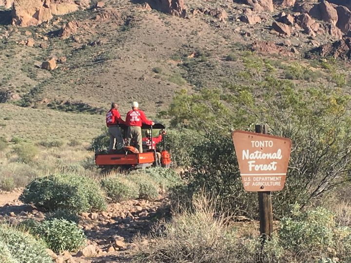
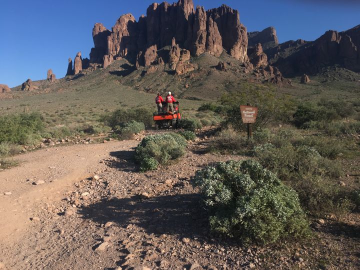
Superstition Search and Rescue is sometimes needed to locate and help hikers who become lost and/or injured.
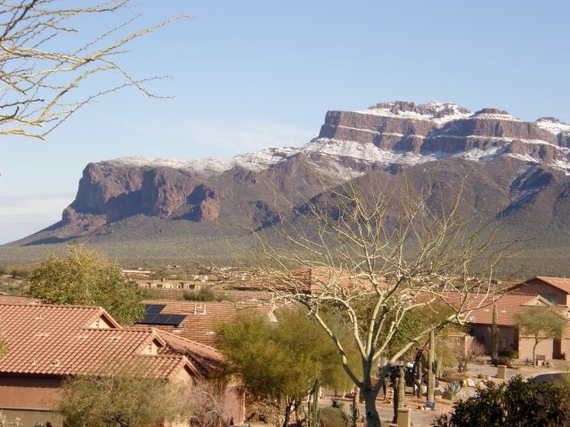
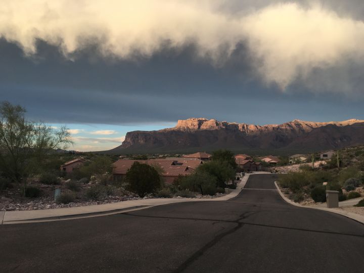
The light snow, although very unusual for this region of Arizona, gives emphasis to the geological structure of the mountain, as seen from our driveway. The highest flat area is called the "Flatiron."
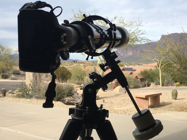
Below is a view of the flatiron taken from my garage using my 4-inch refractor. The scale of the feature can be given by the hikers who are near the point of the flatiron. Shown also is my 4-inch refractor with my Canon T4i camera mounted at prime focus.
The next photo, taken through my 10-inch Dobsonian reflector, shows the point of the Flatiron with hikers and gives a sense of scale for the size of the mountain. Again, my Canon T4i camera was mounted at prime focus.
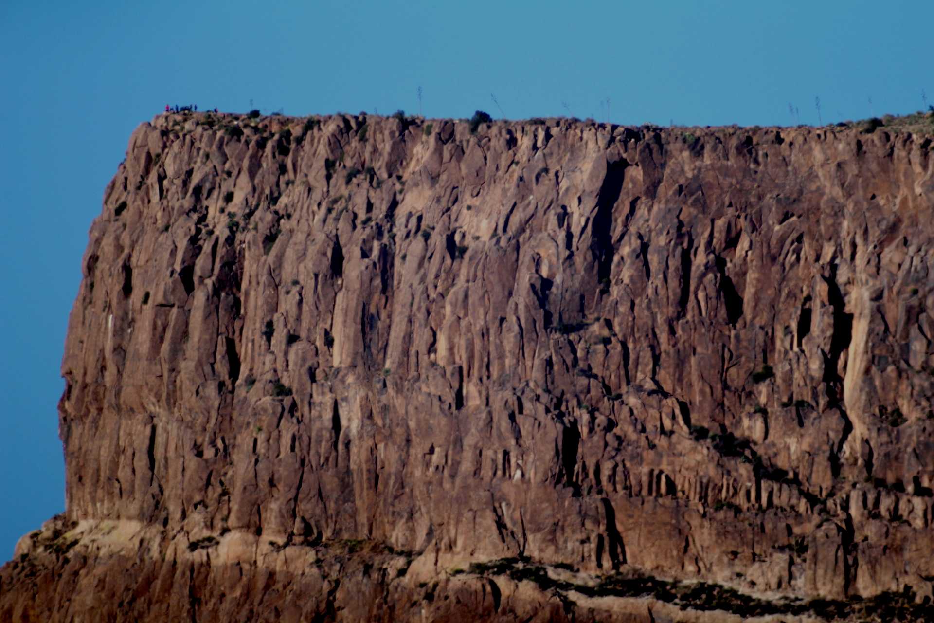
I took the above photograph through my 10-inch reflecting telescope from my driveway. Notice the people near the left edge of the cliff on the Flatiron. The base of this picture is not the base of the cliff; rather, it is the thin layer (easily seen in the previous picture) that is half-way down the cliff face.
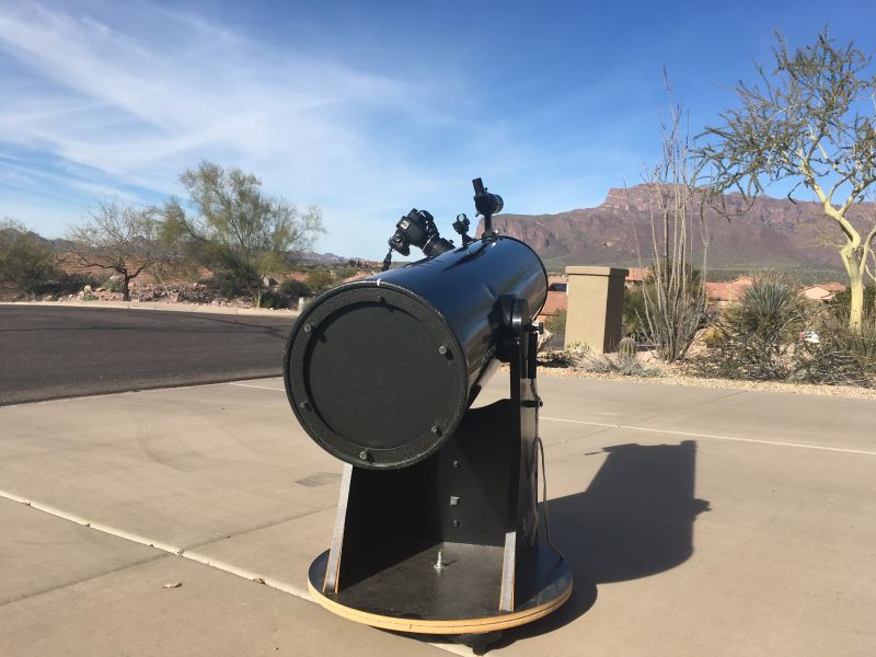
The image above shows the 10-inch Newtonian (reflecting) telescope with my Canon T4i camera setup in my driveway for taking the previous Flatiron image.
The Superstition Mountains: abrupt, compelling, and beautiful..
For a very informative synopsis of the geology of Arizona, see the following:
http://www.janrasmussen.com/pdfs/geol_hist_az_Rasmussen_2012%20preprint.pdf
For the latest geologic map and associated report on Gold Canyon and the nearby Superstition Mountain, see the following:
http://repository.azgs.az.gov/uri_gin/azgs/dlio/246
and
http://repository.azgs.az.gov/sites/default/files/dlio/files/2010/u14/ofr-95-9.pdf
For information about resurgent calderas (also sometimes referred to as resurgent domes), see the following:
http://solarviews.com/eng/valles.htm
and
http://repository.azgs.az.gov/sites/default/files/dlio/files/nid1007/bull_184_geo_guidebook_4.pdf
and
http://www.grapenthin.org/teaching/volc_2016/download/Lipman2000_Calderas.pdf
Rhyolite and dacite are common igneous rocks in this area. Here are links that give more detail about these similar rocks:
https://flexiblelearning.auckland.ac.nz/rocks_minerals/rocks/rhyolite.html
and
https://flexiblelearning.auckland.ac.nz/rocks_minerals/rocks/dacite.html
For information about Lost Dutchman State Park, see the following:
https://azstateparks.com/lost-dutchman/