AZ Geological Society Chilito Copper Mine Field Trip
The Chilito Porphyry Deposit copper mine 2017 field trip was sponsored by the Arizona Geological Society, of which I am a member. Here we are assembling before entering this open pit copper mine. The AZ Geological Society is located in Tucson, AZ, so most of the monthly society guest speaker programs take place in that area, but the annual geological field trips are scheduled for locations throughout Arizona. The Chlito copper mine is only about an hour's drive from Gold Canyon, where I live.
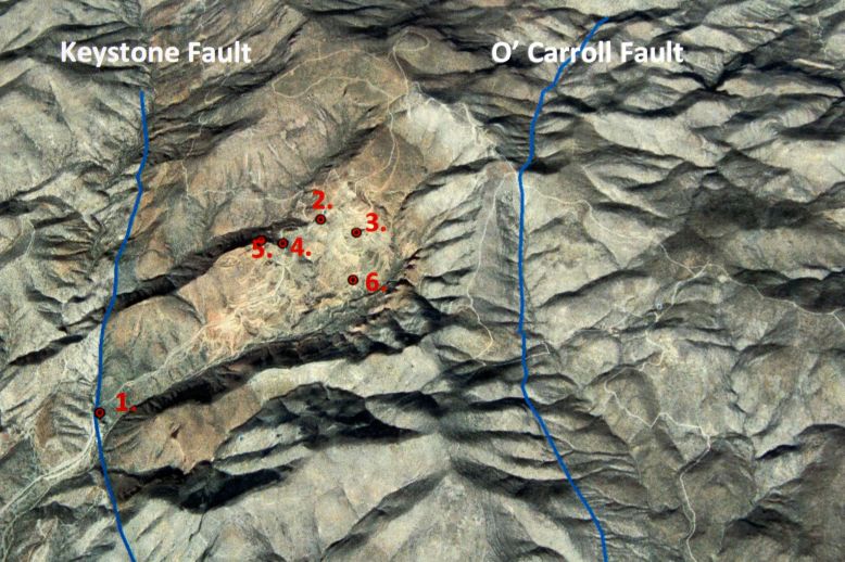
The image below shows the location of the six stops on the field trip. Notice the mine is located between the Keystone Fault on the west and the O'Carrol Fault on the east. The figure is from the field trip guidebook.
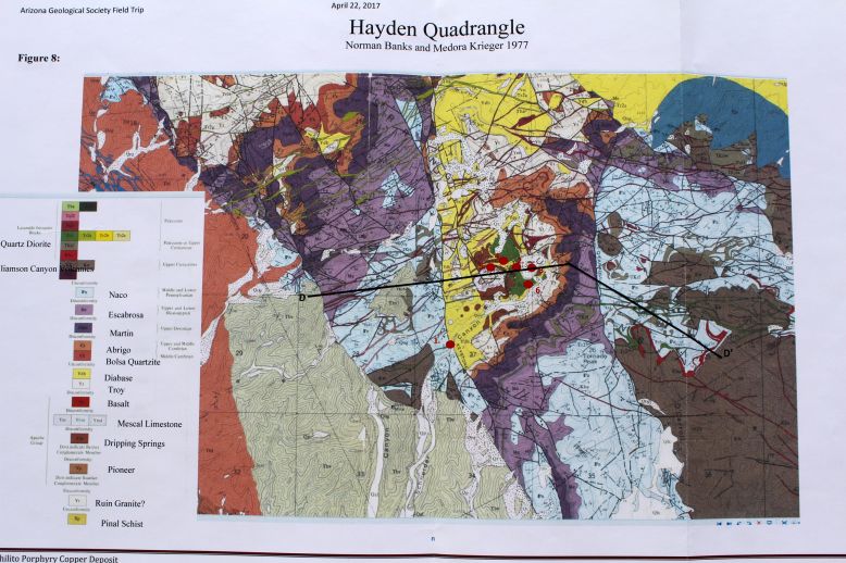
The figure below is a geological map of the mine and the area immediately around the mine. Each of the six field trip stops is indicated on the map by a red dot.
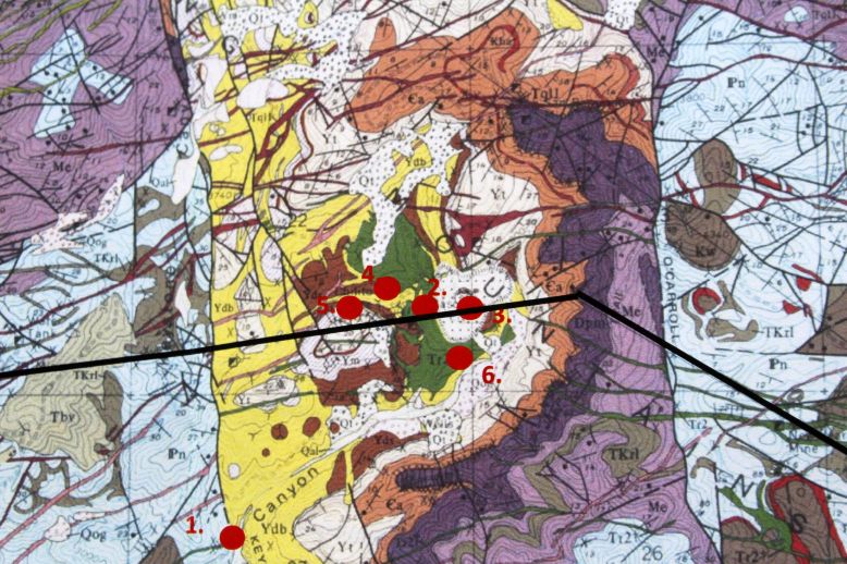
The map below is a closer view of the Chilito mine area of the above map.
The dark line on the above map is drawn as a cross-section on the image below.
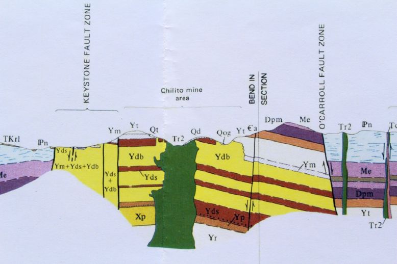
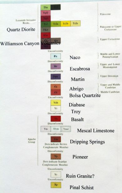
The stratigraphic column (on the figure below) portrays the older rocks on the bottom and the younger rocks on the top. Colors, symbols and names can be applied to the previous maps and cross-sections.
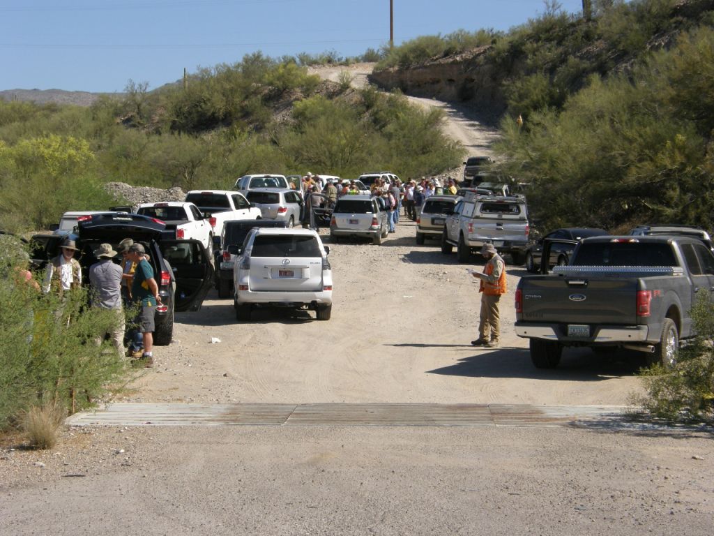
The image below shows the group at the first stop.
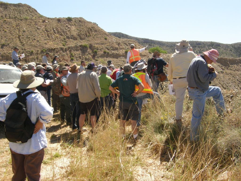
Temperatures were above 100 in the shade, but, unfortunately, there was no shade.
Because the geologic stops within the open pit mine were so far apart, we moved from location to location in a car caravan.
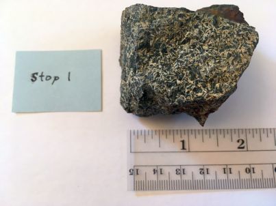
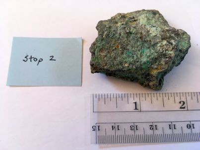
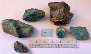
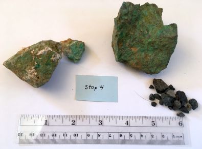
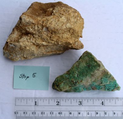
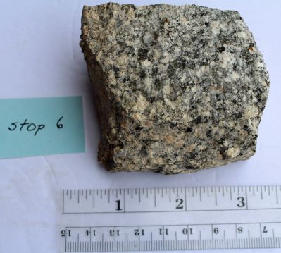
Specimens from field trip stops are below. Copper mineralization is readily apparent as blue/green coloration. Stop 1: Specimens from viewing site of the Keystone fault. Stop 2: Specimens from the overlook of the Chilito stratigraphic section. Stop 3: Specimens from the Velasco pit. Here porphyry dikes crosscut the Troy Quartzite. Also shown are rock chips from deep drilling of deeper parts of the ore body at this location. Stop 4: The Protozoic diabase outcrops here, which is the best host rock for copper oxide mineralition. Also, quartz diorite outcrops here and is the mineralizing event of 66 million years ago. Stop 5: Mescal limestone outcrop. Colorful azurite (blue) and malachite (green) are abundant here. Stop 6: Outcrop of the Chilito quartz diorite stock. This was the deepest exposure on the field trip.
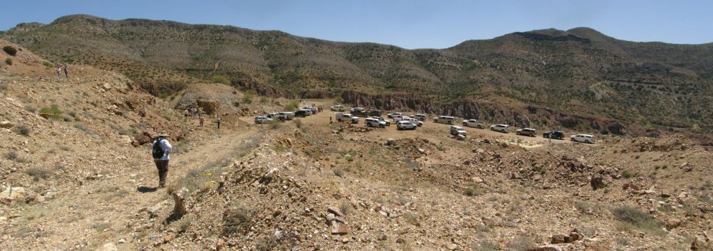
There is considerable distance between stops 5 and 6 in the mine. All in-mine travel for this field trip was done by four-wheel drive vehicles.
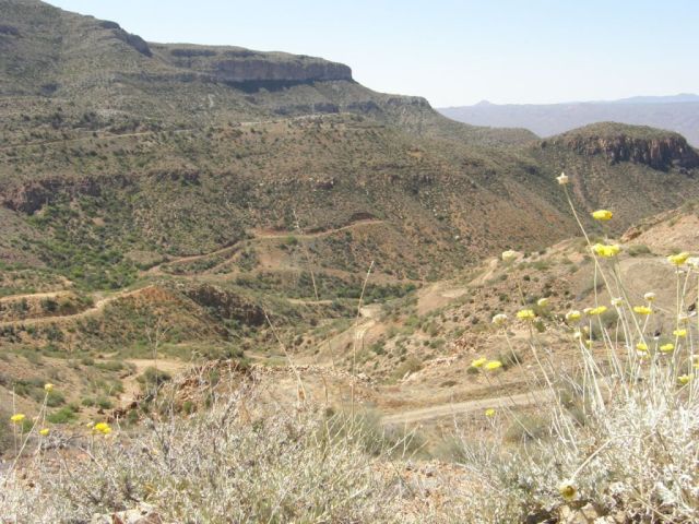
It is a big open pit mine, as can be seen by the winding roads for scale.
References
Applebee, D., and Schuh, W., 2017, Spring 2017 Arizona Geological Society Field Trip Guide: Chilito Porphyry Copper Deposit, Gila County, Arizona. Arizona Geological Society Field Trip, April 22, 2017, 20 p.
For more information about the Arizona Geological Society, see the following reference: https://www.arizonageologicalsoc.org