Earth Fissures: Field Observations
Associated with subsidence in the Hawk Rock area
The Google Earth image below shows the entire area associated with this webpage. The view is a portion of the city of Apache Junction, AZ, and the street that runs W-E across the approximate center of the image is Houston Avenue, a portion of which collapsed into a fissure at the location between the two black arrows. There are housing developments along the western edge of the image and in the NE corner. The Central Arizona Project (CAP) canal runs diagonally as a dark line from top center to the center of the right edge. Known ground fissures are indicated with red lines and suspected ground fissures are indicated with green lines.
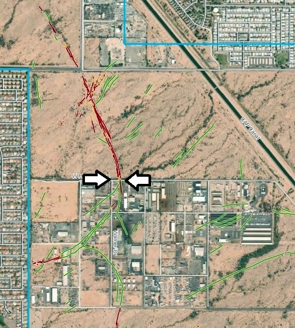
On the above Google Earth image, Houston Avenue separates a tract of undeveloped land on the north from an industrial development on the south. Prior to the interval between 1992 and 2003, when this industrial area started to be developed, a small exposure of bedrock, called an inselberg and named "Hawk Rock," had existed in the approximate center of what is now the industrial area. The Hawk Rock name continues to be applied to this area even though the inselberg was removed as part of the industrial development and even though the inselberg no longer exists as a topographic feature.
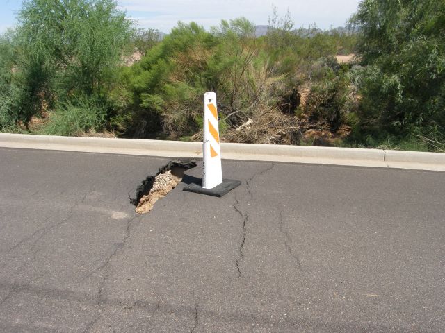
In July, 2017, after a rainy period, an earth fissure extended beneath Houston Avenue, collapsing a portion of the roadway. The highway department immediately installed the barriers to shut down the road. This feature is located about five miles from my home. I took the image below about two weeks after the fissure caused the closing of the road.
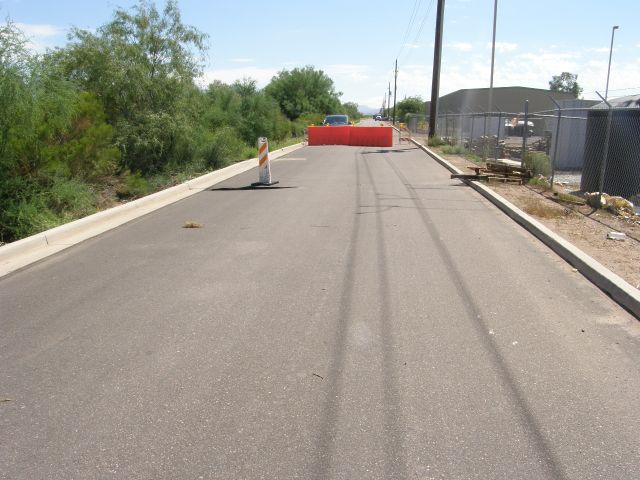
Houston Avenue runs W-E and separates the industrial area to the south from a vacant area to the north. In the image above, the view is to the east, whereas in the image below the view is to the west.
The image below shows a closer view of the collapsed surface of Houston Avenue, looking west.
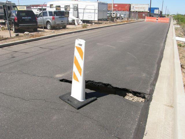
The image below shows the same collapse feature, looking north.
The above view shows the cracks in the road surface where the failure is extending farther from the initial collapse. Beyond the roadway, the growth of vegetation in the fissure obscures it from this July, 2017, view.
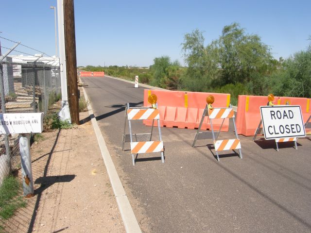
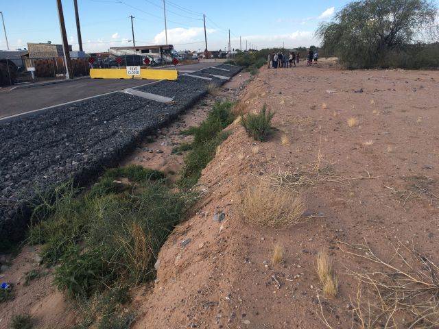
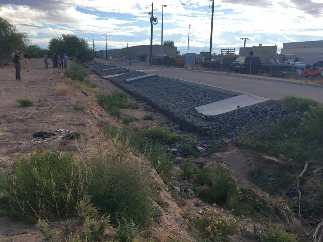
The four images that follow show Houston Avenue and the area immediately north of Houston Avenue in November, 2019. The road improvements were completed in July of 2018, but a local rainstorm about a month later dropped about 2 inches of rain and this reactivated the fissure. The road collapsed again, trapping a truck. The view below looks west and shows the reengineered and reinstalled collapse mitigation structures. Notice the traffic barriers are still present and, as of November 2019, this portion of the road is still closed.
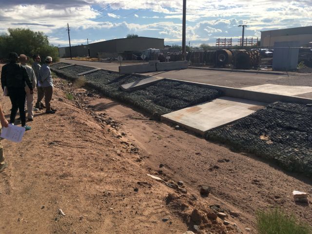
The image below shows the same features, looking to the southeast.
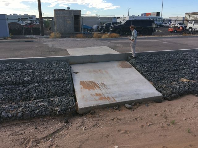
The image below shows the view toward the south. The industrial development beyond the roadway is apparent in the image.
The view below is to the east.
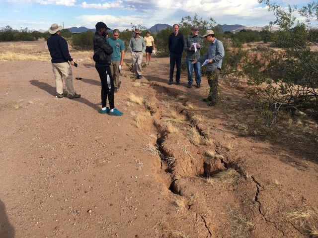
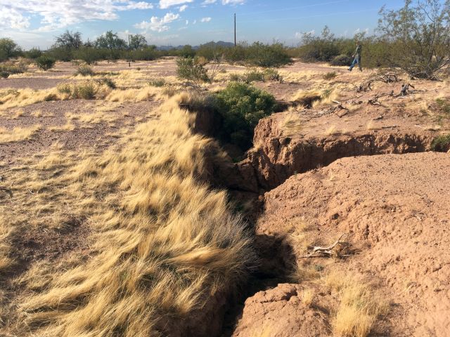
The images that follow show fissures in the undeveloped area north of Houston Avenue.

As seen in the image above, a new fissure often starts as a linear series of isolated depressions.
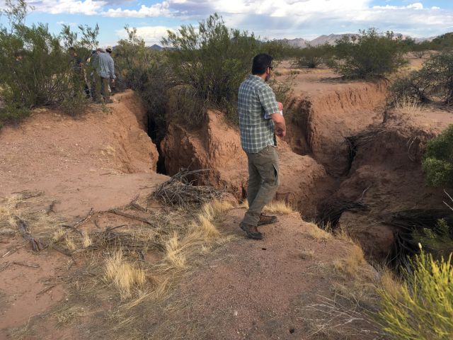
The image above shows how individual depressions coalesce to form a shallow trough-like depression.
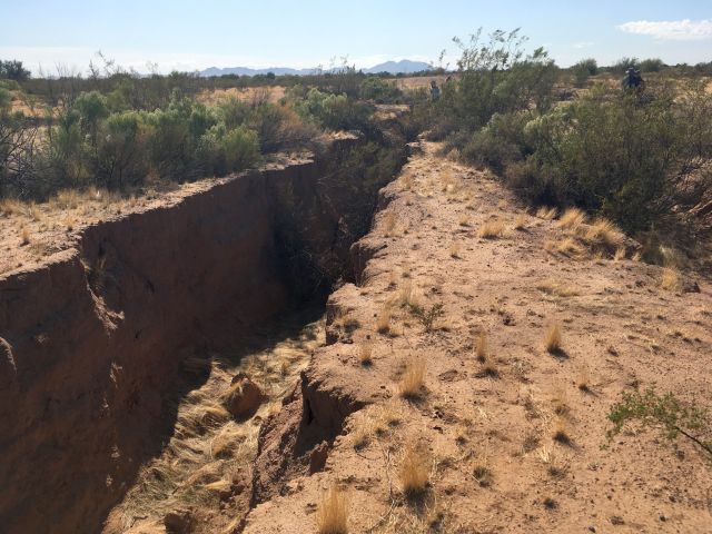
The image above shows a trough that deepened.
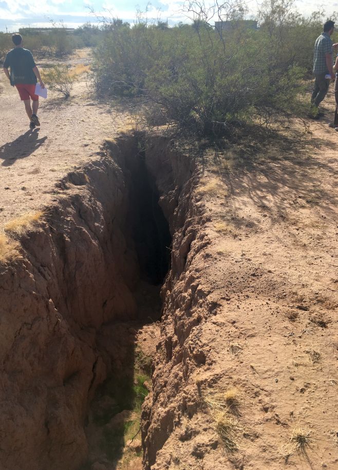
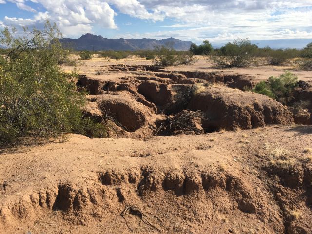
The image below shows a trough that is even deeper than the one above. These deep fissures are conduits for surface water during infrequent times of rain in this desert region, but mostly they are dry and so are sites of circulating cooler air from below. Consequently, they are often favored environments for snakes and hives of Africanized bees.
The four images below show headward erosion of small streams that form along the walls of the fissure. These stream channels facilitate the rapid drainage of occasional downpours from upslope areas directly into the fissure.
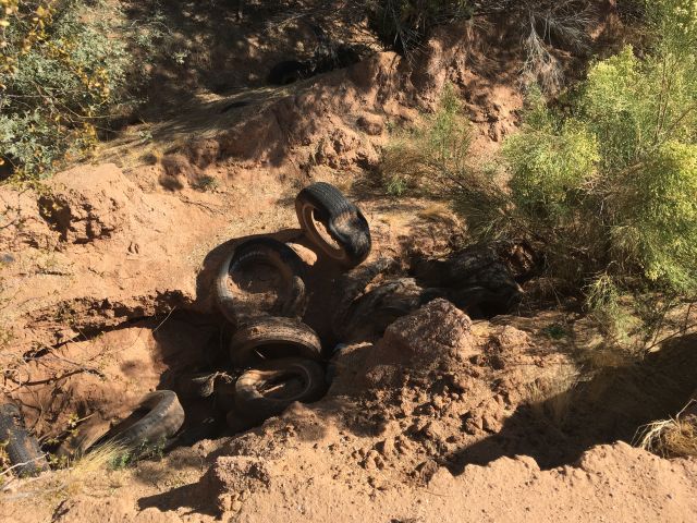
Unfortunately, but not surprisingly, the fissures also are used for the disposal of garbage and trash. The image above shows old tires at the bottom of a deep fissure.
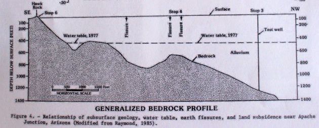
The alluvial deposits in this section of the Hawk Rock area can extend from zero to greater than 2000 feet thick. The alluvium is capable of holding a large quantity of groundwater, but pumping rates have exceeded recharge rates, so the water table has declined 100 to 300 feet, which has caused aquifer compaction and land subsidence in excess of 2 inches per year during the interval between 1978 and 1987. When there is significant horizontal change to the depth of the subsurface bedrock, or significant horizontal change to the properties of the alluvium, then the differential compaction of the alluvium may result in the formation of fissures on the surface.
The image below shows Hawk Rock, for which this area was named. Hawk Rock is an inselberg, which is an unusual and somewhat rare erosional feature that can form in a desert. It represents the yet-uneroded top of a larger mass of bedrock. This feature was located in the approximate center of what became the industrial area immediately south of Houston Avenue. This inselberg no longer exists above ground level because that part of it was removed with the development of the industrial area. If I interpret the Google Earth historic images correctly, they reveal that the inselberg disappeared sometime between 1992 and 2003.
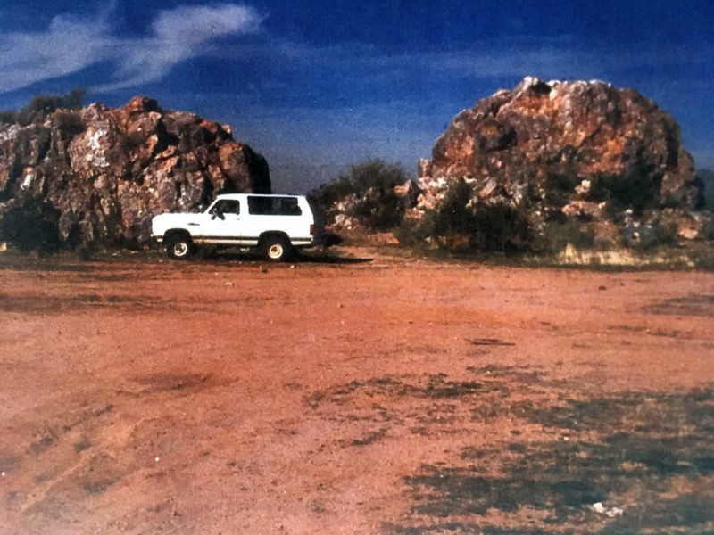
The above historic image of Hawk Rock was published in the Field Trip Guidebook for the Final Meeting of the UNESCO-IGCP641 Project, "Land Subsidence and Earth Fissuring in Arizona and the Southwest," 6 November 2019, Tempe, Arizona. This reference lists Hawk Rock as having been composed of quartzite and having covered an area less than 1500 square meters. It was 7 kilometers from the nearest inselberg. It is not a remnant of the formation of the pediment, but rather is a small tip of a block fault mountain almost, but not quite, completely buried in the alluvium. This is shown in the cross-sectional diagram below (from Pewe, 1987).
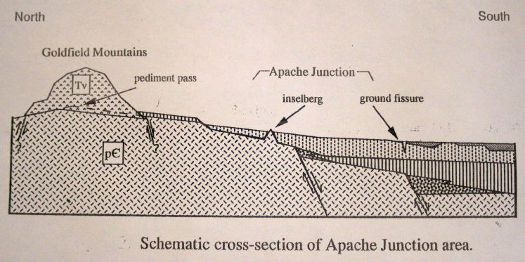
The figure below, modified from Hackleberry, 1994, (figure 2, page 4) shows a schematic view of a N-S cross-section of the Apache Junction area, with an inselberg developed on a shallow pediment. I infer that this inselberg is the Double Knolls bedrock outcrop that is on the north edge of Apache Trail (Main Street in Mesa). The faulting shown on this and the previous cross-sections are steeply dipping normal faults that were produced by tension (pull-apart forces) during the Basin and Range disturbance that occurred approximately 8 to 15 million years ago.
References.
For a detailed map that shows this earth fissure crossing Houston Avenue (which runs east-west on the image), see the following: http://repository.azgs.az.gov/sites/default/files/dlio/files/nid782/apachejunction_v2.pdf. This specific earth fissure is indicated by a red line north of Houston Avenue and as a green line south of it.
For maps that show earth fissures in the region, see the following: www.azgs.az.gov/efmaps.shtml
Hackleberry, G., 1994, Surficial Geology ofthe Appache Jnction Area, Northern Pinal and Eastern Maricopa Counties, Arizona. Arizona Geological Survey OpenFile Report 94-10, 25p, 2 maps.