Weaver's Needle
An Iconic Superstition Mountain Feature
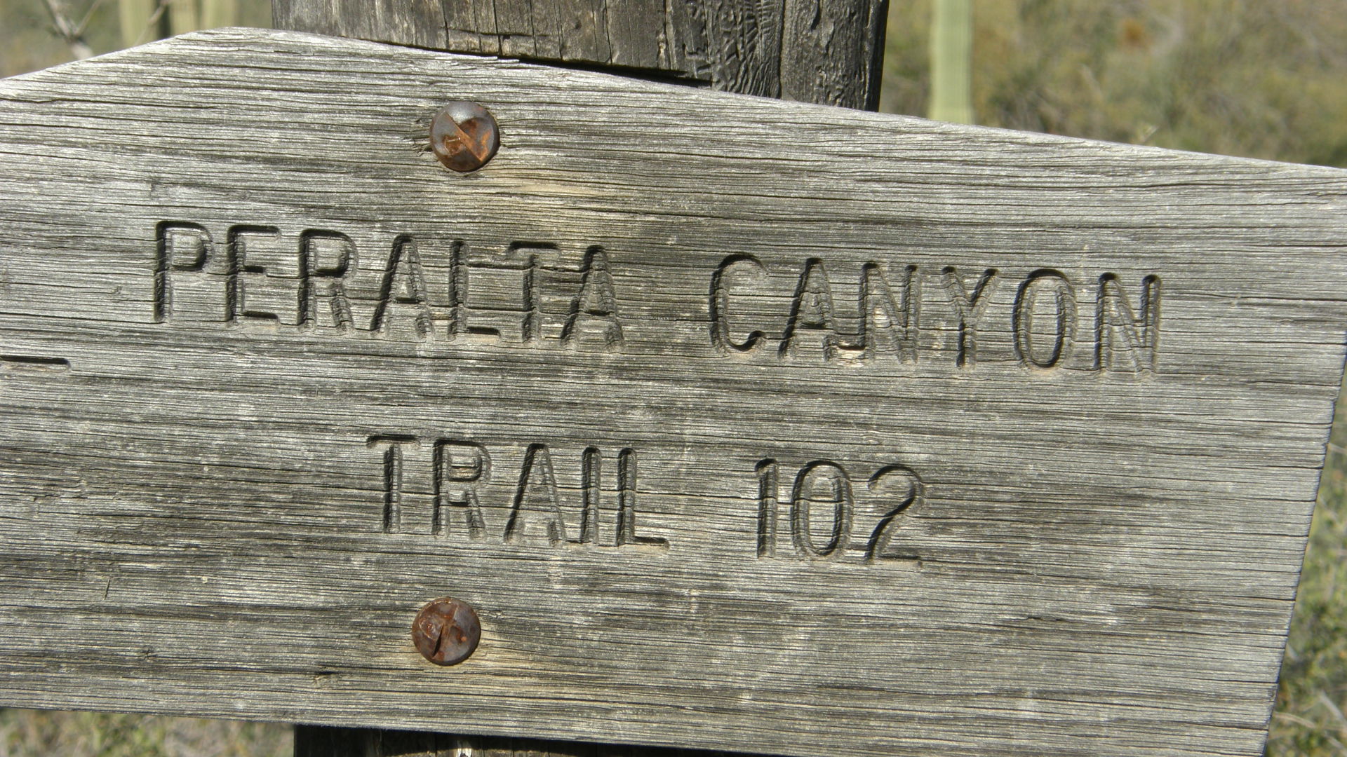
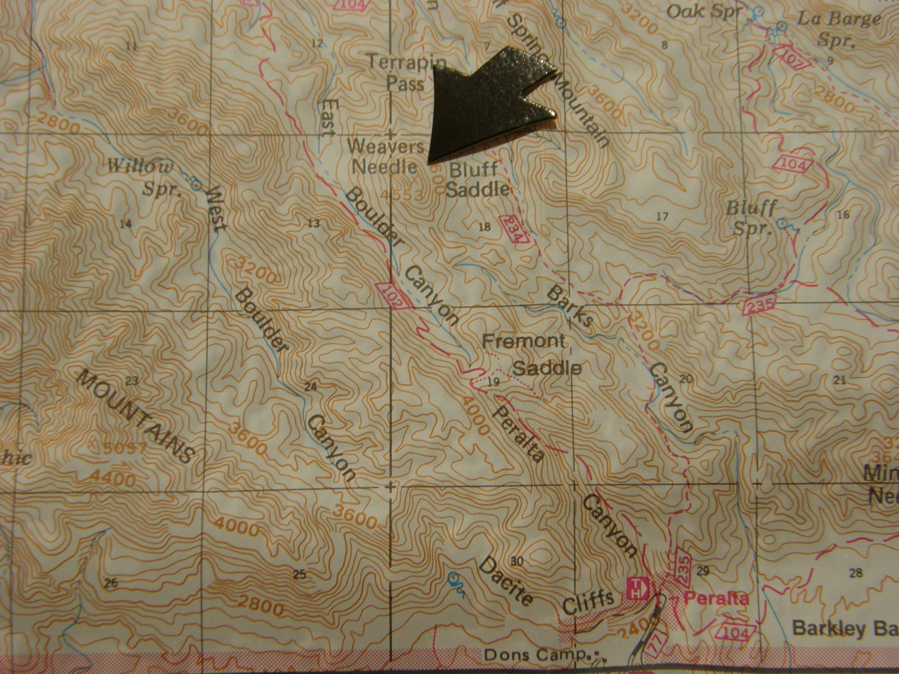
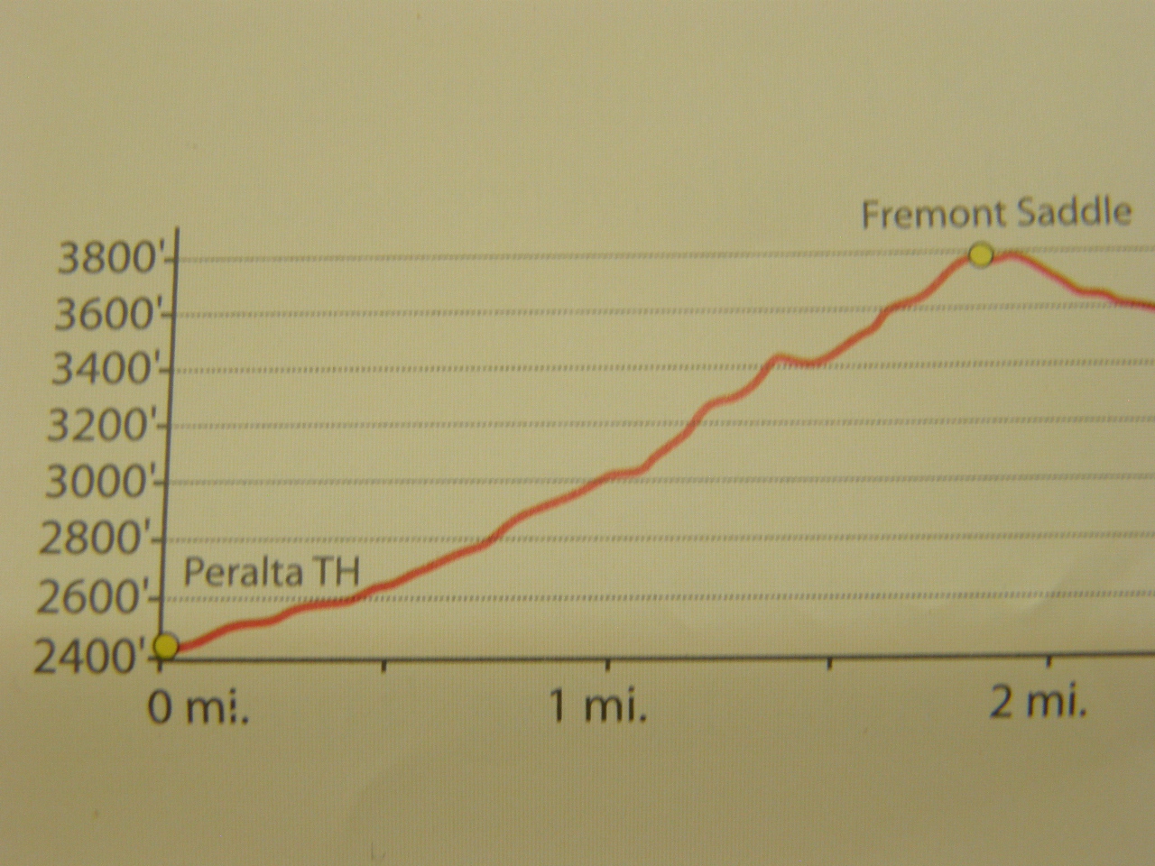
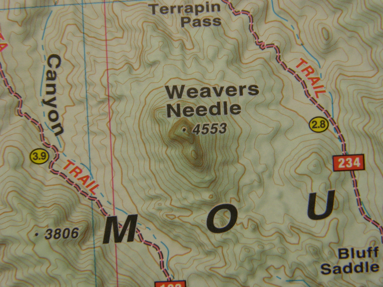
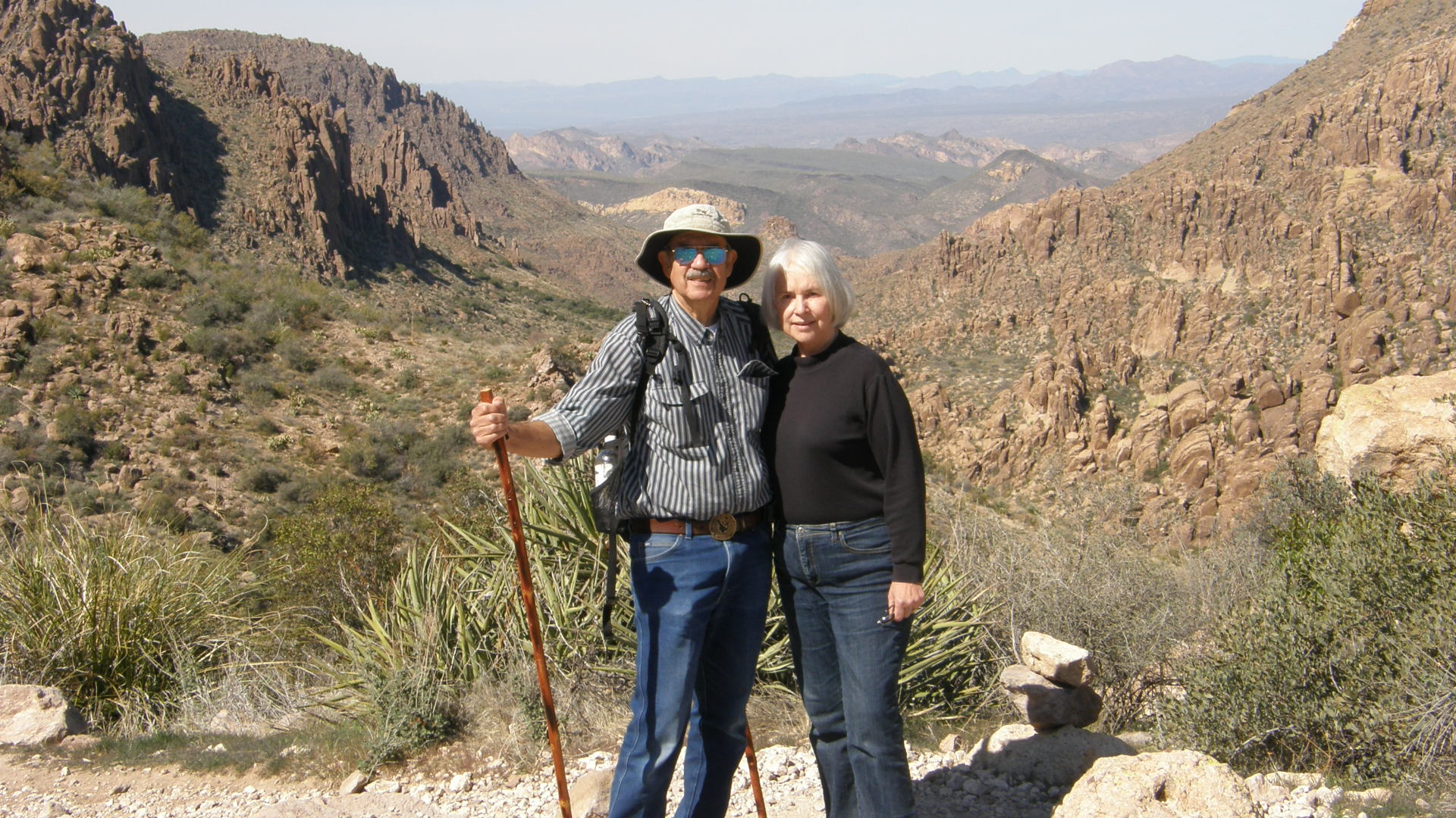
Weaver's Needle is a conspicuous landform, about 1000 feet high, that can be seen from many 10s of miles away and from almost all sides of the Superstition Mountains. At first impression, it appears that it might be a volcanic neck, but its true origin requires a closer assessment. To get a closer approach, we will need to hike Peralta Trail to Fremont Saddle, ascending approximately 1,400 feet in about 2 miles, and then going a little beyond.
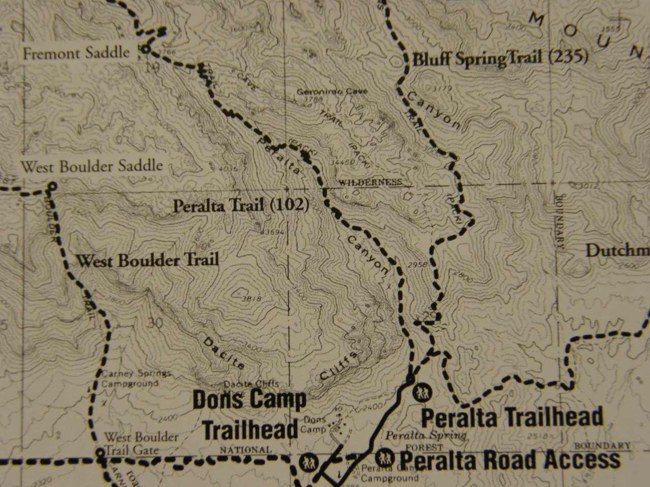
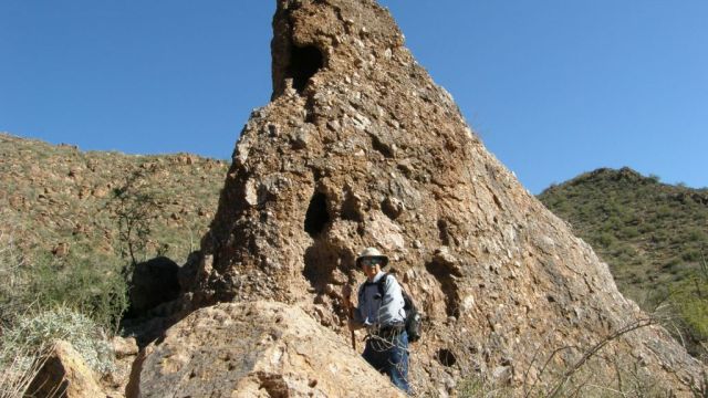
The ascent takes you past volcanic breccias which may have been deposited as volcanic mud flows (see image below).
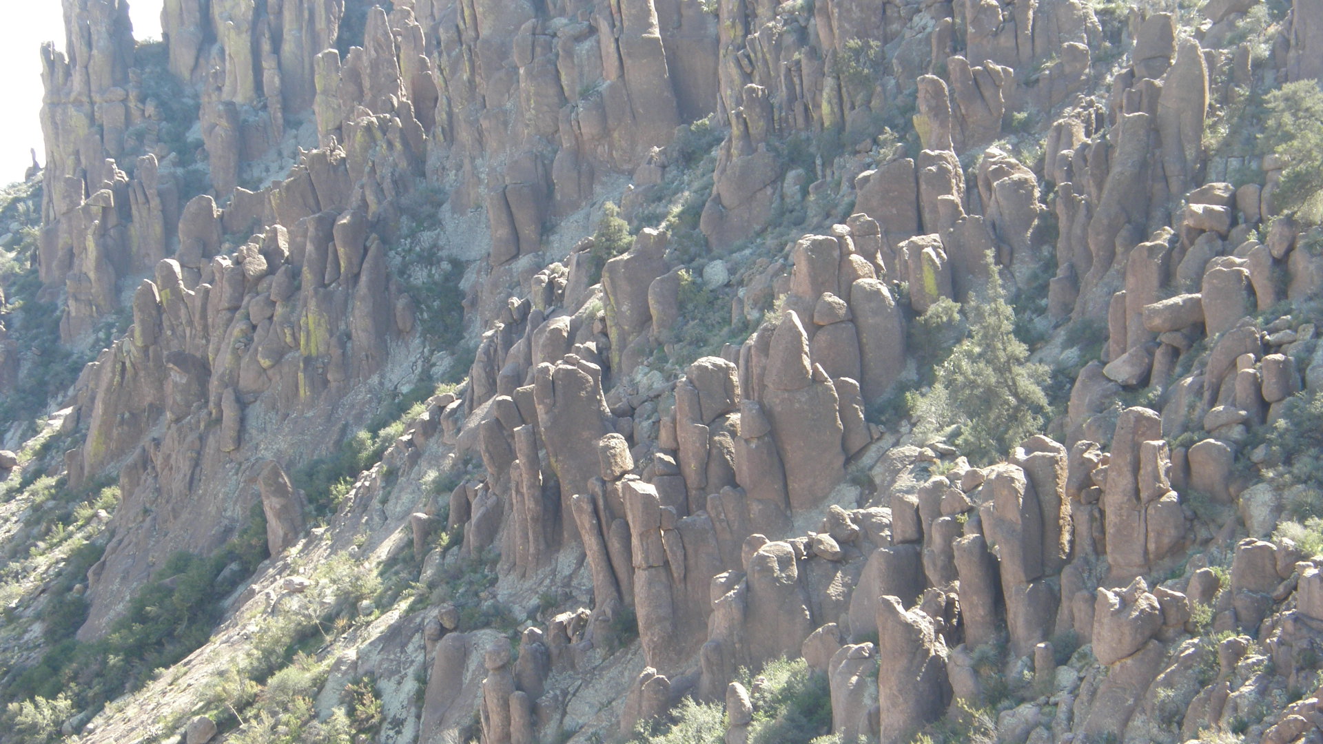
Hiking on the trail, we pass through some thick layers of volcanic ash deposits that were sufficiently hot when the particles settled out of the air that the glassy fragments welded into a solid mostly glassy rock. These glassy layers weather into conspicuous "fingers" that point skyward, also known as hoodoos. Those layers that formed from volcanic ash in a similar fashion, but at lower temperatures, have not welded and consequencly tend not to weather into the hoodoo forms.
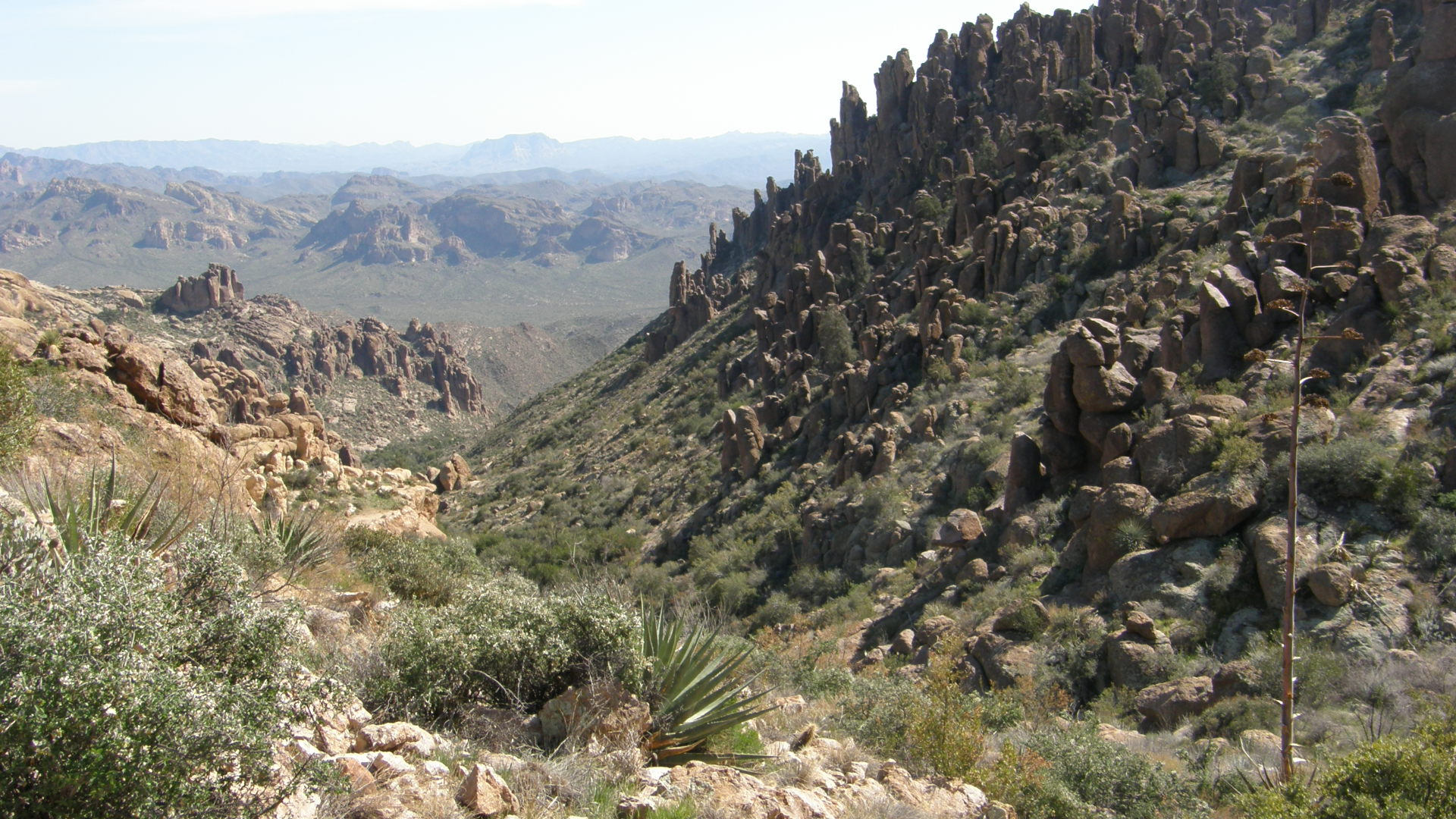
Arriving at Fremont Saddle, we are at the highest portion of the trail.
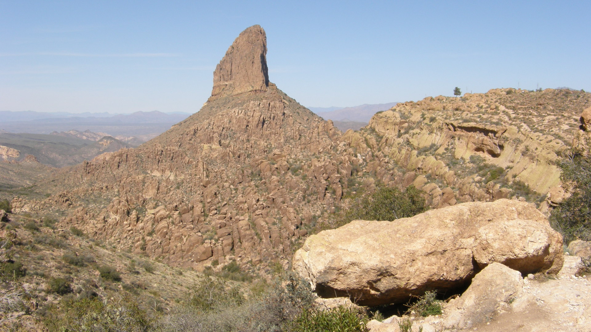
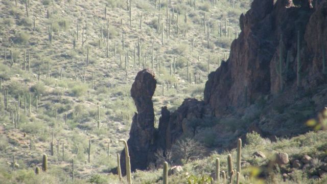
We can now clearly see that Weaver's Needle isn't a volcanic neck, which would be uniform in composition, but rather it is an erosional remnant of layered ash flows. These flows had overlain what is now the upper-most layers of the Superstition Mountains and subsequently have been completely eroded, except for this singular erosional remnant. Weaver's Needle has been mapped as a rock unit of rhyolitic composition.
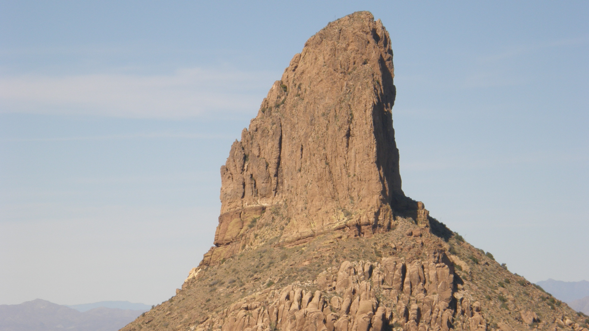
Notice the structures that I think can be seen in Weaver's Needle from this perspective: a near-vertical fault separates the closer half, which appears to be relatively structureless, from the more distant half, which shows distinct bedding. I have not, however, gotten closer to this feature than where I was when I took this photograph, so my interpretation should be considered tentative, at best.
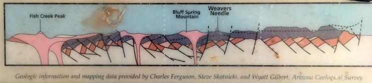
The above image shows a cross section through the Superstition Mountains with Weaver's Needle prominently indicated. This graphic is displayed at Needle Vista Viewpoint.
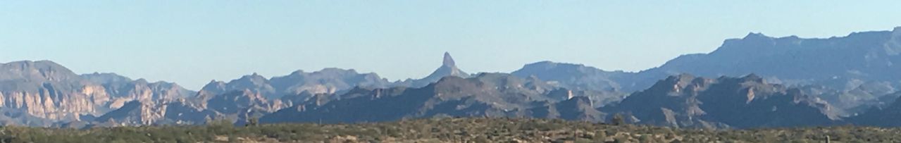
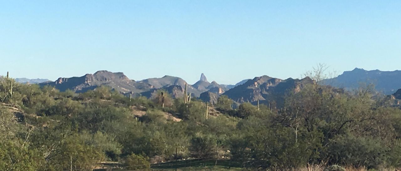
The image above shows Weaver's Needle in the distance, with the volcanic deposits of the Superstitions in the foreground.
. . . . . . . . . . . . . . . . . . . . . . . .
The following two paragraphs are taken from a display, entitled "Geology of the Superstitions," at the Needle Vista Viewpoint. Only a few words have been changed because the accommpanying map and the view are different on a website than when standing at the viewpoint. You are encouraged to read the display and experience the view at the viewpoint.
About 18.6 million years ago a cataclysmic pyroclastic eruption hundreds of times bigger than the 1980 eruption of Mt. St. Helens ejected over 800 cubic kilometers of hot ash, crystals, pumice, and rock fragments high into the atmosphere. When it settled, the material was so hot and thick that it welded together into a dense hard rock called the Apache Leap Tuff. Although it covered over 5000 square kilometers of central Arizona, most of the tuff fell back into a giant elliptical volcanic crater called the Superstition caldera.
Where is the caldera? The northwestern rim of the caldera is just to the southwest of the Needle Vista Viewpoint. The high standing ridge of the Superstition Mountain on the southwestern horizon (as seen from Needle Vista Viewpoint) is composed of intra-caldera Apache Leap Tuff where it is nearly 1 km thick. Outside the caldera, the same substance is much thinner. Superstition Mountain was pushed up shortly after formation of the caldera. Geologists know this because the middle portion of Weavers Needle is composed of an avalanche deposit, one of several that spread out across the caldera floor shortly after it formed. Most of these avalanches were derived from the caldera walls, but the one at Weavers Needle is unique. It is composed of boulders that could only have come from the northern edge of Superstition Mountain. The upper third of Weavers Needle is the remnant of a thich pile of lava that continued filling the caldera until about 18 million years ago.
. . . . . . . . . . . . . . . . . . . . . . . .
.
See the following for the geologic map and associated report of the region that includes Peralta County Park and Weaver's Needle:
http://repository.azgs.az.gov/uri_gin/azgs/dlio/245
For a report more specifically about Weaver's needle, see the following:
http://azgs.arizona.edu/photo/weavers-needle-superstition-mountains-central-arizona
Rhyolite and dacite are common igneous rocks in this area. Here are links that give more detail about these similar rocks:
https://flexiblelearning.auckland.ac.nz/rocks_minerals/rocks/rhyolite.html
and
https://flexiblelearning.auckland.ac.nz/rocks_minerals/rocks/dacite.html