M. S. Thesis Field Work

Summer, 1966

I was in the perfect program at the perfect place at the perfect time. Having gotten my BS degree in Earth and Space Science in May of 1965, I was now enrolled in an MS degree program in Geology at Penn State just a few years before the first human was to land on the moon. Certainly most, maybe all, lunar craters were caused by meteorite impact, so interest was high to study impact craters on the earth. There was a circular lake, 4000 feet in diameter, in Quebec that had the appearance of a meteorite impact crater. But was it an impact crater? Dr. David Gold had previously studied several meteorite impact craters in Canada and had written a grant to NASA to determine if this feature, called the Mecatina Crater, was or was not a meteorite impact crater. I learned of this project and expressed an interest in concentrating on this area of geology. Result: this was going to be my master's degree thesis project.

The image below is a mosaic of 22 individual aerial photographs that were flown in 1961 by the Canadian survey to support a future project to investigate the origin of this unusual feature.

The map below shows the confirmed and suspected terrestrial meteorite impact craters in North America as of about 1961. Notice the listing of the Mecatina structure (the name in the red box).

The map below shows the location of the Mecatina crater, which is about 10 miles inland from the coast of the Gulf of Saint Lawrence and about 100 miles from the Labrador border.

The Google Earth image below shows the crater and the near-by fishing villages of Mutton Bay (1966 population of about 200) and La Tabatiere (population about 600) and two smaller fishing villages, one of which was abandoned. During this project, I stayed overnight in all three populated villages that are on this image.

Dr. Barry Voight joined Dr. David (Duff) Gold and myself for the project. I asked a friend, Terry Harlacher, from the neighborhood in which I grew up, if he would serve as my field assistant for that summer. I couldn't afford to pay him, but I would cover all his expenses and he would have an interesting adventuring experience in an unusual location. Terry agreed and so our party for the field work portion of this project became a group of four. We drove my car north to almost the end of the paved highway along the shore of the Gulf of St. Lawrence. Dr. Gold purchased a Peter Borough cedar strip canoe at a frontier-style sporting goods store and then our group, and the canoe, took the ship, "Jean Brillant," farther up the coast to the fishing village of La Tabatiere, stopping at the many small fishing villages along the way.

The image below shows some of the fishing villages that are regularly serviced on a weekly schedule by this ship. The town of Mutton Bay is highlighted.

The image below shows our canoe (to the left of the car) on the deck of the ship.

The image below shows local people meeting the ship when it docked at a small fishing village along the way northward.

The two images below show views of the interior of this small fishing village.

The image below shows the fish processing plant in La Tabatiere, a fishing village of about 600 population. It is here that we disembark the "Jean Brillant." This community is large enough to have a lodge where a room can be rented and a Hudson Bay store where supplies can be purchased.

Our group of four hired a local fisherman to carry us, our gear, and our canoe to Mutton Bay, the village closest to Reeds River (Gros Mecatina Rivere), the river that we plan to take to travel to the vicinity of the crater. I am the person in the brown hat.

The image below shows our group being dropped off at the mouth of Reeds River, the river that we will use for access to the crater. I am the person on the far right.

The image below shows the canoe being pulled upstream by a motorboat in the coastal section of the river where that was possible. In 1966, the fishing rights for Atlantic salmon in this river were held by the Fish and Game Club. The motorboat belongs to the club. At that time, privately-held restricted fishing rights for Atlantic salmon were common for the many rivers that flowed into the Atlantic Ocean from Labrador and Quebec. Local fishermen who lived in the nearby villages generally fished the salt water of the Gulf of St. Lawrence for cod using gill nets.

The image below shows the view from the canoe which is being pulled by the fishing club motorboat. The motorboat could not go beyond the first rapid.

The image below shows one of the many rapids on the river that caused us to portage the canoe and the camping equipment.

The image below shows a portage path through the forest adjacent to one of the rapids.

The image below shows my field assistant, Terry Harlacher, at a campsite along the route to the crater. The group learned that four people and all their camping gear cannot be fit and efficiently moved in a single canoe in a single trip, so the decision was made to split the group in two: the two Penn State geology professors would travel into the crater and determine if the site was a former meteorite impact crater, thus satisfying the conditions of the NASA grant, and the other group of two (myself and my field assistant, Terry) would return to Mutton Bay and study whatever rocks and structures that were exposed along the coast. So Terry and I returned to the Mutton Bay fishing community and we embarked in making field observations and acquiring some rock samples for later laboratory analyses.

The image below shows the fishing village of Mutton Bay. Terry and I stayed with a local family who rented a room to us and prepared our morning and evening meals, as well as making a lunch that we carried with us into the field each day. The community athletic field is in the foreground.

The image below shows the pontoon equipped airplane that, to my surprise, landed in the Mutton Bay harbor on some sort of religious mission. I hired the plane (and pilot), at a rate of a dollar a minute (the 2020 equivalent would be about $8 per minute), to fly us over the crater so I could obtain oblique images of the Mecatina crater. Such views were previously unavailable to us.

The image below shows some of the river rapids that Drs. Gold and Voight had to portage.

The image below shows another rapid that they had to portage.

The image below shows the 4000 foot diameter circular lake and the larger crater structure surrounding it.

The three images below show progressively closer views of the Mecatina crater.

The image below shows a geological map of the Mecatina structure published by Drs. Gold and Voight. The structure is not of impact origin. Rather, it results from folding within the Grenville gneiss, with subsequent erosion and then glaciation.

The image below shows a 1990's map of meteorite impact craters in Canada. Notice the conspicuous absence of the Mecatina "crater."

The image below shows the ship "Jean Brillant" sailing out of Mutton Bay, carrying Drs. Gold and Voight back to Penn State, and leaving me and my field assistant, Terry Harlacher, behind to work on the geology of this coastal area. Before leaving, Dr Gold and I spent a day together in the field defining the geological problem I would be working on and, for me, practicing and refining some field sampling techniques. Fortunately for me, little previous geological work had been done here. Also fortunately for me, there were conspicuous dikes that had intruded the bedrock. The bedrock here is a syenite pluton. Syenite is a coarse-grained igneous rock that is similar to granite, but has less quartz than granite.

The image below shows a Google Earth image of the region, with the arrows pointing to the crater and with the fishing towns of La Tabatiere and Mutton Bay indicated. The red line separates the Grenville gneiss (on the left) from the syenite pluton (on the right). The syenite pluton is a circular intrusion of a quartz-deficient granitic melt that was injected into the older Grenville gneiss. The pluton is about 15 miles in diameter. The gneiss has "swirlly" patterns from having been highly deformed in ancient mountain building. It has subsequently been fractured, creating the linear arrangement of the many lakes. The syenite pluton, at least at this scale, appears to be more uniform. There are fewer lakes in the syenite pluton because the sysenite is more resistant to erosion than the gneiss, and therefore the syenite exhibits higher topography than the gneiss.

The image below, taken from my Master's thesis, shows the study area.

The image below, also taken from my Master's thesis, is colored to show the Grenville gneiss in blue and the syenite pluton in red. Bodies of both salty water and fresh water have been left as white. I have plotted sampling locations and structural observations on this map, but at this scale they are too small to be seen well.

The image below shows the coarse-grained texture that is characteristic of the syenite pluton. My geological hammer is for scale. Most of the coarse flat surfaces are cleavage planes developed on the abundant feldspars of the syenite.

The image below shows a section of the strand with my geologic hammer for scale. Notice the surface is almost smooth enough for roller skating, due to the recent glacial polishing the syenite bedrock. There is, however, a fine surface texture of parallel striations caused by small stones imbedded in the ice that was moving across the surface, away from the observer in this image.

The image below shows more glacial polish on the syenite, with the fishing village of Mutton Bay in the distance.

The image below shows the glacially-polished syenite bedrock at the strand, but with conspicuous flutes and grooves caused by the glacial ice dragging large boulders across the bedrock. Some of these boulders, called "glacial erratics," are in the foreground.

The image below shows conspicuous dikes as negative relief features in a glacially-smoothed syenite bedrock peninsula. The photo is taken from a fishing boat that was taking me and my field assistant, Terry, to one of the islands that are off the coast.

The image below shows my field assistant standing next to one of the dikes that were seen from the boat in a previous image. This dike weathers more rapidly than the more-resistant syenite bedrock that makes the majority of the scene. The dike formed by melt that was injected along a vertical crack that expanded and filled the crack and hardened to form an igneous rock. During glaciation, both the top of the filled crack (the dike) and the surrounding rock were beveled by the glacier to be at the same level, but subsequent weathering and erosion has affected the dike rock at a faster rate than the surrounding syenite of the pluton, leading to the negative topographic expression of the dike. Some dikes have weathered 30 or 40 feet below the syenite bedrock and present a hazard to walking across the landscape.

The image below shows several cross-cutting dikes in the syenite along the strand. My hammer is for scale. Younger dikes cut older dikes.

The image below shows a map of the above image. There are dikes of four different compositions that have cross-cutting relationships. From the geometry, the sequence of events can be inferred.

The image below shows Terry standing next to two parallel dark-colored dikes along the strand which are both cut by a diagonal dike that has a lighter color and appears in the foreground.

The image below shows the general topography of the sysenite pluton. Notice the lack of trees on the wind-swept landscape near the coast. Dikes can be seen on distant islands as dark slashes.

The image below shows four dogs on a small island; after I took this picture, several other dogs appeared. The photograph was taken from a small fishing boat that I hired to transport Terry and me to some of the islands to make observations and to take samples. However, I omitted some of the islands because, like this one, some are used to keep dogsled teams during the warmer months. The owner of the team probably is a salt-water fisherman during the summer and, when passing the island, stops by to feed them on a regular schedule. When the cold weather arrives, the dogs are so anxious to leave the island that they will pull the sleigh with great enthusiasm. We decided to not land on this island.

The image below shows the "caribou moss" which covers the bedrock hill crests. It is actually lichen and moss and some hardy grass. It makes a very soft surface on which to walk. My knife is for scale.

The image below shows a high, glacially smoothed hill crest in the syenite pluton. Notice the high areas in the distance are treeless, but the low areas, near the river, is deeply forested. Terry is for scale.

The image below shows some of the forested lowland areas. They are very difficult to walk through. If possible, it is better to walk around them rather than to try to walk through them.

The image below shows our canoe, which was left behind when Drs Gold and Voight returned to Penn State. Terry and I would often use the canoe to get to some of the more widely-dispersed sampling sites.

The image below shows mixed terraine, with highs and lows and areas in between.  Much of the landscape was similar to what you see here. We saw significant evidence of bear activity throughout the area, but we didn't see any bears, perhaps because we purposely talked loudly and tried to make continuous loud noises as we traversed the landscape. We did not want to surprise any bears, particularly bears with cubs, by unexpectedly approaching them. We carried no weapons, other than our geological hammers.

The image below shows a microscopic view of a thin-section that I subsequently made from a sample taken from one of the dikes. Notice the big crystal. It is a feldspar that shows distinct zoning from the center to the edges, indicating the melt was changing its composition as the feldspar crystal was forming.

The images below shows microscopic views of a thin-section that I made from a different dike. The large, perfectly-formed titanaugite crystal is in a matrix of finer crystals that are more poorly formed. This is seen with both "normal" light and with cross-polarized light.

The image below shows Terry with our canoe. The canoe paddles have been lashed to the canoe frame and seat in preparation for a single person to lift and then carry it on a portage around a rapid. Notice how the bottoms of Terry's pants legs are tucked into his socks. This is done to keep the mosquitoes (by night) and black flies (by day) and/or both (at dusk and dawn) from gaining entry to the skin of his legs and body. Insect repellant is used in abundance for the hands and head. These are effective techniques you learn quickly in this environment.

The image below shows me lifting the canoe into the portage position. Notice my pants legs are also tucked into my socks.

The image below shows me with the canoe in the portage position. Notice the paddles are positioned to rest on my shoulders and the canoe is approximately balanced at its center of mass.

The image below shows the syenite pluton (red) and the surrounding Grenville gneiss (blue) and the water bodies (white) in a figure that I drew for my thesis. The many black lines are linements that can be found on aerial photographs of the region. Most of these linements are the dikes that were studied, but some of the linements are fractures and/or faults.

Much of the research for the thesis was done after I returned to campus. The research involved petrographic analysis (thin sections of rock under the microscope) on all samples, bulk chemistry of 24 rock samples, and 21 paleomagnetic determinations of the earth's remnant magnetic field from the oriented samples I collected in the field.

The image below shows four thin sections for petrographic analysis, an oriented rock core for magnetic analysis, and finely ground bulk rock for chemical analysis.

Being the first graduate student at Penn State to incorporate paleomagnetism in a geological study, I had to use the specialized equipment at the University of Pittsburgh and, later, at Princeton University. Subsequently, the Geology Department at Penn State established its own rock magnetism laboratory.

My approved thesis is dated September, 1968.

---------------------------------------------------------------

The title of my thesis is as follows: Structural Relationships, Petrography, Chemistry, and Magnetic Properties of Some Dike Swarms in and around the Mutton Bay Pluton, Quebec.

I presented this work at the 1968 Northeastern Section Meeting of the Geological Society of America. The abstract follows:


The Significance of Some Dike Swarms along the North Shore of the Gulf of St. Lawrence in Eastern Quebec

Gerencher, J. J., and D. P. Gold, Dept. Geology-Geophysics, Pennsylvania State University, University Park, PA.

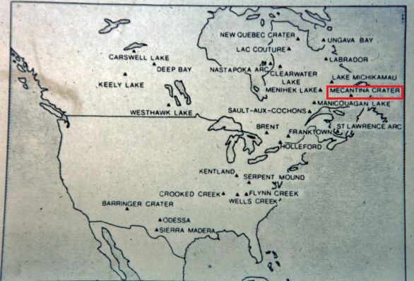
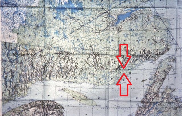
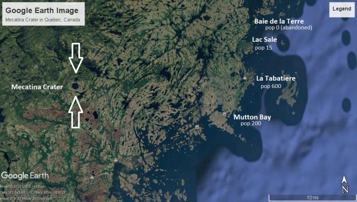
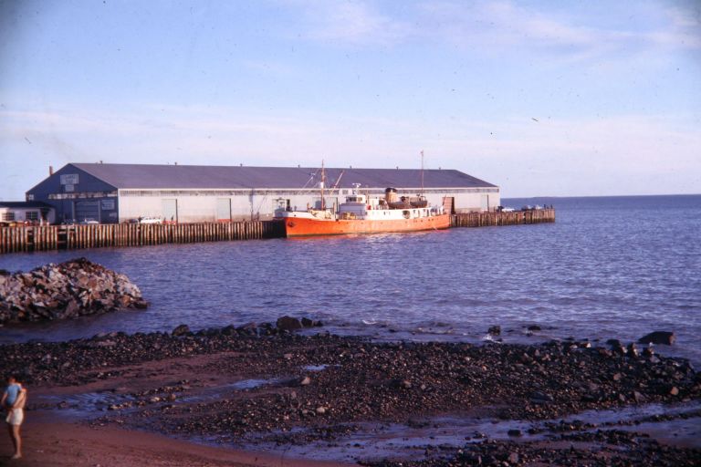
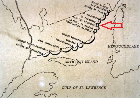
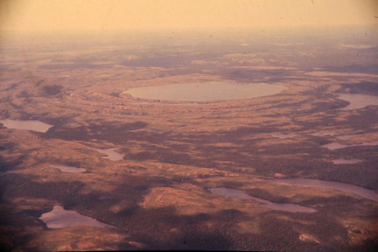
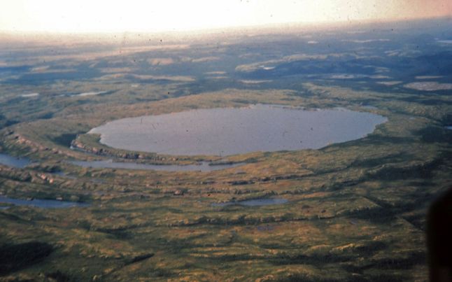
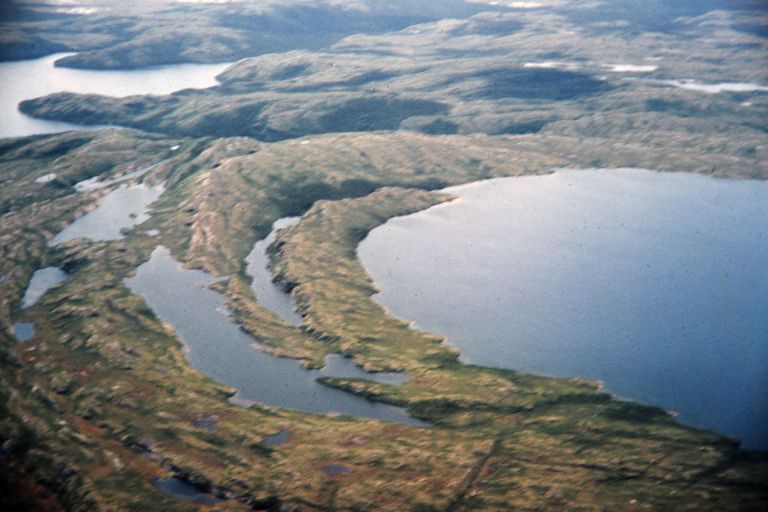
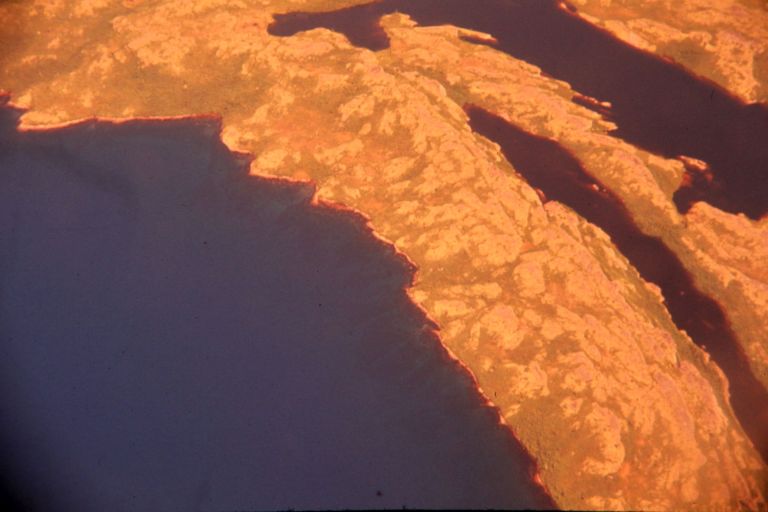
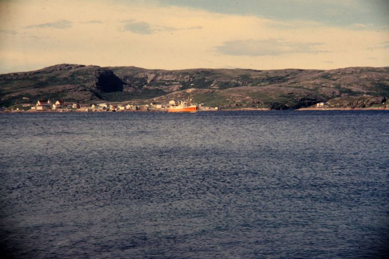
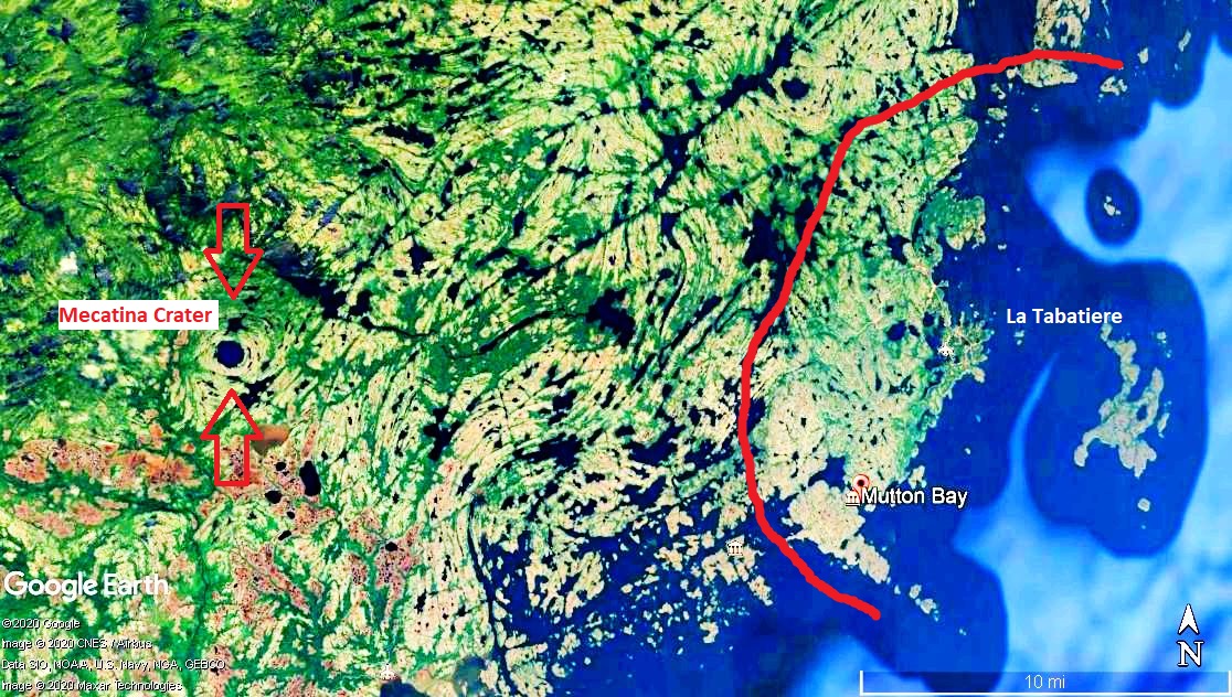
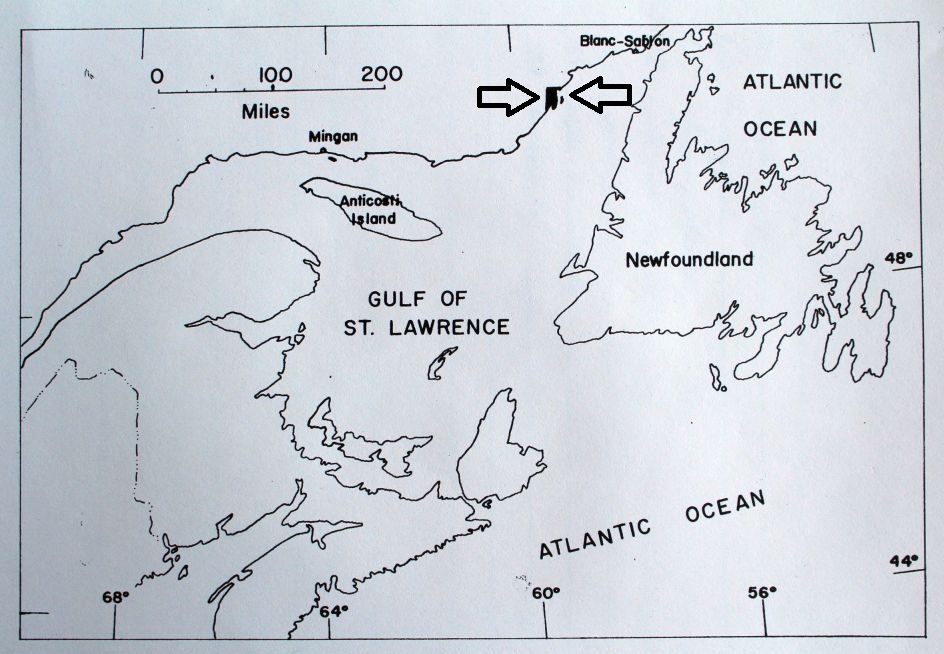
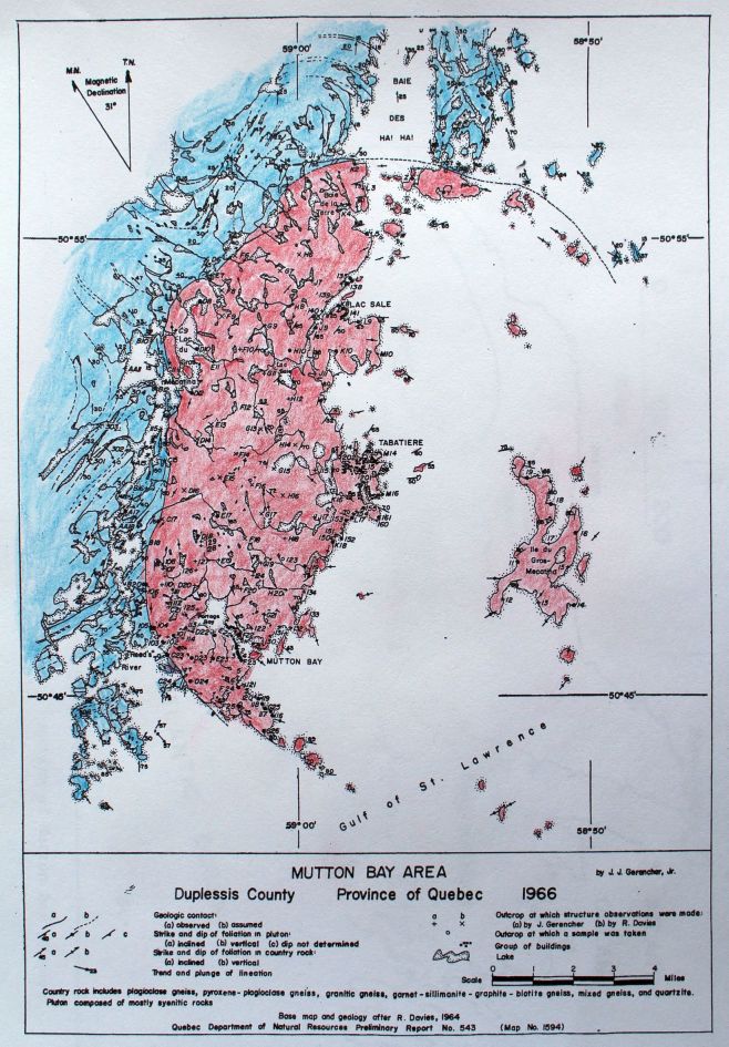
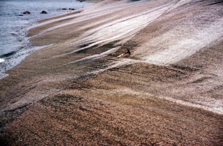
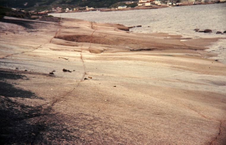
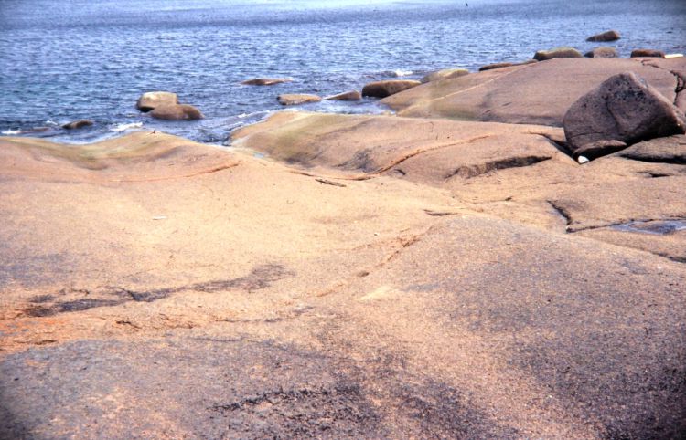
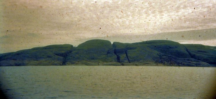
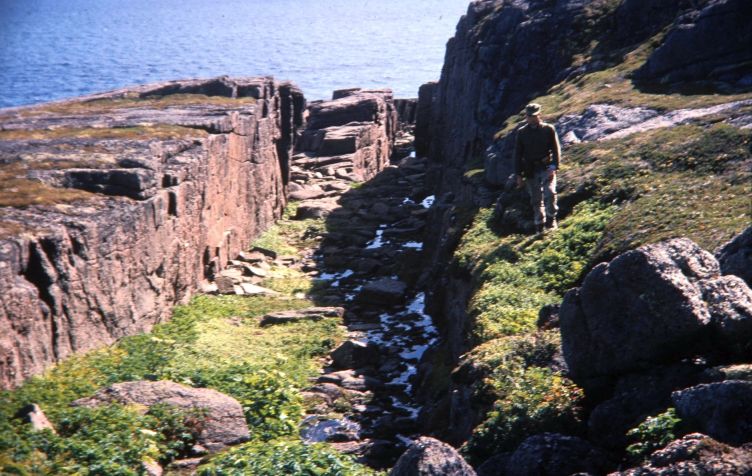
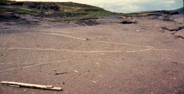
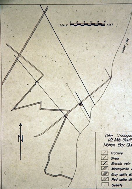
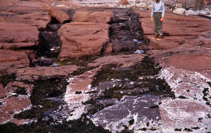
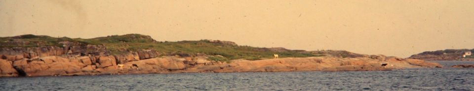
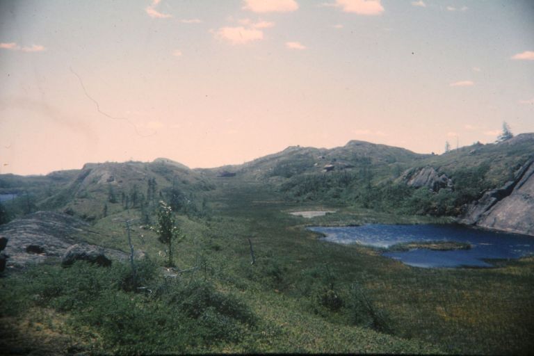
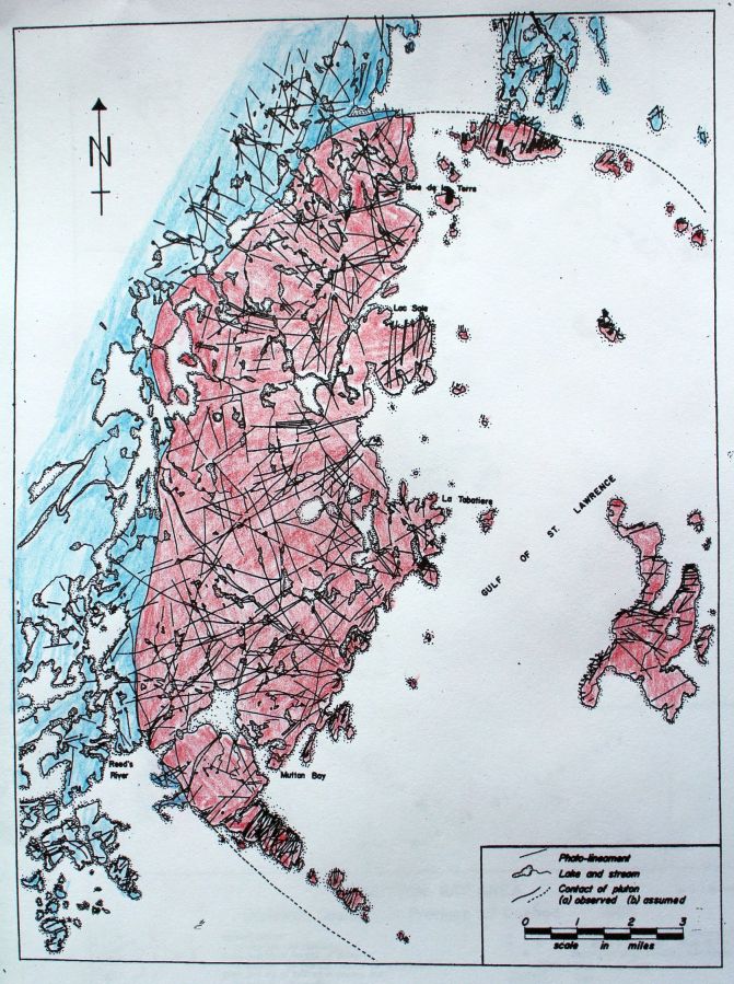
Dikes are well exposed along the coast near Mutton Bay and La Tabatiere, about 80 miles southwest of Labrador, in an area largely underlain by a 15-mile-diameter syenite pluton. The pluton is dated at 650 m. y. (Davies, 1966) and intrudes Grenville gneisses. Structural studies and field relations of dikes and fractures indicate that the dikes are preferrentially oriented parallel to the coast, but have no definitive relationship to the fractures.

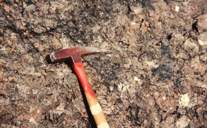
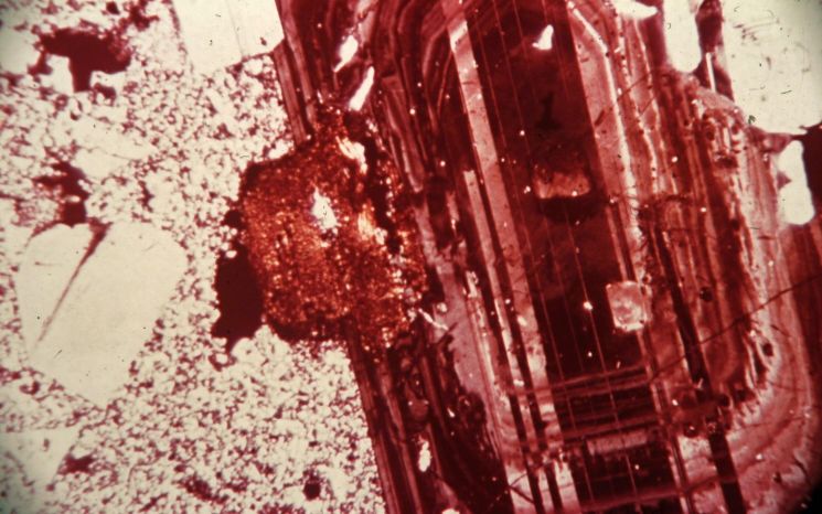
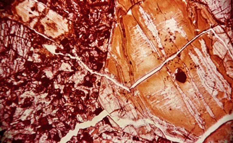
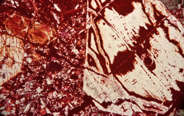
The chronological sequence of dikes is: (1) aplite dikes associated with late-stage consolidation of the syenite; (2) alkali gabbro dikes containing phenocrysts of titanaugite; (3) red microsyenite and black camptonite dikes, appearing to be the most common; (4) nepheline basalt and micromonzonite dikes; (5) breccia veins consisting of feldspar and quartz fragments in a finely crushed matrix.

The position in the intrusive sequence of a carbonite dike containing fragments of altered micromonzonite and of a limbergite dike is not known.

Magnetic studies on 21 samples did not yield a constant paleomagnetic vector.

The alkaline character of these dikes contrasts with that of the basaltic dikes near Mingan and on Anticosti Island which intrude Ordovician limestone and with post-Lower Cambrian flood basalts in southern Labrador and on Newfoundland. The recent suggestion (Kumarapeli and Saull, 1966) that the St. Lawrence valley represents a rift valley system of possible Mesozoic age is appealing, in that the dikes parallel the coast and exhibit alkaline affinities, as do the intrusives in the Monteregian Petrographic Province near Montreal.