A compelling landmark and an excellent astronomical observing site
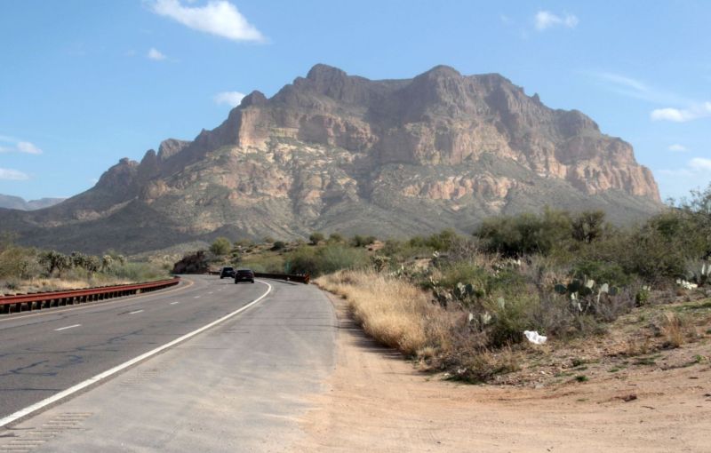
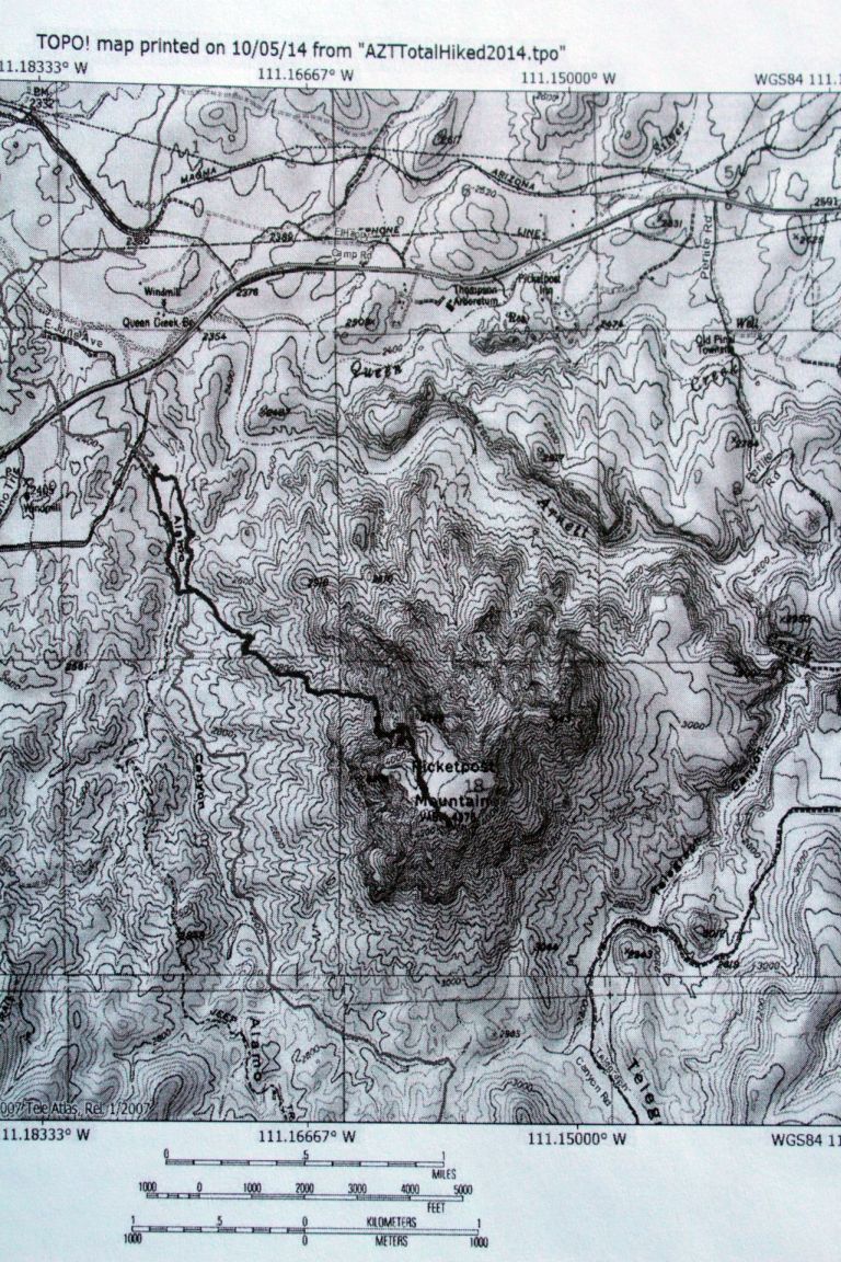
Picketpost Mountain is located about 18 miles east of Gold Canyon and is very near Route 60, the major highway of the area, which is shown on the image above. It is located about 4 miles west of
the town of Superior. As can be easily seen on the topographic map below, the mountain is butte-shaped with a nearly flat summit that is about 1200 feet above the surrounding countryside.
The mountain gets its name from a military encampment that was located at its base for the Apache Wars which were fought between 1849 and 1886.
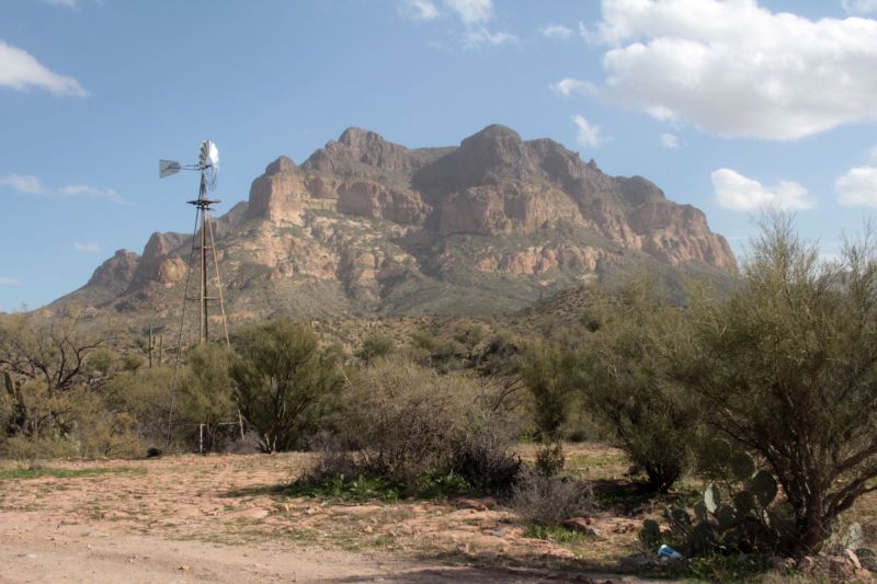
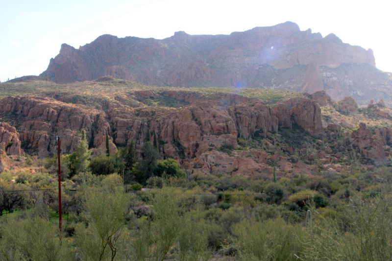
The image below was taken from a local access road that connects Route 60 to the parking area/trailhead at the base of Picketpost Mountain. The access road is paved on some portions and dirt-surfaced along others. As is implied by the image, cattle are free to roam throughout this area, including the parking lot/trailhead.
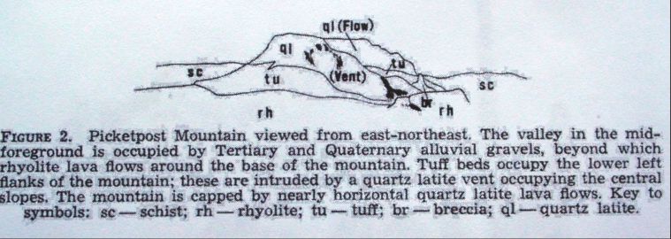
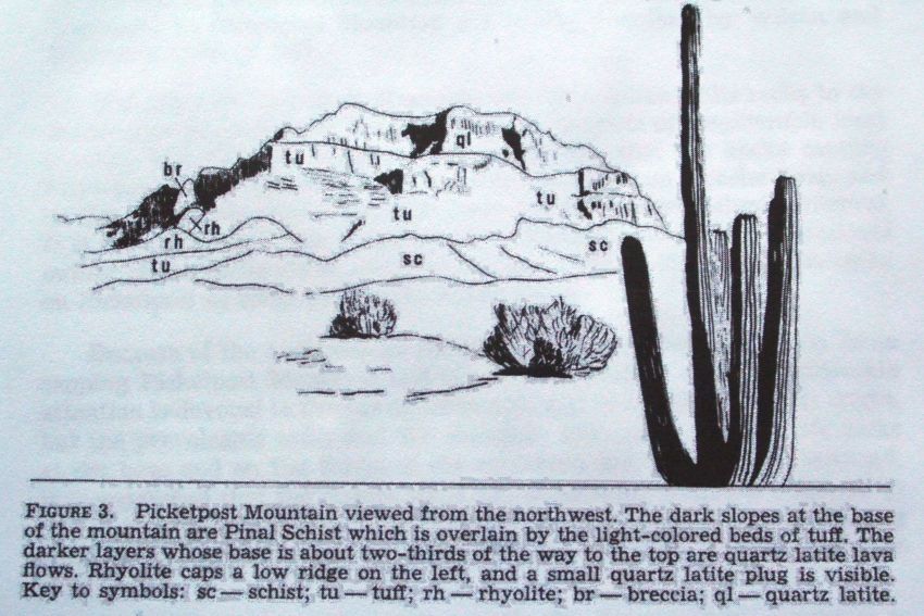
The mountain is composed entirely of volcanic rocks that date to about 18 million years, with ash deposits in the basal portions and with an extrusive, thick quartz latite lava flow occupying about the upper third, including the relatively flat surface of the top. In addition, and as the cross sections that follow on this page will show, the volcanic vent, which was the source of the quartz latite lava flows, is well exposed, particularly on the eastern side of the mountain. As seen from the ground, the thick quartz latite lava flow appears distinctly darker than the ash beds beneath it. The entire feature is an impressive geological exposure.
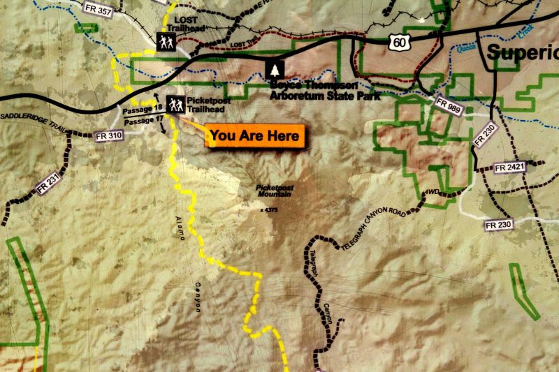
The next two images show a location map that is displayed at the trailhead/parking area. These images show the local development in the area at two scales, including the town of Superior and the location of Boyce Thompson Arboretum State Park.
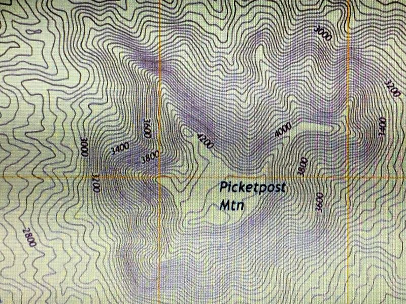
The topographic map below shows the path of the trail from the parking area/trailhead to the summit of Picketpost Mountain. The trail on the steep mountain slopes is listed as being confusing to follow in portions.
The view below shows portions of Boyce Thompson Arboretum State Park in the foreground and Picketpost Mountain beyond it. The view is looking to the southwest, unfortunately into the afternoon sunshine.
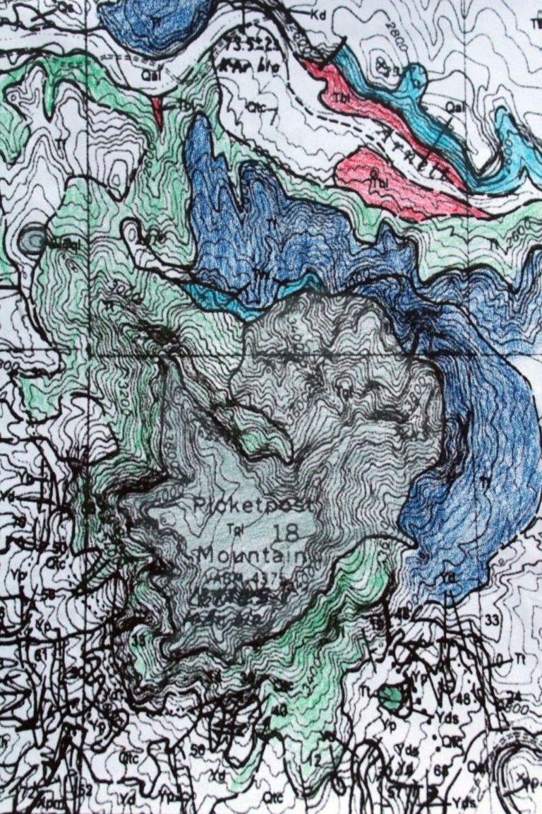
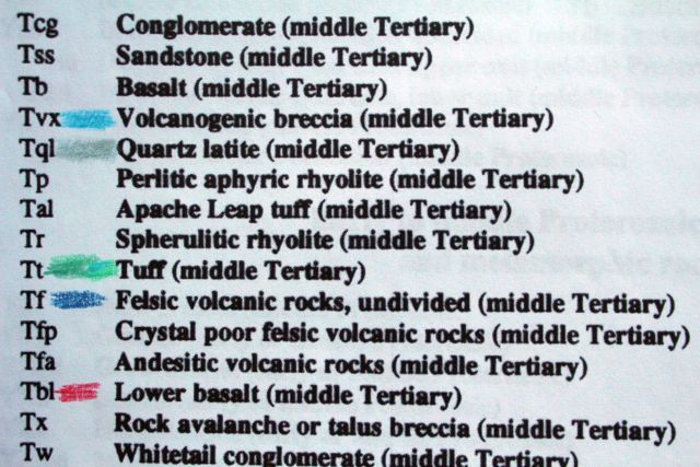
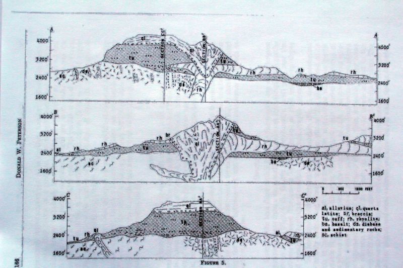
The geologic map below is taken from Peterson, D. W. (1966) The Geology of Picketpost Mountain, Northeast Pinal County, Arizona. Arizona Geological Society Digest: 8: 159-176. The explanation for the symbols and rock identities are given to the right of the map. The red lines are cross section locations that appear later on this web page.
A more recent geologic map is presented below. I have hand-colored some of the rock units on the map and on the stratigraphic column on the figure that follows it. Both were taken from the following publication:
Spencer, Jon E. and Richard, Stephen M. (1995) Geologic map of the Picketpost Mountain and the southern part of the Iron Mountain 7 1/2' Quadrangles, Pinal County, Arizona. Arizona Geological Survey Open File Report 95-15.
The next three images are taken from the Peterson publication mentioned previously. The identity of the rock units on the explanation is difficult to read on the figure, so I have reproduced it here as a stratigraphic column (youngest on top and oldest on the bottom).
al
alluvium
ql
quartz latite
br
breccia
tu
tuff
rh
rhyolite
ba
basalt
ds
diabase and sedimentary rocks
sc
schist
On the figure below, the A-A' cross section goes from the SW to the NE. The B-B' and C-C' cross sections both go from from the NW to the SE, but the B-B' is located farther north than the C-C' cross section. The traces of all three cross sections are indicated on the Peterson geologic map (the previous geologic map that was left uncolored) as the three red lines.
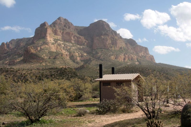
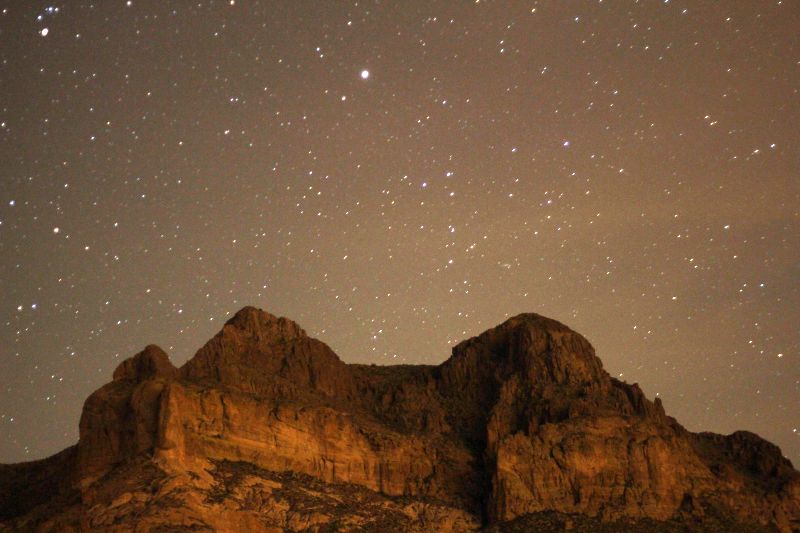
The parking area/trailhead of Picketpost Mountain is on the side of the mountain opposite the nearest community, which is the small copper mining town of Superior. The mountain acts as an effective shield of Superior's few city lights, so the night-time sky at the parking area is among the darkest in this region, and thus it is favored by amateur astronomy groups for individual and group night-time observing. In addition to easy access and ample parking, there are even pit toilets at the site.
This is a night-time view of the mountain from the Picketpost trailhead/parking lot. A little sky glow from the lights of Superior can be seen near the summit of Picketpost Mountain. The mountain itself is illuminated by the light of the moon which is not in the picture.
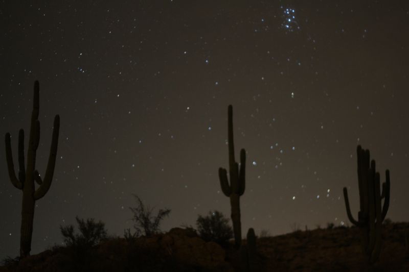
I took the image above which shows the Pleiades star cluster rising behind saguaros that are near the edge of the Picketpost parking area/trailhead.
Spencer, Jon E. and Richard, Stephen M. (1995) Geologic map of the Picketpost Mountain and the southern part of the Iron Mountain 7 1/2' Quadrangles, Pinal County, Arizona. Arizona Geological Survey Open File Report 95-15.
A copy of the geologic map and report can be obtained from this URL:
http://repository.azgs.az.gov/uri_gin/azgs/dlio/942
Nelson, Eleanor W. (1966) The geology of Picketpost Mountain, Pinal County, Arizona, A Master's thesis to the University of Arizona. The thesis, geologic map, and cross sections can be downloaded at the following URL:
http://hdl.handle.net/10150/551845