Red Mountain (also known as Mt. McDowell, but apparently also known less well as FireRock and Gunsight Butte) is about 16 air miles northwest of Gold Canyon, AZ. It is located on the reservation of the Salt River Pima-Maricopa Indian Community. Access to the public is restricted by tribal officials apparently because of previous vandalism of historic petroglyphs. Thus, I have not visited the site; I have only seen it from roads that are near the edge of the reservation boundary. The geological information on this web page is taken uniquely from a geological report done by Stephen J. Skotnicki in 1995, which, except for a 2018 revised version by the same author (see references at the end), is the latest geological report on the geology of the mountain of which I am aware.
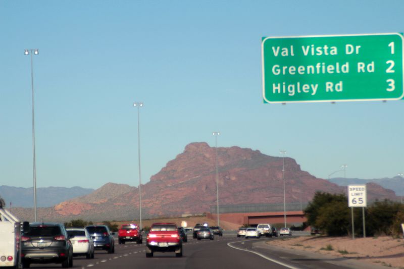
The montain is included on my website because it is such a distinctive and compelling topographic feature and because it is located so close to Arizona State Loop 202, which is a major transportation route for residents on the eastern edge of the Phoenix metropolitan area. Indeed, the northern portion of AZ Loop 202 is called the "Red Mountain Freeway." I took the image below from a moving car on this Freeway.
The image below shows Red Mountain as a distant background for housing developments between Loop 202 and the border of the reservation. A distinctive topographic feature of the mountain is the apparent notch, similar to a gunsight, that can be seen on this image along the skyline to the left of the summit.
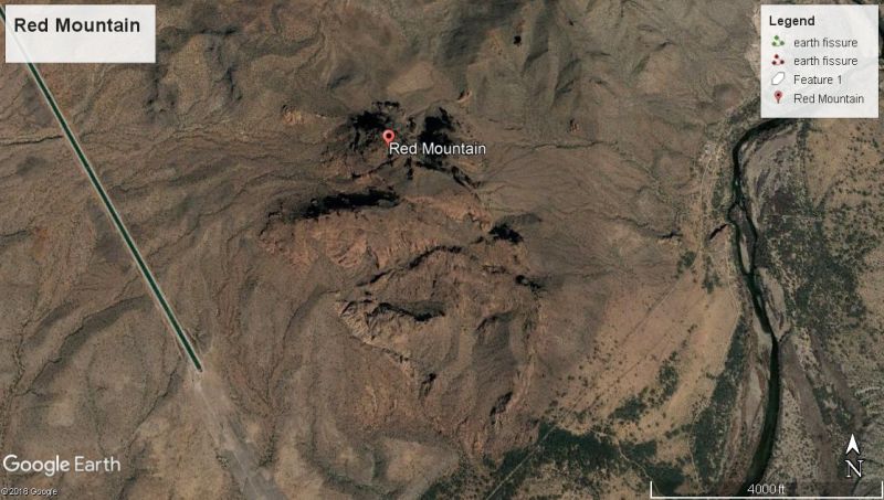
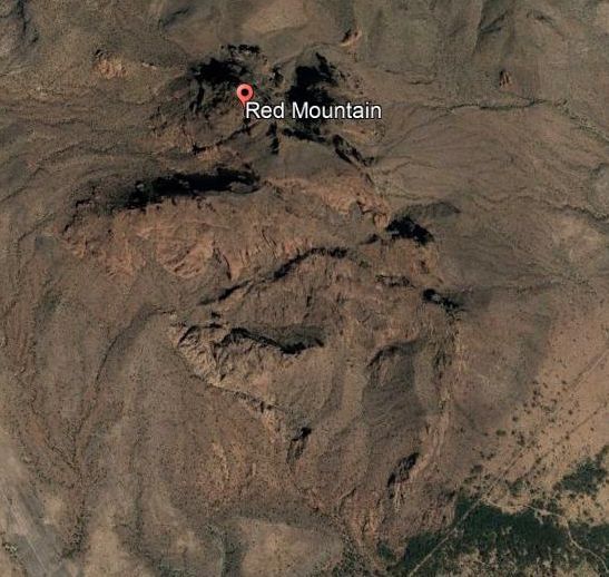
The next two images show the Google Earth view of Red Mountain. The red color of the mountain results primarily from the color of its sedimentary rocks which were deposited on alluvial fans and in stream channels and on stream terraces, all of which were in an oxygen-rich environment. Under these wet/dry conditions, the iron content is oxidized by the earth's atmosphere to the red iron oxides.
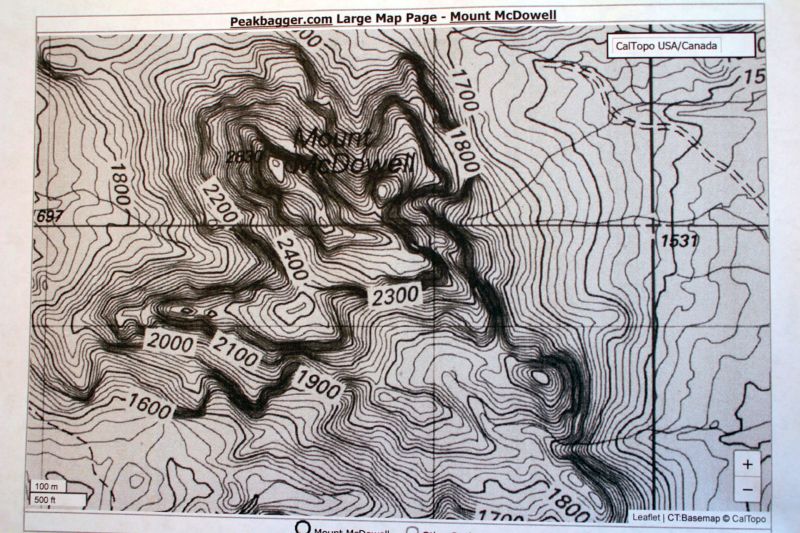
The image below is a topographic map of Red Mountain (also known as Mount McDowell). As shown on the map, its summit, at an elevation of 2830 feet, is about 1100 feet above its approximate base.
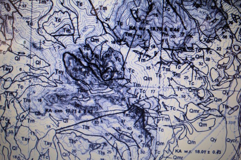
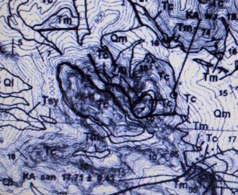
The next two images show the geological map of Red Mountain, on a topographic map base, at different scales. They were taken from the the following reference: Skotnicki, Stephen J. (1995) Geologic Map of the Fountain Hills/Mount McDowell Area, Maricopa County, Arizona, Arizona Geological Survey Open File Report 95-16.
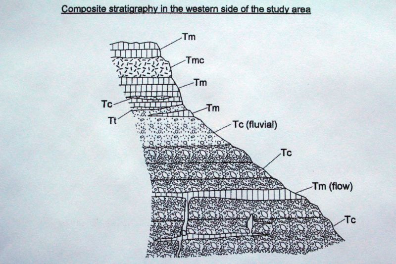
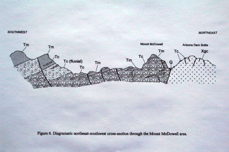
The generalized stratigraphy (rock layers) are indicated on the composite cross section below. The rock units begin with the letter "T" which indicates Tertiary age (from 66 million to about 2.5 million years ago). An age date on an intrusive rock within the sedimentary red beds produced an age of 18 million years. The Skotnicki report, which I paraphrase, characterizes the red beds as extensive deposits of tilted, mostly red-colored, interbedded breccias (a rock composed of angular rock fragments), conglomerates and sandstones. Locally these red beds are interbedded with dark grey volcanic flows. In many areas the volcanic rocks have intruded the sedimentary rocks.
Conglomerate, breccia, and sandstone (middle Tertiary)
Tt
Bedded tuff (middle Tertiary)
Red Mountain is referenced in the Skotnicki report as Mount McDowell, so I will switch the name of the peak to Mount McDowell for consistancy with the report and its maps and cross sections.
Skotnicki reports that at Mt. McDowell a non-bedded massive tuff overlies and is, in turn, overlain by red beds. On the south side of Mt. McDowell the tuff is overlain by well-sorted, red, wind-deposited (eolian) cross-bedded sandstone. He also reports that some other authors suggest that this tuff may be related to some of the tuffs of the Superstition Mountains. This would make them contemporaneous in age. Indeed, he reports there is evidence that the tuffs of the Superstitions once may have overlain Mt. McDowell.
Skotnicki reports that, unlike the Whitetail Conglomerate and other younger valley-fill alluvial deposits, the Mt. McDowell red beds are interpreted to be debris flow deposits (breccias) that originated from the area that is a few miles north and is now the approximate site of the town of Fountain Hills. The composition of the Mt. McDowell red beds are about 60 to 80 percent breccias. Some of the clasts (angular fragments) in these red beds are in excess of 30 feet across. These red beds are interpreted by Skotnicki as late Tertiary basin-fill sediment that was deposited in aggrading (upward filling) basins that predate the integration of the modern Salt and Verde river systems.
The above figure shows a broader cross section view with the base of Mt. McDowell in fault contact with very ancient rocks to its northeast.
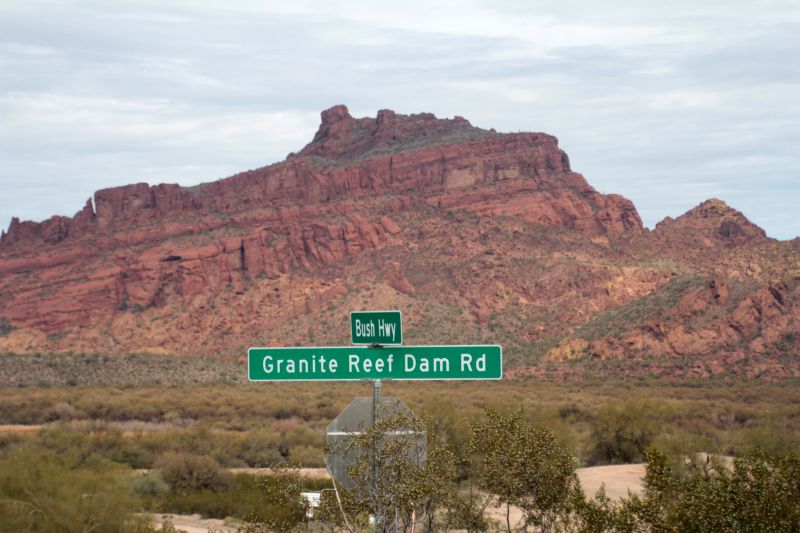
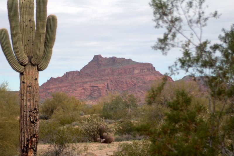
As shown below, an excellent viewing area of Mt. McDowell is from the Power Road/Bush Highway.
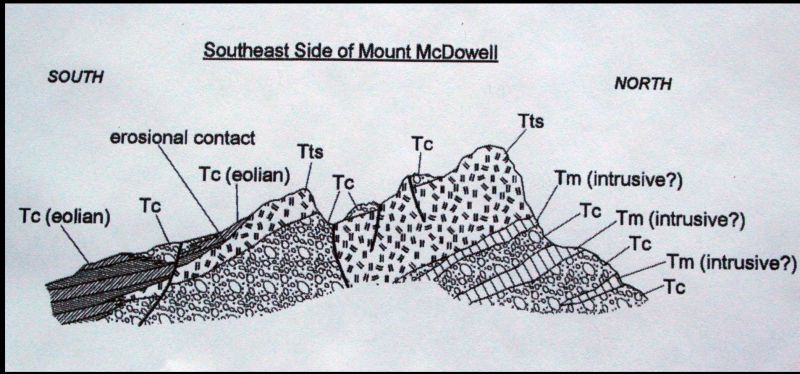
The image below shows a cross section of the southeast side of Mt. McDowell. The distinctive "Tts" rock unit is the Tertiary-aged ash flow tuff that was mentioned earlier and on Mt. McDowell reaches
thicknesses of as much as 300 feet. It has been age-dated at 17.7 million years.
The above image generally corresponds to the cross section that immediately preceeds it.
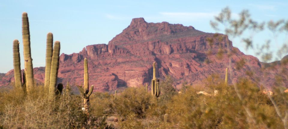
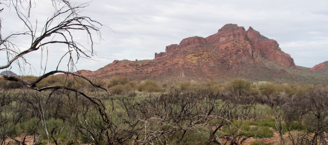
I end this presentation with the image of Mt. McDowell below -- a pretty picture. There is compelling beauty to this red mountain.
Stephen Skotnicki has produced a more detailed geologic map with cross sections of the McDowell Mountains and this new version is available in digital form for both the tablet/laptop and smart phones. The link below was created in 2016 to provide downloads for the smartphone: http://tinyurl.com/GeoMap-McdowellMtns
and this link downloads the 2018 tablet or laptop version: http://repository.azgs.az.gov/uri_gin/azgs/dlio/1890