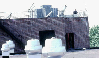
The platform is one level above the main roof area of Collier Hall of Science.
The equipment was stored inside the door which exits onto the lower roof.
Telescope Platform,
as it appeared in the mid-1980s.
The geographic coordinates for the telescope platform, in
various formats, (using the 1927 map datum) are as
follows:
latitude:
40.62987 degrees North
40 degrees 37.792
minutes North
40 degrees 37 minutes 47.6 seconds North
longitude:
75.38253
degrees West
75 degrees 22.955 minutes West
75 degrees 22 minutes 57.1 seconds
West
altitude:
420 feet (128 meters)
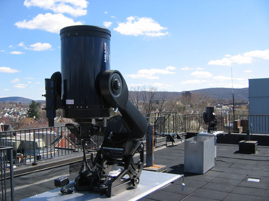
The photographs below were taken in the mid-1980s and show the telescope platform and the astronomy equipment that supported the astronomy course at that time. Although the platform remains relatively unchanged, additional equipment is now present on the platform, including an 8-inch Schmidt-Cassegrain Telescope (SCT), a 10-inch SCT, and an 11-inch SCT and a 4-inch refractor.
(click on any image to enlarge)
The platform is one level above the main roof area of Collier Hall of Science.
The equipment was stored inside the door which exits onto the lower roof.

The photograph above shows the equipment cabinet inside the exit door to the lower roof.

The photograph above was taken during the spring and shows the view from
the platform looking north.

The photograph above was taken during the winter and shows the view from the platform
looking south.