Four Peaks Geology
Dramatic and Impressive by Every Measure
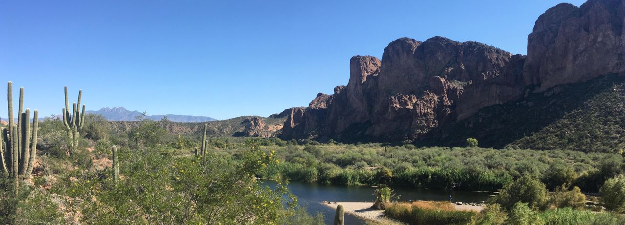
I took this panoramic view of the Four Peaks at a rest stop on the Bush Highway. The Salt River separates the rest stop area from the relatively young volcanic deposits of the Superstition Mountains to the right, and the Four Peaks are conspicuous as the background on the left. The geology of the Superstitions and the Four Peaks differ in almost every respect: age, structure, lithology, geologic history, and appearance.
I took the view above from the parking area at the intersection of the Bush Highway and Route 87.
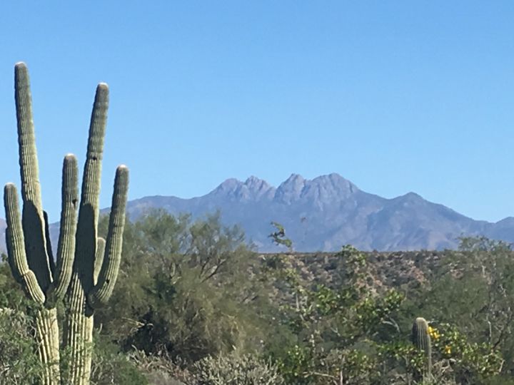
I took this image of the Four Peaks from the running track of the gym in Apache Junction.
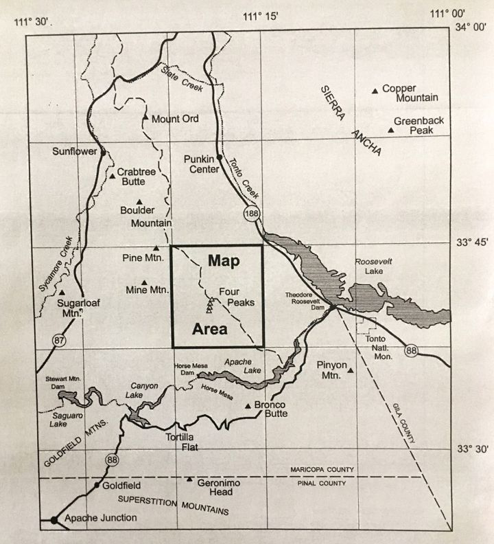
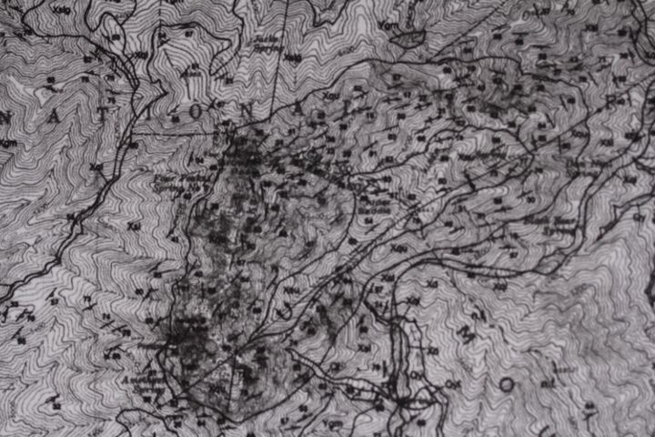
The map above locates the Four Peaks relative to features and roads that would be familiar to residents of Apache Junction and Gold Canyon, AZ. It also gives a sense of scale of the topographic and geologic maps which follow.
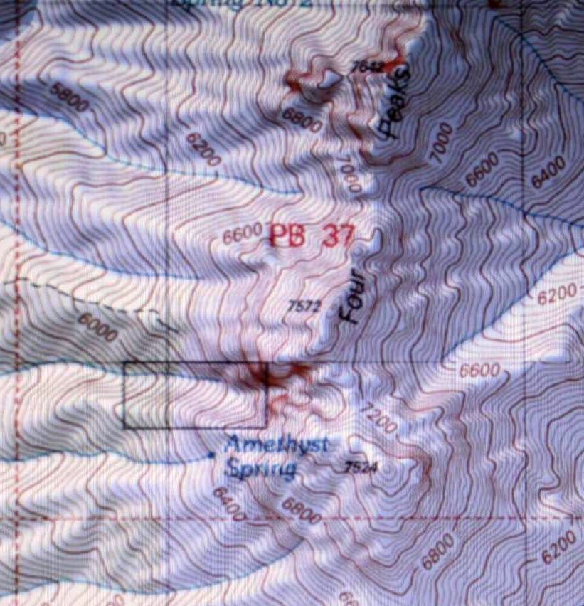
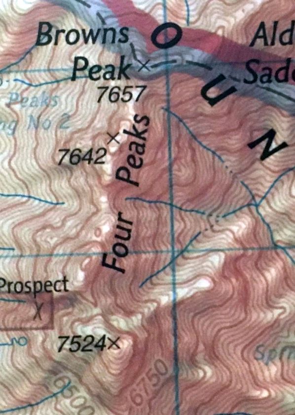
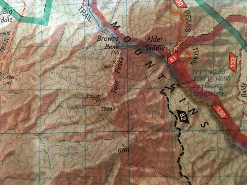
 Map by Stephen Skotnicki
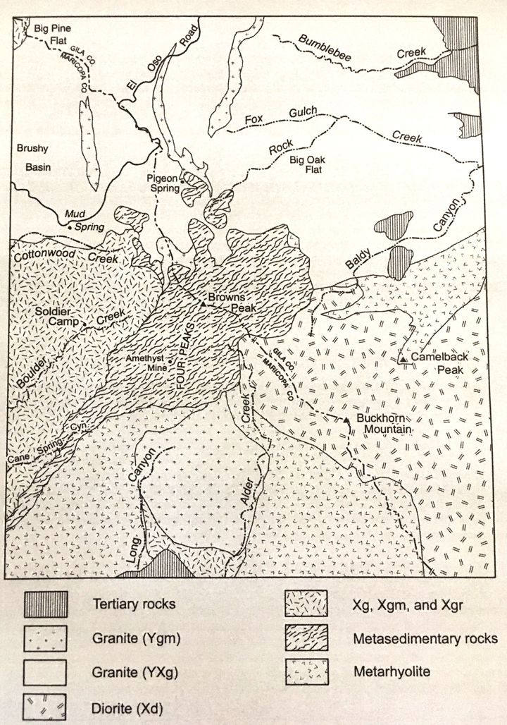
The generalized geologic map, above, shows the rocks that make up the Four Peaks to be the squiggely pattern, which is identified as "Metasedimentary rocks." These rocks are sandstones and shaly sandstones that have been metamorphosed to pure to impure quartzites. Quartzites are extremely resistant to weathering, which accounts for the high elevation of these peaks, the highest of which, Brown's Peak, is 7657 feet above sea level. During the winter months the peaks are often covered with snow, which makes an attractive backdrop on the northern horizon for the residents of Apache Junction and Gold Canyon. The rocks that surround the quartzites are generally granites and other coarse-grained igneous rocks.
 Map by Stephen Skotnicki
The map above shows a detailed geologic map of the quartzite area and the igneous rocks that immediately surround it. Much of the detail will remain unaddressed in the discussion that follows.
The geologic map below was provided by Calvin Mako and is based on a figure in his master's thesis on selected aspects of the geology of the Four Peaks area. The four black triangles locate each of the four peaks, all of which are composed of a rock unit named the "Four Peaks Quartzite." The squiggly pattern on the map is identified as "Mylonites," which are a broad zone of highly sheared rock, whatever their compositions. Notice that on the Mako map, the rocks that include the Four Peaks Quartzite aren't sheared, although they partially cover that sheared zone, indicating that the shearing predates the age of the Four Peaks Quartzite and the rocks immediately above and below it.
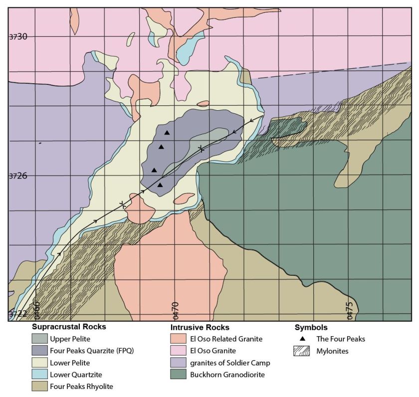 Map by Calvin A. Mako.
The map below shows a generalized representation of the previous geologic maps. The four triangles on the generalized map represent the four peaks. The green colors represent the sandstones, now metamorphosed to quartzites, and the reds represent the surrounding granites and other metamorphosed coarse-grained and fine-grained igneous rocks. North is to the top of the map.
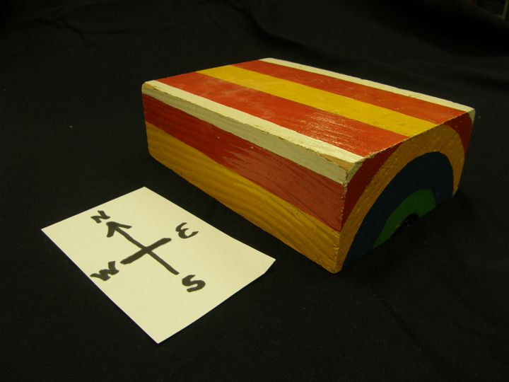
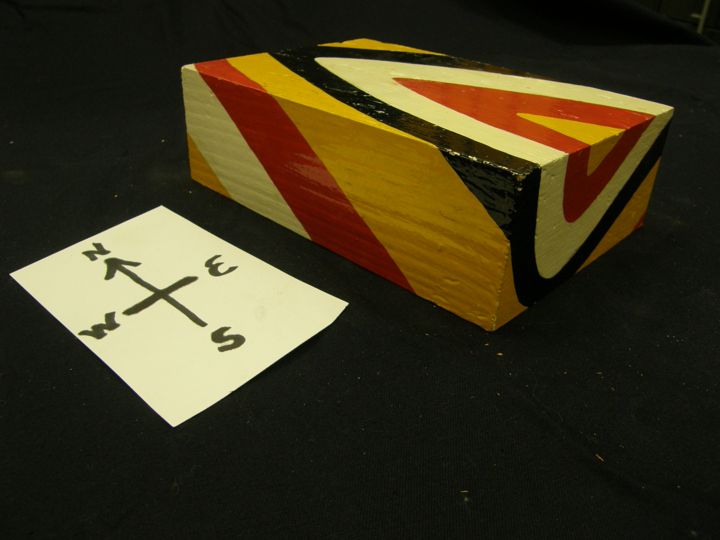
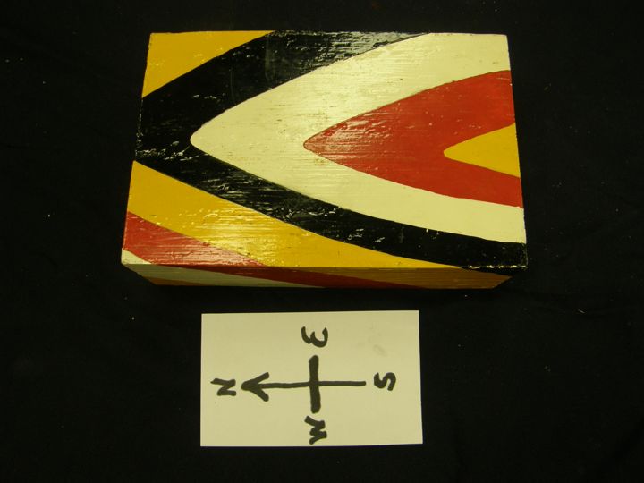
To present the structure of the Four Peaks area, I will be referencing images of block models that I made for the teaching of geology at Moravian College. For each model, I placed a card with compass directions next to the model so I could be more specific in my directional references.
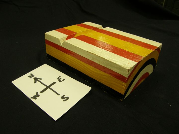
The first model (below) shows a sequence of sedimentary rocks that were originally deposited nearly horizontally (with the oldest on the bottom and the youngest on the top) and which were folded by being compressed by forces from the east and west. In this case, the fold was upward, called an "anticline," and everything above the top of the block was eroded off, leaving a surface pattern of stripes of, from edge to edge, white, red, yellow, red and white. Geologists often are able to investigate only the view provided on the top of the block and then, based on the pattern, have to infer the structure of the entire block.
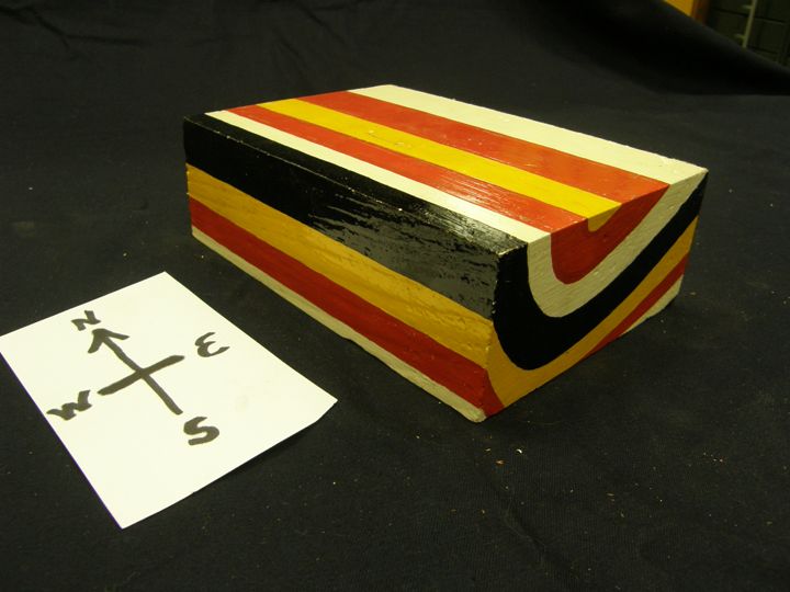
The model below shows the same structure (an anticline) but the surface is now cut by a stream. In this stream valley small portions of the larger structure are partially revealed. The deviations of the surface from the horizontal, both up and down, are useful in helping a geologist to discern some of the structures below.
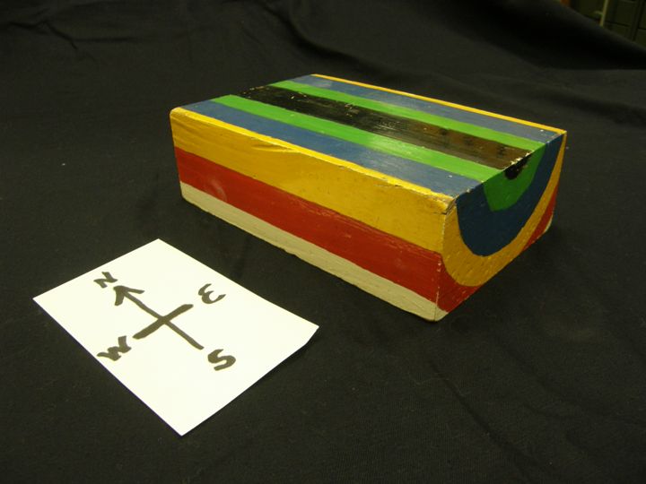
Below I have flipped the anticlinal block over to show a fold downward, called a "syncline, in geology. Because the major strcture of the Four Peaks area is a syncline, all further references using blocks will show fold-down (synclinal) structures, with erosion removing all material from above the top of the block.
The anticline and syncline folds may not run horizontal, in which case they may plunge into the block. In the block below the syncline plunges to the south.
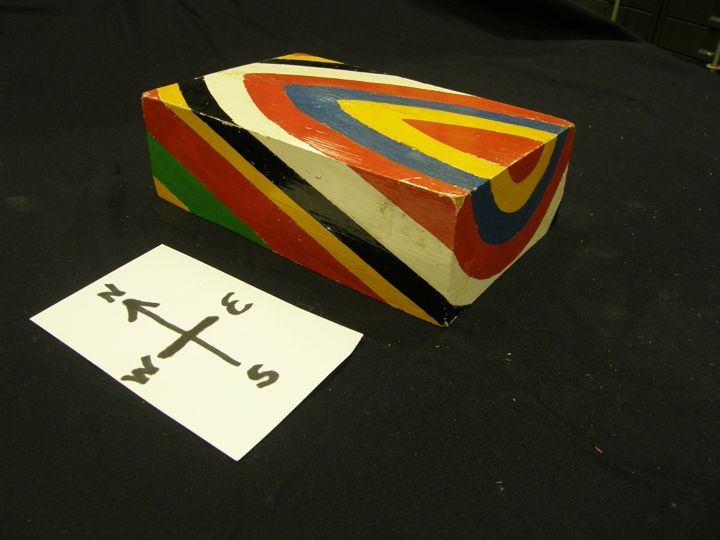
In the block below the syncline has a double plunge: the north side southward and the south side northward. The youngest rock exposed on the surface would be the blue unit and the oldest exposed on the surface would be the black unit. But notice the thus far all folding has been symmetrical so that the thicknesses of the surface exposures has been uniform for each rock type (each color). But sometimes nature is not that simple, so we have to consider asymmetrical folding as we proceed further.

Below is a non-plunging syncline folded asymmetrically so the fold axial plane tilts eastward above the block top and, continuing, tilts westward below the block top. A geologist would say that the fold axial plane "dips to the west." Notice that on the block top the red and white beds are wider on the east side of the fold axial plane (where the dip of each bed is gentle) and narrow on the west side of the fold axial plane (where the dip of each bed is steep).
The block below shows an asymmetrically folded southward plunging syncline. The fold axial plane dips to the WNW.
The block shown below is the same one as the block above, but the camera view is more nearly vertical so the variation of the exposed beds is more easily seen. Notice the beds (colors) are wider on the eastern side (where the dips are shallow) than on the western side (where the dips are steep).
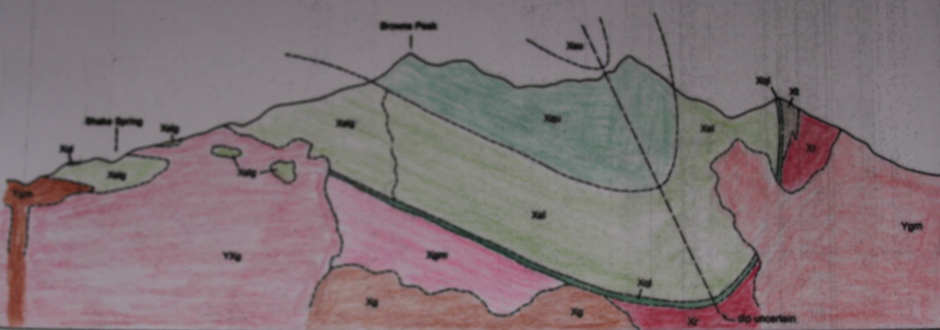
Shown below is a very over-simplified geologic map of the Four Peaks area, with four triangles showing the locations of the four peaks. North is to the top of the map. Notice the pattern of colors matches the doubly plunging syncline block model, and that the colors on one side are wide, whereas those on the other side are more narrow, allowing us to conclude the fold is asymmetric with the southeast side having steep dips and the northwest side having gentle dips. The peaks are in the gentle-dipping portion.
Below is the hypothetical cross-section of the Four Peaks area. The green units are sedimentary rocks, primarily quartz sandstones, that have been folded as described in the previous paragraph, but notice that the sedimentary units with the steep dips are actually overturned near the center of the fold. In this cross-section, the sandstones, which were metamorphosed to quartzites, are surrounded by granites, which are colored shades of red or pink. Notice also that in the deeper parts of the fold, the quartzites are younger than the granites below because they formed (originally flat) as sandstones on an eroded granite surface, whereas on both sides of the fold shown in the cross-section those granites have intruded the green quartzites, so those granites are younger. Granites are suitable for radioactive age dating, so the quartzites are younger than the deep granites and older than those at the edges of the profile.
 Cross section by Stephen Skotnicki.
What are the ages of these granites? The oldest is dated at 1677 million years (1.68 billion years) and the youngest at 1449 million years (1.45 billion years). A detailed analysis by Calvin Mako, available in the references below, using techniques not covered in this presentation, puts the date of formation and deformation of the rocks that form the Four Peaks at 1.68 to 1.65 billion years.


A few practical questions:
Why do the peaks stand so high? Answer: Because they are made of the rock quartzite and, as the name implies, quartzite is composed of the mineral quartz. On or near the earth's surface, quartz is very resistant to weathering because of the following: (1) chemically, it is almost inert; (2) it is harder than steel; and (3) it has no cleavage (no planes of weakness, so it is equally hard in all directions). Thus it is among the most resistant of all rocks. Quartzite, where ever it occurs, usually forms topographich high areas because it weathers less rapidly than whatever rocks are adjacent to it.
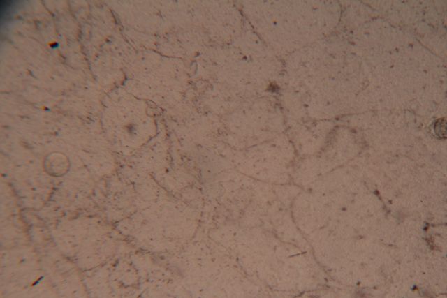
The two photographs below show a microscopic view of a sandstone made of rounded quartz sand grains and some clay between the grains. The two views show the same thin section; the first shows it in plane polarized light and the second shows it in cross polarized light.
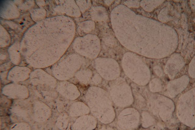
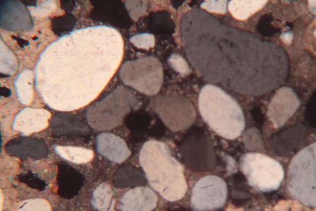
Photomicrographs of a sandstone above and a quartzite below.
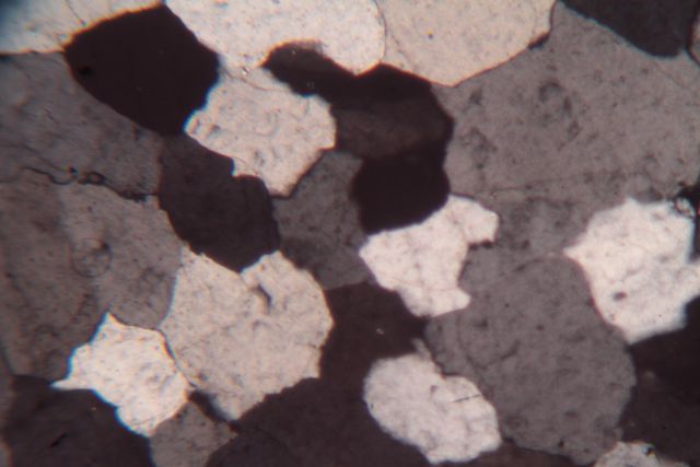
The two photographs above show a microscopic view of a quartzite made of annealed quartz grains. The two views show the same thin section; the first shows it in plane polarized light and the second shows it in cross polarized light.
The quartzites in the Four Peaks area are found in a doubly plunging syncline (a fold downward), so what happened to the quartzites that were not part of this major synclinal structure that makes the Four peaks area? Answer: They were weathered, albeit slowly, and eroded and transported primarily by flowing water toward the ocean or even all the way to the ocean where it was deposited on beaches or on the ocean floor. Some quartz sand grains in less-ancient sandstones or in other sediments may have originated from the weathering and erosion of these now-absent quartzite layers. So the quartzite that we see when we look at the Four Peaks area is a very small remnant of a former much more extensive quartzite layer.
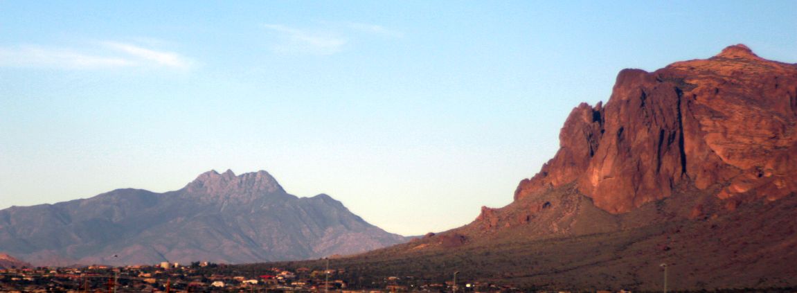
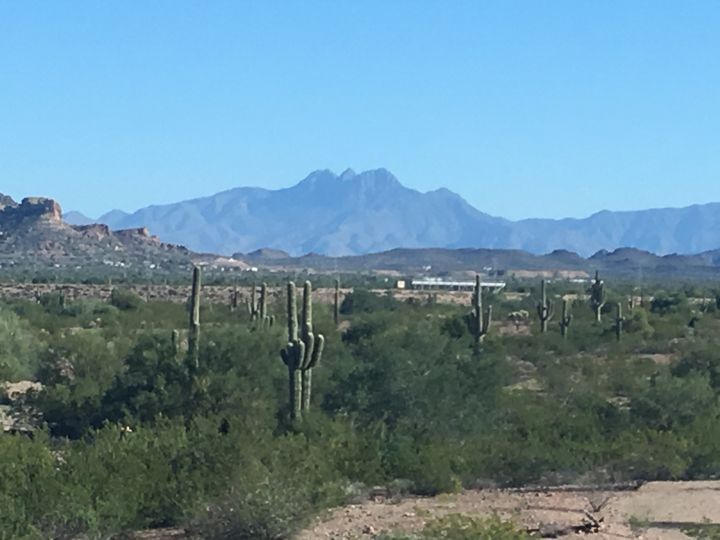
This view, taken from Route 60, shows Superstition Mountain to the right and the more distant Four Peaks to the left, with some of the houses of Apache Junction in the foreground. These peaks are located about 23 air miles to the NNE of my home in Gold Canyon, which is less than a mile from where I took the above picture.
---------------------------------------
If we put a date of 20 million years on the formation of the Superstition Mountains, then the rocks that form the Four Peaks are in excess of being 75 times older. Thus the first image on this web page, as well as the view above, both show two mountains in Arizona which differ from each other in age, structure, lithology, geologic history, and appearance. They are both beautiful and, fortunately, both are on our horizon and delight us, but the similarities end there.
Click HERE for my brief description of the geology of the Superstition Mountains.
I donated all the painted wooden structural models to the Department of Physics and Earth Science of Moravian College when I retired in 2009.
See the references below for additional information about the topography and geology of the Four Peaks area:
Stephen Skotnicki USGS geological map and report http://repository.azgs.az.gov/uri_gin/azgs/dlio/805
Stephen Skotnicki geological report http://repository.azgs.az.gov/sites/default/files/dlio/files/nid805/ofr-00-11_four_peaks_report.pdf
Calvin Mako Master's Thesis about the geology of the Four Peaks area https://scholarworks.umass.edu/cgi/viewcontent.cgi?referer=https://google.com/&httpsredir=1&article=1077&context=masters_theses_2
Topographic map of the Four Peaks area https://catalog.data.gov/dataset/usgs-1-24000-scale-quadrangle-for-four-peaks-az-19647b292