Lehigh Valley Geology Field Trips
Field Trip 1, Stop 3
The Youngest Rocks: Sedimentary and Igneous
(Click on images to enlarge)
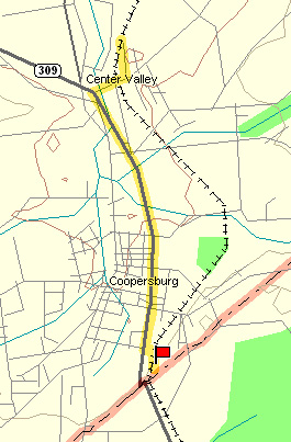
(Source: DeLorme 3-D TopoQuads)
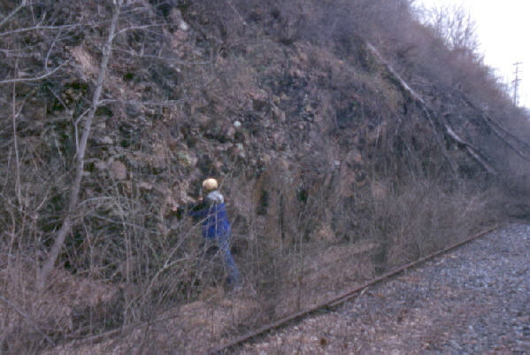
Abandoned railroad paralleling PA Route 309, near southern edge of Coopersburg. The railroad track and railroad ties were removed subsequent to the taking of these photographs in preparation for the former railbed to be converted to a rails-to-trails path. Park somewhere in southern fringe of Coopersburg and walk south along the former railroad bed about 1/4 to 1/2 mile.
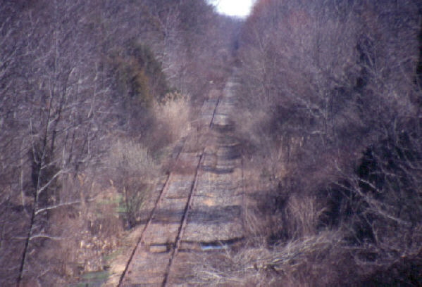
The track cuts through shale that is distinctly red in color and is essentially flat-lying because it was deposited AFTER the formation of the Appalachian Mountains and, consequently, was not folded or metamorphosed.
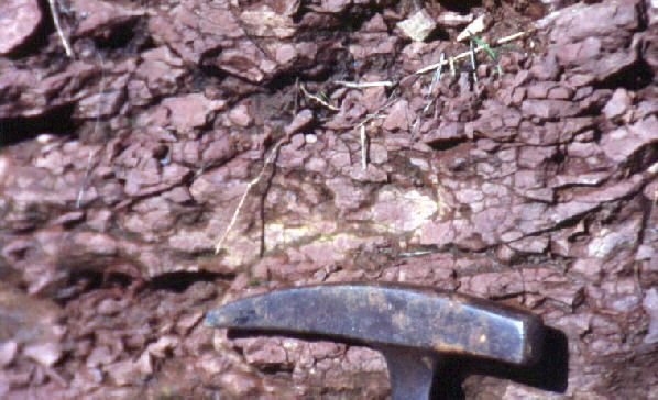
The Triassic-age (245 - 208 million years) shale was never metamorphosed. It crumbles easily in your hand. Its red color results from the oxidation of any contained iron during the deposition of the sediments. The iron was oxidized because the muddy sediments, which later became the shale, were deposited on land, rather than under water, and the Earth's atmosphere had abundant oxygen. The sediments were deposited in floodplains by streams that flowed into down-faulted valleys, called grabens. These grabens were created by the plate tectonic motion of Africa pulling away from North America as the Atlantic Ocean was born in the widening gap between them. It is the age of early dinosaurs, which roamed these river floodplains and left footprints. A modern example of a graben due to contemporary plate tectonic motions would be the Rift Valley in Africa, which is the source region for the Nile River.
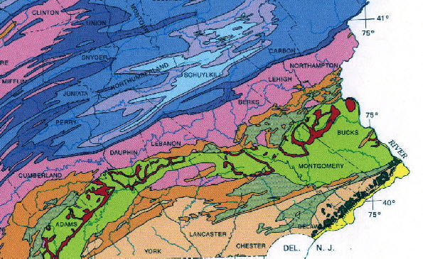
(Source: PA Geological Survey)
The map above shows the distribution of the Triassic-aged shale in Pennsylvania as the bright green color. This shale is exposed continuously from the Gettysburg area (left lower edge) to the Delaware River (center right side). While this shale was forming in Pennsylvania, it was intruded by a basaltic melt, a magma. In New Jersey there are surface basaltic lava flows (the Watchung Mountains) interbedded with the shales, indicating the lava flows and shales were forming simultaneously. The basaltic magma in Pennsylvania may also have reached the surface to form volcanoes and lava flows, but subsequent erosion has removed much of the upper levels to expose that which cooled below the Earth's surface as a series of sills and dikes. These intrusions are indicated on the above map by the bright red color within the bright green area (the Triassic-aged shale) mentioned previously.
Farther along the track the shale has been intruded by a younger Triassic-age diabase (diorite-to-gabbro) dike. The diabase intrusion was a basaltic magma that was injected into the red shales and metamophosed the surrounding shale adjacent to the contact between these two rocks (contact metamorphism). The diabase is a medium grain-sized igneous rock that appears homogeneous and black in the exposure.

Access to this exposure of diabase is made difficult due to poor drainage near the outcrop.
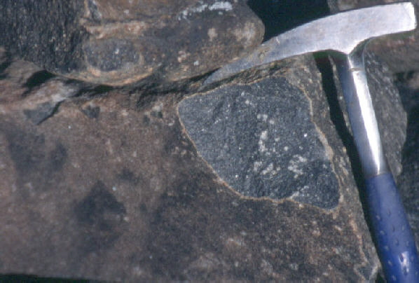
Feldspars in the diabase weather to a lighter brown-green, making the surface lighter than the unweathered rock interior, which appears to be a darker gray. The unweathered interior of this medium-grain sized igneous rock has a "salt and pepper" appearance due to the roughly equal proportions of darker pyroxenes and the lighter feldspars.
Related regional geological features that are NOT seen on these field trips.
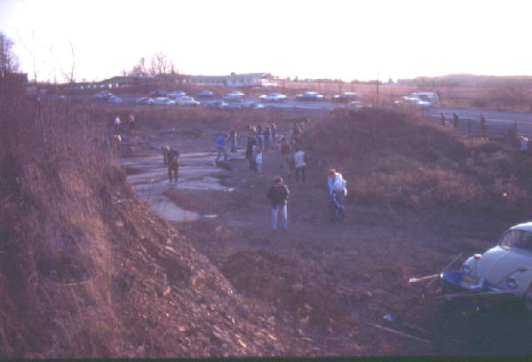
PA Route 309 ascends a slight hill just south of Coopersburg. The horizontal beds of shale are exposed in this roadside clearing. CURRENTLY, THIS PROPERTY IS POSTED, FENCED, AND LOCKED. NOBODY IS PERMITTED ONTO IT. This property is located about 10 meters from the railroad track of this field trip stop. We cannot visit this site due to the restrictions by the present land owner.
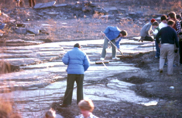
In 1979, when these pictures were taken, the surface was cleared and the site was available for study. The Triassic Period was the age of early dinosaurs, but they were only about the size of humans at that time. This site had individual dinosaur footprints, perhaps about 200 in number, and even a few footprint trackways. Students enrolled in the Moravian College geology course during the 1980's would visit the site and examine the footprints.
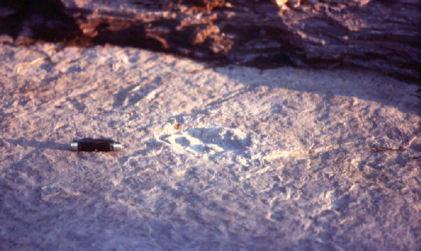
This is one dinosaur footprint of the many that were exposed. Subsequent to the taking of this photograph, three unknown individuals arrived at the site and, without permission, removed the best footprints by cutting them out with a concrete saw. This was an act of theft. These individuals have not yet been caught. DON'T EVEN THINK ABOUT GOING ONTO THIS PROPERTY!

Shown above are the thin beds of red shale after they were cut by the concrete saw to remove the dinosaur footprints. Notice the straight edges and square corners, evidence that a saw was used in the theft. The above photograph was taken in 1990.
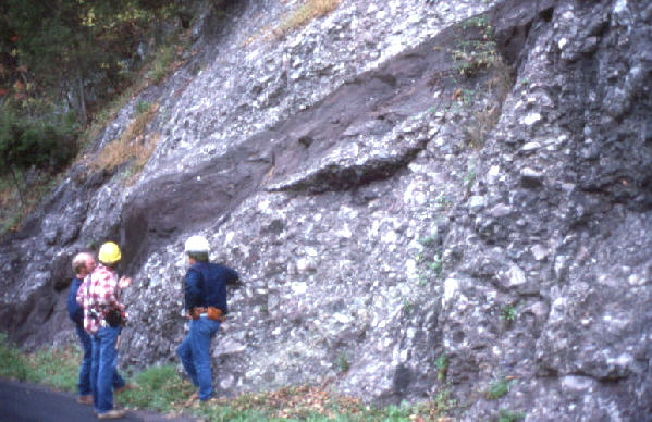
Many of the cliffs along the Delaware River south of Riegelsville are exposures of Triassic-age conglomerates. These very coarse-grained rocks probably formed from streams that flowed down steep slopes on alluvial fans in a semi-arid environment. Such deposits are sometimes called "fanglomerates." These boulder deposits are cemented together to form very resistant rocks. They are more resistant then the Triassic-age shales, so they and the diabase intrusives make the higher topographic features within the broad region of Triassic-age formations that underlie much of Bucks and Montgomery counties between Bethlehem and Philadelphia. Some dinosaur footprints occur in the finer Triassic-aged shales but not in the conglomerates, and certainly never in the diabase intrusives.
End Stop #3 of Field Trip #1
(all photographs by J. Gerencher)