Lehigh Valley Geology Field Trips
Field Trip 3, Stop 2
Camel's Hump: A Very Significant Minor Hill
(Click on images below to enlarge)
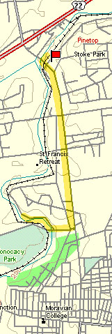
(Source: DeLorme 3-D TopoQuads)
Camel's Hump is encountered going north along Linden Street (PA Route 191) just prior to crossing the railroad tracks near the entrance to US Route 22. Turn left onto Birry's Bridge Road and park near the intersection.
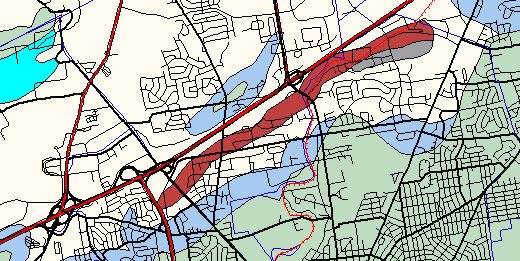
(Source: ArcView GIS Software)
Camel's Hump is composed of the same Precambrian gneiss as South Mountain, which is seen on field trip #1, stop #1. On the geologic map above, it is the red rock unit. The severe metamorphism that occurred approximately one billion (1000 million) years ago altered the preexisting rock to the gneiss we see today. The rocks around it (blues and grays on the above map) are less than half the age of the one billion year-old gneiss. The significance of the occurrence of the gneiss in the middle of the limestone/dolomite valley floor is better examined at the next stop of this field trip, which is a similar geologic and topographic situation, but is located nearer to Easton.

Camel's Hump appears to be a double-crested hill. The Precambrian gneiss weathers to produce a poor soil, so the land was left uncultivated. The forest on this hill adds to its unusual appearance. The intensive agriculture around Camel's Hump was made possible from the fertile soils that formed on limestone/dolomite bedrock of the low valley floor.
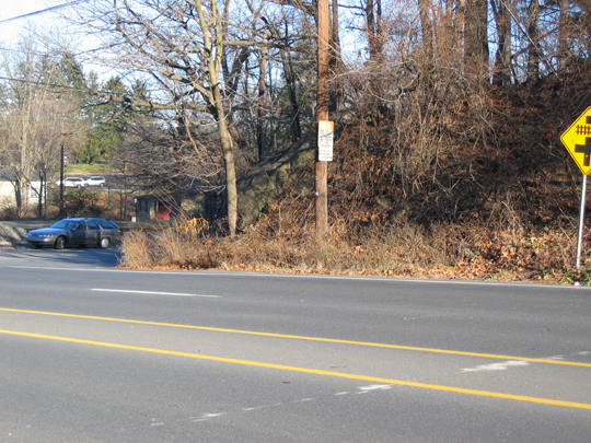
The exposure of Precambrian granite gneiss is easy to miss because it occurs behind the trees at the very corner of the busy intersection of Linden Street (PA Route 191, in the foreground) and Birry's Bridge Road (where the car is parked on the above photograph). This is a dangerous intersection because Linden Street is four lanes and cars travel at high speeds.
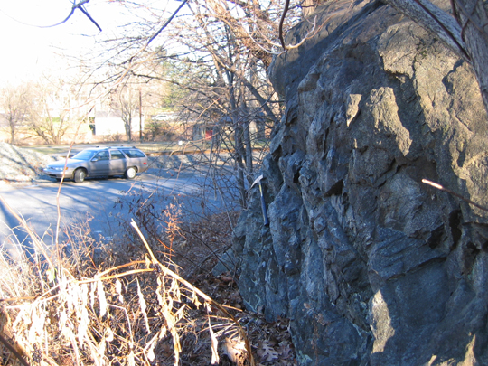
The exposure is to the right, with a hammer for scale. The car in the distance is parked on Birry's Bridge Road.
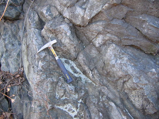
This is a closer view of the Precambrian granite gneiss at this outcrop. The rock has the same composition as the rock seen on the summit of South Mountain, which was the first stop of the first field trip. The age of the this rock is about one billion (1000 million) years, roughly 20 to 25 percent of all geologic time.
End Stop #2 of Field Trip #3
(all photographs by J. Gerencher)