Lehigh Valley Geology Field Trips
Field Trip 3, Stop 5
Ice / Water Depositional Features
(Click on images below to enlarge)
(Source: DeLorme 3-D TopoQuads)
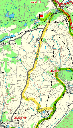
Follow minor highway T 730 northwest to parallel Oughoughton Creek to the intersection of PA Route 611 in Richmond, and follow PA Route 611 north past Mount Bethel, but about a half-mile out of Portland turn left onto Middle Village Road and continue to the "T" intersection with Boulder Road. Turn left onto Boulder Road. Continue about a half-mile. Alternatively, go all the way into Portland where you can pick up State Street, and then head west on this road to the intersection with Boulder Road.
(Source: DeLorme 3-D TopoQuads)
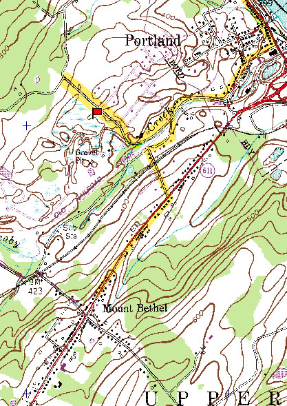
The site is a large gravel quarry west of Boulder Road. THIS LAND IS OWNED BY UPPER MOUNT BETHEL TOWNSHIPAND IS POSTED FOR NO TRESPASSING! YOU MUST HAVE PREVIOUS PERMISSION TO ENTER THE SITE. TO OBTAIN PERMISSION, YOU MUST CONTACT OFFICES OF UPPER MOUNT BETHEL TOWNSHIP. THEY MAY REQUIRE A LETTER RELEASING THE TOWNSHIP OF ANY LIABILITY. The gravel operations are now inactive. The site is very large and there has been no recent mining activity in the portion of the quarry near Boulder Road. We only venture about 100 meters away from the Boulder Road into the site.
(Source: DeLorme 3-D TopoQuads)
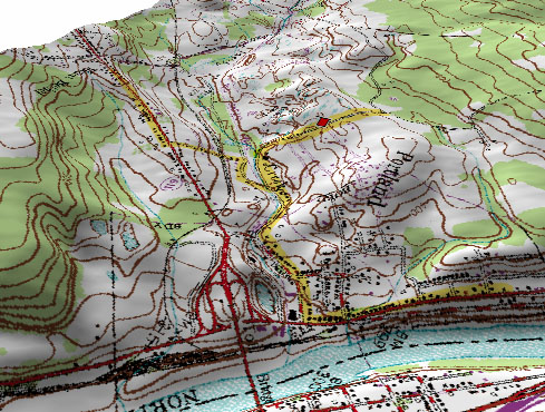
The perspective map above shows the valley occupied by Jacoby Creek, as seen from the northeast, with the Delaware River in the foreground, flowing from right (north) to left (south). The red mark on the map is the gravel quarry site. During the Pleistocene the ice advanced from the northeast (behind you), over the Delaware River, and into and through the Jacoby Creek valley. Approximately 17,000 years ago the front of the continental ice sheet started to melt back toward Canada, but for a period of time the ice front dammed the valley outlet to create a temporary lake in the Jacoby Creek valley. Streams of glacial melt water flowed both on the glacier surface and within the ice. These streams discharged into the lake and built deltas that formed below the lake surface to the level of the lake. These deltas were composed of well-sorted and well-washed sands and gravels. Once the ice front melted back farther, the trapped water in the valley was released into the now-flowing Delaware River and the lake drained. With the draining of the (temporary) lake, the deltas were exposed as dry, flat-topped hills that are made of stratified sands and gravels. These glacial water depositional features are called kames.
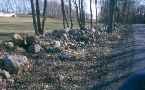
Glacial erratics are piled along the road near the gravel quarry. The erratics originate from the tills that were deposited in this valley before it was flooded with glacial melt water with the retreat of the glacier. The quarry site shows glacially polished bedrock, glacial tills, glacial erratics, and kame deposits. It is the kame deposits that are economically valuable because they are easily-excavated sources of pre-washed sands and gravels. Washed sands and gravels are used in the manufacture of concrete and other products.
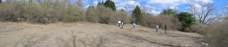
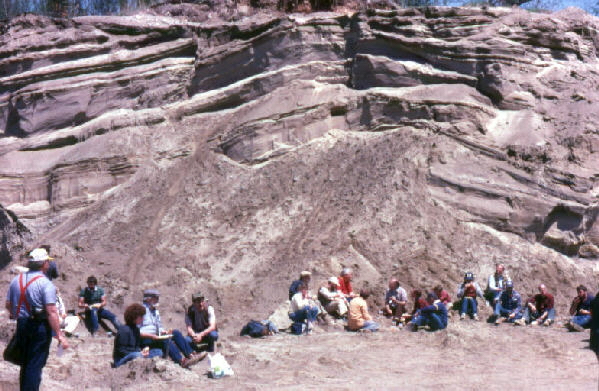
In the photo-mosaic above, Moravian students examine the sand that remains from the removal of the kame deposits that were and are extensive at this location. These sands were deposited as a delta that was built into a temporary glacial lake which subsequently drained as the glacier retreated, allowing the lake to drain into the nearby Delaware River.
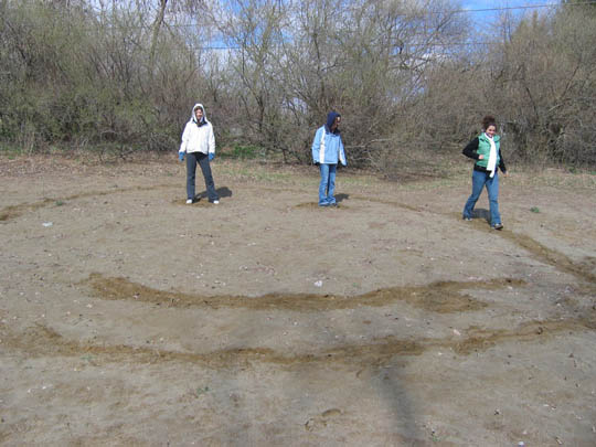
Students have fun in the sand at this location. They are making a "smiley face" in the damp sand.
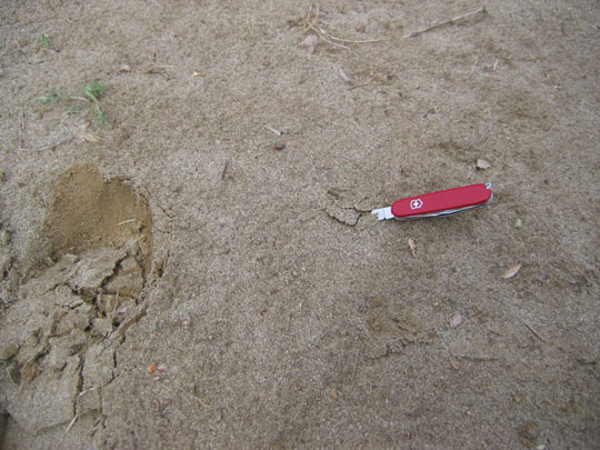
This is a close-up view of the sand of the kame deposit, which was damp just below the surface due to rains that fell a day or two before this photograph was taken.
Related regional geological features NOT seen on these field trips.
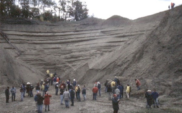
The photograph above shows a kame deposit near Stroudsburg which is exposed in an active quarrying operation. Notice the sands are layered and well washed. Kame deposits are depositional features made by water from the melting ice, rather than being deposited by the ice itself. These sand deposits are not cemented so they can be extracted with a shovel rather than with a hammer.
The kame deposit shown in the above photograph is exposed in an active sand and gravel quarry operation in Great Meadows, New Jersey. Although formed under water, it is now exposed as a flat-topped hill. The top of the hill was the level of the lake's surface. The lake drained when the glacier melted back and the temporary ice dam was removed.
End Stop #5 of Field Trip #3
(all photographs by J. Gerencher)