Lehigh Valley Geology Field Trips
Field Trip 2, Stop 4
Lehigh Water Gap: Structure and Topography
(Click on images to enlarge)
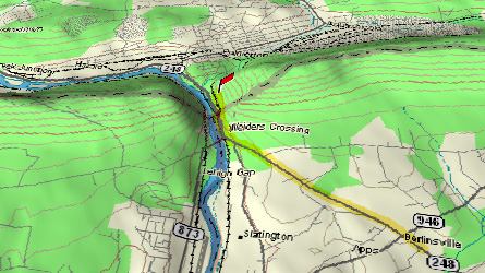
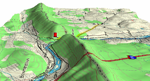
(Source: DeLorme 3-D TopoQuads)
The outcrop is exposed along an abandoned railroad grade which runs parallel to PA Route 248, east of the Lehigh River, just south of Palmerton. A steep dirt road provides access to the site from PA Route 248, south of its intersection with PA Route 145.
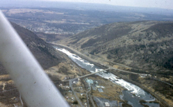
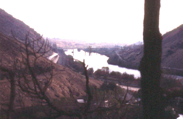
The photograph above shows the Lehigh River flowing south through the gap. The gap provided transportation through the Kittatinny Mountain (Blue Ridge Mountain) for railroad lines on each side of the river and for the major highway, PA Route 248, which creates a tight squeeze. The view is upstream, from south to north.
In the photograph above, PA Route 145 is clearly visible to the right (east) of the Lehigh River and the abandoned railroad grade is immediately to the right of the highway. The bridge south of the gap carries Mountain Road across the Lehigh River.
Blue Ridge Mountain has a summit that appears to be of uniform height. It is created by the resistant Shawangunk Formation, also referred to as the Tuscarora Sandstone or Tuscarora Quartzite (or Tuscarora Orthoquartzite), which is a quartz pebble conglomerate and quartz sandstone that is cemented together by quartz cement, making an almost-entirely quartz rock. The formation strikes to the northeast and dips to the northwest, away from Bethlehem. This quartz-rich rock is very resistant and creates topographic highs wherever it is exposed. The Lehigh River has cut the gap in this resistant rock unit. The river is now "trapped" in this gap.
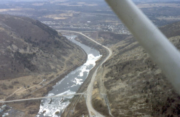
This is the view from the hill beyond the gap, looking south. The exposures observed on this field trip stop are to the left side of the river. The river is flowing away from you in this view.
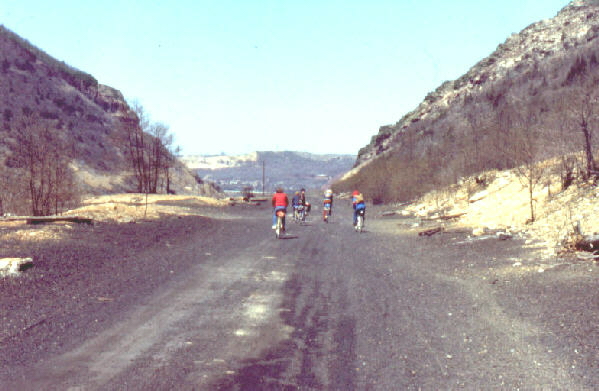
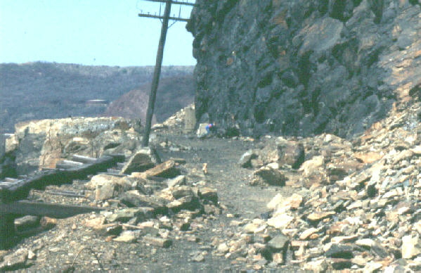
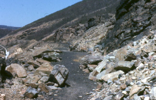
Follow the former railroad grade into the water gap. The railroad grade narrows significantly as it approaches the exposure of the resistant rock that makes the ridge.
Along the abandoned railroad, before it reaches the resistant Tuscarora Quartzite, the Martinsburg Shale is well exposed. Here the bedding of the Martinsburg dips to the left but the foliation dips to the right. Bedding and foliation are oriented almost perpendicular at this location, giving the outcrop and the shale fragments at its base an unusual appearance.
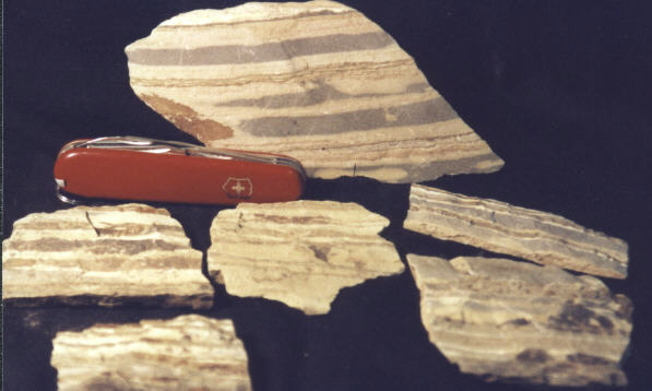
The photograph above shows several pieces of the metamorphosed shale from the exposure shown in the previous picture. Notice the pieces are tabular in shape and striped with color bands. The shape results from splitting along foliation, which was developed when the formation was metamorphosed. The coloration is the bedding of the original shale before metamorphism. The foliation and bedding are oriented approximately perpendicular to each other at this location. The fragments, consequently, manifest both the effects of the earlier sedimentation and the later metamorphism.
Walking north into the gap, after you pass the outcrops of Ordovician aged (505 to 438 million years) Martinsburg shale, you arrive at the Silurian aged (438 to 408 million years) Tuscarora Sandstone, which is tilted steeply but less metamorphosed than the Martinsburg Shale. The contact between these two units is easily visible. Although appearing to have similar orientations, these two formations differ in strike direction, revealing that the contact is not a simple sedimentary contact. It may be a fault contact or an unconformity. If an unconformity, it separates the earlier, more severe deformation of the Ordovician-aged rocks to the south from the less severely deformed Silurian-aged rocks to the north. It represents the hiatus -- the break in time -- during which the older rocks were being eroded subsequent to their metamorphism, but prior to the deposition of the sediments that would become the Silurian and younger rocks to the north of this location. Modern geologic maps reveal this contact to be a fault boundary also.
Blocks of resistant Tuscarora Sandstone ("Quartzite") break off the cliff face and roll down the steep grade of the mountain side. Sometimes these blocks continue past the railroad bed and tumble onto the major highway, PA Route 248, below.
(Source: DeLorme 3-D TopoQuads)
The summit of Blue Ridge, seen from the southeast toward the northwest, creates a relatively uniform summit. In this view north is to the left, Bethlehem is to the right, and the Lehigh River flows from the left to the right. The Tuscarora Sandstone strikes in the direction of view and dips toward the left. Consequently, rocks exposed to the left of the ridge are younger than the Tuscarora, and rocks exposed to the right of the ridge are older than it.
Related regional geologic features NOT seen on these field trips.

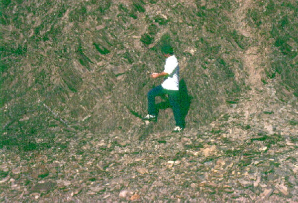
Shown here is the Tuscarora formation, tilted and folded, as it appears by the Laurel Creek Dam near PA Route 322 northwest of Harrisburg. Note the two persons for scale. This rock unit is called the Tuscarora Formation in western and central Pennsylvania, but the Shawangunk Formation in eastern Pennsylvania and New Jersey.
End Stop #4 of Field Trip #2
(all photographs by J. Gerencher)