Lehigh Valley Geology Field Trips
Field Trip 1, Stop 4
Origin of "Strange" Big Rounded Black Boulders
(Click on images to enlarge)

(Source: DeLorme 3-D TopoQuads)
Along the side of State Road, between Coopersburg and Pleasant Valley. There are many places along the right side of the road where these features can be seen.
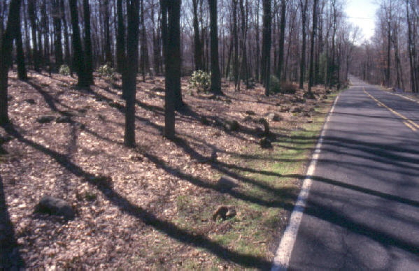
On the photograph above, the boulders are evident between the trees within the cleared area of this private property. The boulders all appear to be black in color and uniformly rounded. The extensive accumulation of rounded black boulders presents an unusual view.

The photograph above shows the dark color and uniform composition of one of the boulders, revealing it is diabase (diorite to gabbro), an igneous rock that cooled slowly at depth to produce an intermediate grain size. It is the same rock unit as seen in the previous field trip stop. It is, indeed, part of the same dike that is exposed along the railroad track.
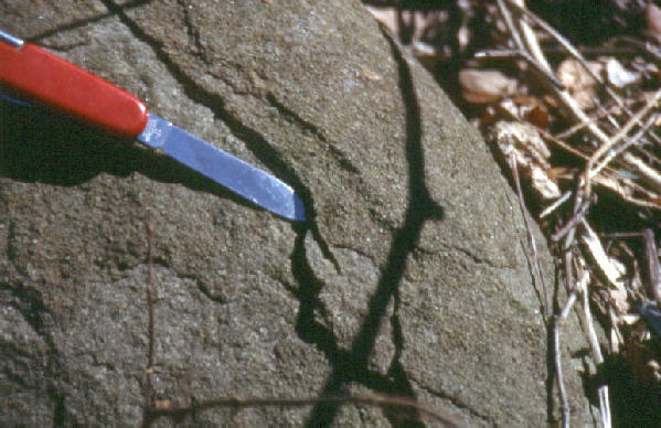
The photograph above shows exfoliation, which is a weathering phenomenon limited to rocks that formed under high pressure conditions. Exfoliation causes the sub-spherical shapes of the boulders. The diabase formed under high pressure because the magma from which it formed cooled at depth. The diabase tends to expand with the release of pressure as erosion lowers the surface of the Earth to expose the rock. When exposed to the atmosphere on the Earths surface, the feldspars in the diabase weather to a gray-green clay. The clay, in turn, is weak and aids in the formation of onion-like sheets which are sub-parallel to the surface of the boulder.
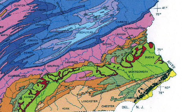
(Source: PA Geological Survey)
The geologic map above shows the Triassic diabase intrusions as the bright red color within the area of the Triassic shale (the green on the map). The diabase forms a series of discontinuous sills and dikes between Gettysburg to the south and the Delaware River to the east.
Related regional features NOT seen as stops on these field trips.
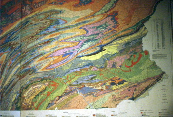
(Source: PA Geological Survey)
On the map above, the intrusion of diorite is shown in bright red and makes a discontinuous string of exposures from Gettysburg, near the southern border of central-PA, to the Delaware River along the eastern edge, and continuing off the map through New Jersey to New York City.
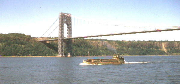
The photograph above shows the Palisades Sill, located along the NJ side of the Hudson River adjacent to New York City. It is the same intrusion of diabase (diorite-to-gabbro) magma as mentioned previously, but here it is exposed as a sill, rather than as a dike. The George Washington bridge is shown crossing the Hudson River. The east side of the bridge is anchored in the Palisades sill, which is about 800 feet thick at this location.
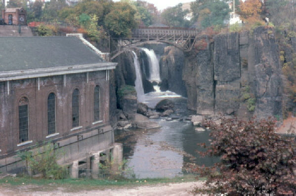
The above photograph shows the waterfalls in downtown Patterson, NJ, which are developed on columnar-jointed lava flows of Triassic-aged basaltic magma. These formed in the Triassic graben where the basaltic magma erupted onto the Earth's surface.
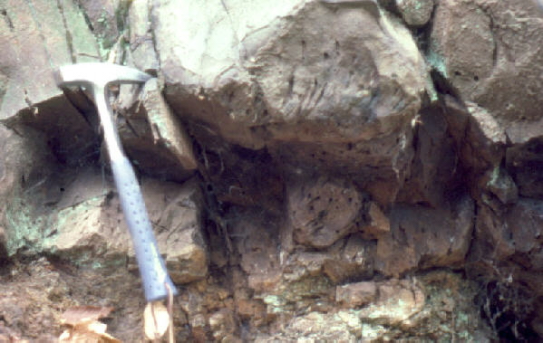
The photograph above shows basalt lava flows in the Watchung Mountains of NJ, which are extrusions of the same diabase magma during Triassic time. The intrusions and extrusions were caused by the pulling apart of the the North American Plate from the European and African plates -- it marks the timing of the formation of the Atlantic Ocean. To the right of the hammer head are vesicules, formed by dissolved gas being released by the cooling magma under surface pressure (low pressure) conditions.
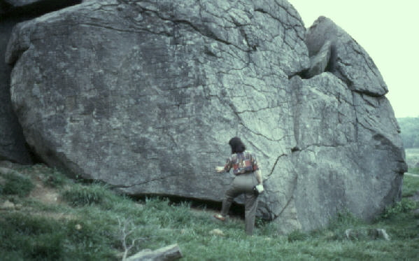
The diabase in Gettysburg provided the relief of the battlefield that was instrumental in the Battle of Gettysburg. Shown here are diabase boulders, with evident exfoliation, making up Devil's Den. In the battle, the Confederate forces held this position to fire upon the Union forces on Little Round Top, which is also an exposure of the diabase intrusion. Many men died at this exact location during the battle.
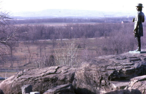
The view from Little Round Top in the Gettysburg Battlefield, which was held as high ground by the Union troops during the battle. The statue commemorates the men who fought and who died here. The troops at this location shot down onto the Devil's Den position which was held by the Confederate Army. Notice that the diabase is dark in color. Although the composition is uniform, the surface is weathering into onion-skin-like layers by the pressure release and chemical action by the atmosphere -- exfoliation.
End Stop #4 of Field Trip #1
(all photographs by J. Gerencher)