Lehigh Valley Geology Field Trips
Field Trip 3, Stop 7
Mt. Pocono Summit: "Appreciation" of Glacial History
(Click on images below to enlarge)

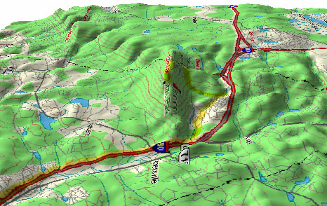
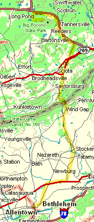
(Source: DeLorme 3-D TopoQuads)
Follow PA Route 611 to Interstate 80 north to Camelback Ski Area exit. Follow signs to Camelback Ski Area and continue on Camelback Road to the summit of Camelback Mountain where there is a parking area.
(Source: DeLorme 3-D TopoQuads)
The bedrock here is the Catskill Formation, chiefly gray sandstones and reddish sandy siltstones of Devonian age (408 to 360 million years), which makes them the youngest of all the bedrock seen on field trips #2 and #3, but older than the Triassic-aged (245 to 206 million years) red shales and diabase intrusives seen on field trip #1. The deformation that tilted the Tuscarora Sandstone affected these rocks as well, although they are close to horizontal at this location. The involvement of the Catskill Formation in the deformation dates the formation of the Appalachian Mountains as being between the age of the Devonian and the age of the Triassic. Farther north than the route taken by these field trips are sediments, including coals, that are Carboniferous in age (360 to 286 million years) that were also deformed in the mountain building, so this further restricts the interval of time during which the mountain building episode occurred.
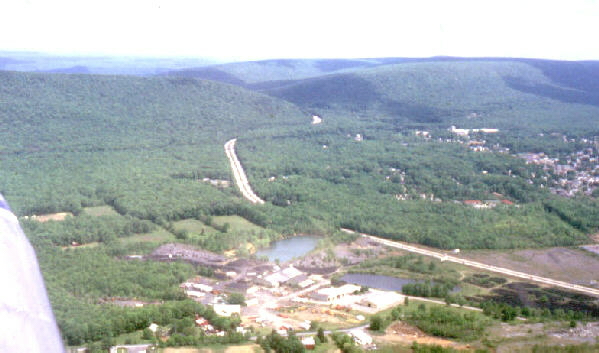
The Catskill Formation in this area is nearly horizontal and its present surface makes an elevated plateau. The perspective view above, seen from the northeast, shows Interstate 80 climbing from the valley on the left to the top of the plateau on the right. Mount Pocono is a topographic peninsula of the plateau which sticks out into the the valley of the Scot Run Creek (the foreground), somewhat the way the state of Florida sticks out into the Gulf of Mexico. Field Trip Stop #7 (this stop) is on the crest of the peninsula of the Pocono Plateau. The plateau surface extends northward from this point into New York state (to the right in the view above). During the most recent glaciation of the Pleistocene, the glacier overrode the summit of Mount Pocono, as evidenced by glacial striations on the bedrock and glacial erratics left behind, and glacial ice filled the valleys to the right and left of the summit. The ice cover on top of the summit of Mount Pocono was only a few hundred feet thick because the ice cover extended only about a mile to the southwest along the ridge crest, which would be about one-third of the way along the left edge of the plateau as shown on the perspective map above.
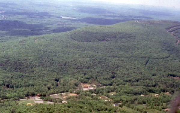
The summit of Mt. Pocono is shown above, as seen from the air. The perspective is almost identical to that shown on the previous map. All of the summit area seen here would have been covered by ice during the last glaciation.
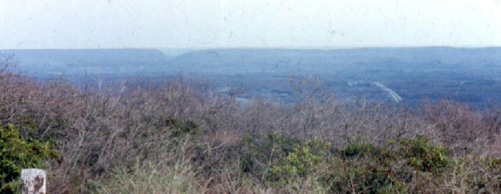
Kittatinny Mountain (also called Blue Ridge Mountain) forms the skyline seen from the summit of Mount Pocono looking south. The notch in the ridge is Delaware Water Gap.
During the Pleistocene, the glacier followed the "grain of the land" from left to right and was sufficiently thick to cover the far ridge crest to the notch (Wind Gap, PA) near the center of this elongated picture. It was only a few hundred feet thick over the Mount Pocono summit and over the ridge crest at the water gap. It would have flowed in a large lobe, from left to right, to fill the valley between these two ridges for about 10 miles to the right (southwest). Then about 17,000 years ago, it started melting back.
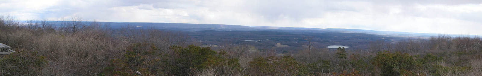
PA Route 33 south takes you back to Bethlehem. You pass through Wind Gap, shown in the picture above, which is the name of this wind gap. Wind gaps were formed by streams eroding a gap through a ridge, but after the stream drainage is captured by the headward erosion of another stream, the former river valley is left as a dry depression in the ridge. Although it typically is a windy place, and although it is called a wind gap, it was NOT caused by the wind. The view above is looking north with an abandoned slate quarry in the foreground.
(Source: DeLorme 3-D TopoQuads)
The route back to the main campus of Moravian College is very direct. You go back down the mountain on Camelback Road to Interstate 80 south to PA Route 33 south to US Route 22 west to PA Route 512 south to Elizabeth Avenue west.
Related regional geological features NOT seen on these field trips.

(photograph by the late Jack Weidner)
The Lehigh River and its tributaries flow through the Pocono Plateau in a deep gorges north of the location of this field trip stop. The system of rivers and gorges provides the relief for dramatic overlooks. Shown here is the view of the Lehigh River at Pine Creek Gorge.

(photograph by the late Jack Weidner)
The steep river gradient and interesting topography provides ample opportunity for recreation. The segment of the Lehigh River shown above is located between White Haven and Jim Thorpe. This section of the river is the most popular for weekend river rafting. On several specific weekends during the summer, the state releases additional water from the Francis E. Walter Dam to increase the water depth and rate of flow in this section of the river to support exciting white-water rafting.
End Stop #7 of Field Trip #3
(all photography by J. Gerencher, except the two photographs of river activities by the late Jack Weidner)