Lehigh Valley Geology Field Trips
Field Trip 1, Stop 5
Floodplain and Meandering Stream Features
The floodplain is located on private property.
Permission of the owner is needed to enter the land.
(Click on images to enlarge)
(Source: DeLorme 3-D TopoQuads)
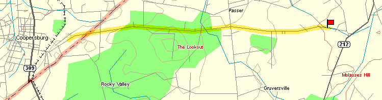
The floodplain is located near the intersection of State Road and PA Route 212, near Pleasant Valley.
(Source: DeLorme 3-D TopoQuads)
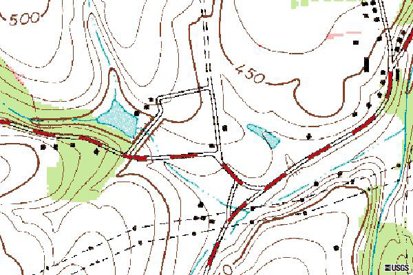
The site map above shows the stream draining to the southeast from the man-made lake. The stream segment observed at this stop occurs downstream from the lake immediately after the major road (red-and-white map symbol near the center of the map) crosses the stream.
(Source: TerraServer.microsoft.com)
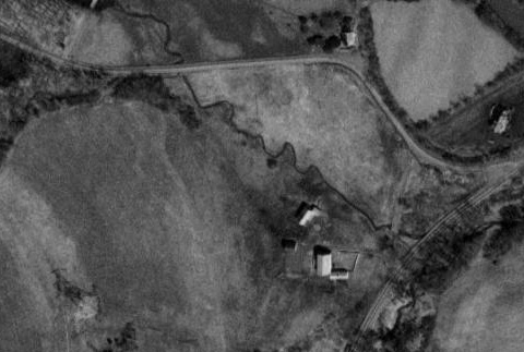
The aerial photograph above shows the stream flowing from upper left to lower right. Meanders form on the stream and propagate slowly in the same direction. The man-made lake shown on the map is off the upper right edge of the aerial photograph. The meandering pattern shown here changes from year to year. Notice the lower section (lower right) is straighter than the up-stream part (upper left). This is because the lower part was purposely straightened by the property owner in the interval 1975 - 1980 to reduce flooding damage to the home adjacent to the stream.
Meanders form on the stream. The buildings are located on bedrock off the floodplain, but are elevated only slightly above the floodplain.
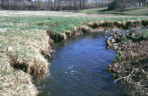
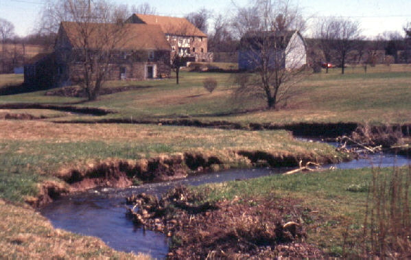
The meander on the above photograph shows active undercutting. On this meander, the grass collapses into the stream as the stream cuts into the left bank, and sediment is deposited on the gentle slope on the right bank, so this stream meander is moving progressively to the left. The left side is called the undercut bank and the right side is called the slip-off slope.
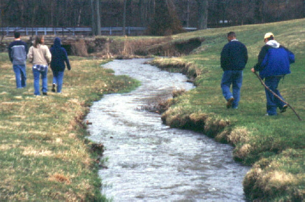
The downstream portion, as seen in the above photograph, was straightened in 1975-1980, but is now beginning to meander again. In time these slight meanders will become as broad and extensive as is evident in the present upstream portion.
End Stop #5 of Field Trip #1
(all photography by J. Gerencher)