Lehigh Valley Geology Field Trips
Field Trip 3, Stop 6, Parts A and B
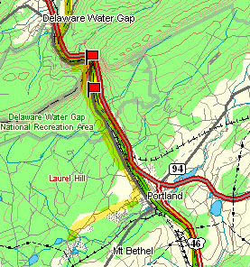
Delaware Water Gap: Structure, Topography and History
(Source: DeLorme 3-D TopoQuads)
Return to the Delaware River in Portland and follow PA Route 611 north to Delaware Water Gap National Recreational Area. Because it is a national recreational area, no rock hammers should be used at this site. There are two stops: Part A, which is on a small path just south of the gap adjacent to a small parking area, up a steep slope to an exposure of the bedrock at this location, the Martinsburg Shale, here metamorphosed to a good-quality slate; and Part B, which is at an observing platform in the gap itself adjacent to a large parking area.
(Click on images below to enlarge)
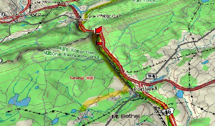
(Source: DeLorme 3-D TopoQuads)
A perspective view shows the Delaware River cutting the gap through ridge formed of the resistant Tuscarora Sandstone (quartzite), and serving as the subsequent route for Interstate 80 which crosses the Delaware River from the NJ side south of the gap to PA north of the gap. The ridge is called Kittatinny Mountain in this region and to the northeast, but is called Blue Ridge Mountain to the southwest. Whatever the name, it is still the same feature.
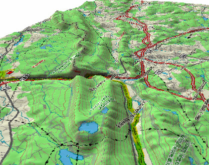
(Source: DeLorme 3-D TopoQuads)
This perspective view, seen from the northeast, shows the crest of the ridge, cut by the Delaware River, with the city of Stroudsburg north of the gap (to the right). During the Pleistocene, the glacier advanced from the northeast (from behind you in this view) to the southwest and was thick enough to cover the ridge completely on both the near and far sides of the gap, as evidenced by glacial striations on the bedrock of the ridge crest on both sides of the gap. The maximum ice advance of the last glaciation covered the ridge crest for about three miles beyond (southwest of) the gap, but was not sufficiently thick to cover the ridge crest beyond that. However, the ice continued advancing farther to the southwest in separate lobes on each side of the exposed ridge crest. Ice completely filled the gap that is now occupied by the Delaware River.
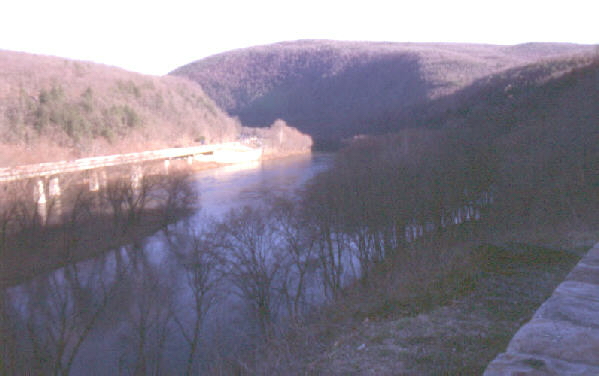
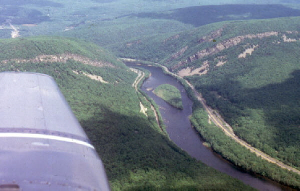
The photograph above shows the view within the gap looking downstream, with NJ to the left and PA to the right. Interstate 80 is evident on the far bank of the Delaware River. Ice filled the gap and overrode the mountain summit on both sides of the river. The river is oriented almost perpendicular to the crest of the ridge at this location. The ice flowed parallel to the mountain crest, not along the river course.
The photograph above shows the water gap viewed from the south, looking upstream. The resistant Tuscarora Sandstone (quartzite) is the prominent ridge-forming rock unit. It strikes parallel to the direction the airplane is flying and dips away from you in this view. The prominent bed "V's" upstream, revealing the dip direction.
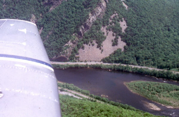
The photograph above shows a closer aerial view of the water gap with Interstate 80 on the far shore and PA Route 611 on the near shore and the river flowing from left to right. Notice the talus covering the contact of the major rock units within the gap. The resistant beds of Tuscarora Quartzite dip to the left.
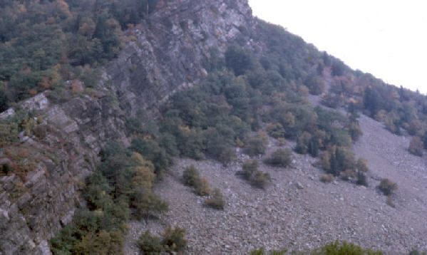
The photograph above shows a closer view of the talus cover on the NJ side, as seen from the observing platform on the PA side. The river flows from left to right. You are looking along strike, and the dip of the beds is to your left, approximately 30 degrees from the horizontal. Rocks to the right are older than the Tuscarora Sandstone and those to the left are younger. The structural situation is similar to that seen in Lehigh Water Gap (field trip #2, stop #4) where the contact between the rock units is exposed to plain view, but here the contact is veneered with the talus. Although attractive, the talus hides the "good stuff," which is the unconformable contact between the Silurian-aged Tuscarora Sandstone and the older Ordovician-aged Martinsburg Shale.
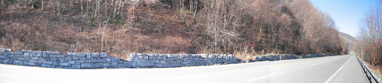
The panoramic view above shows PA Route 611 about a mile or two south of Delaware Water Gap, looking north into the gap. The Delaware River can not be seen in this view, but it is about 100 yards to the right of the highway. The slope to the left of the highway is veneered with till, from which large glacial boulders (glacial erratics) are released from the upper portions of the slope as the till weathers and the slope retreats. The stone wall was built to keep these glacial erratics from rolling onto the highway, but it is evident from the multiple violations of the wall that some glacial erratics have previously rolled over and maybe even through the wall and onto the road. In this view, the glacier traveled from right to left.
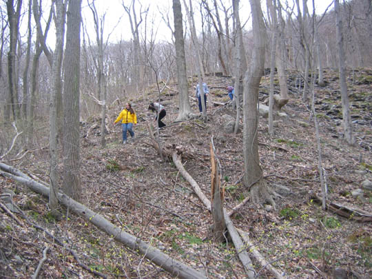
Moravian students descend from a slope after examining the Martinsburg shale, which here is metamorphosed to a good-quality slate, about a quarter-mile south of the gap itself. The contact between the slate (shale) and the ridge-forming quartzite is hidden by talus at this location, so the field trip examines each separately. The contact between these two units is directly exposed in Lehigh Water Gap, which is Field Trip 2, Stop 4.
Related regional geological features NOT seen on the field trips.

Glacially polished bedrock (Tuscarora Quartzite) at High Point, New Jersey, the highest elevation within the state (elevation 1803 feet). This is the same rock that is exposed in the Delaware Water Gap. Similar glacially polished and striated features are exposed on the crest of the ridge on both sides of the Delaware Water Gap.

The southern end of Central Park in New York City shows convincingly that the bedrock has been smoothed and polished by the movement of the glacier during the Pleistocene. In this case the bedrock is the resistant Manhattan Schist, which is not a rock that is exposed in the Lehigh Valley area.
End Stop #6 of Field Trip #3
(all photography by J. Gerencher)