Lehigh Valley Geology Field Trips
Field Trip 3, Stop 1
Monocacy Park: Stream Behavior, Past and Present
(Click on images below to enlarge)

(Source: DeLorme 3-D TopoQuads)
Monocacy Park is about a half-mile north of Moravian's main campus. Main Street can be taken north to intersect with Illick's Mill Road. Turn left onto Illick's Mill Road, which crosses the Monocacy Creek at the park entrance. Park in the lot at the park entrance. Conversely, a person can walk from Lerch's Quarry (Field Trip #2, Stop #1) upstream along a path that parallels Monocacy Creek to the park entrance. The City of Bethlehem maintains a nature walk along this corridor.
(Source: DeLorme 3-D TopoQuads)
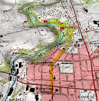
The map above is a perspective view of the Monocacy Creek valley in the park area. There are two stops in the park: stop 1A is at a stream gauging station and stop 1B is at a small lake behind the dam at the upstream-end of the park.
(Source: DeLorme 3-D TopoQuads)
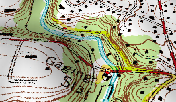
The stream gauging station is given a special symbol (a circle with alternating black-and-white quadrants) on topographic maps produced by the US Geological Survey. "Gauging" can also be spelled "gaging."
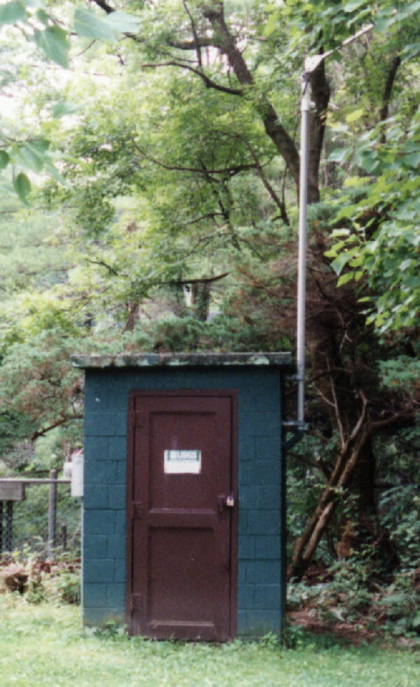
The above photograph shows the equipment shed at the stream gauging site in Monocacy Park near Illick's Mill. It is located at the edge of the main parking lot for the park and the mill. The stream data is transmitted to the US Geological Survey in real time via the antenna, which is attached to the mast on the right side of the building.

This is the sign on the door of the stream gauging equipment shed in Monocacy Park.
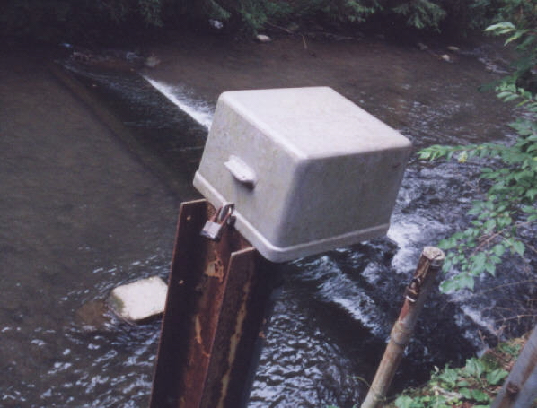
The photograph above shows the weir in the bed of the river
behind the stream gauging equipment shed and some of the equipment used for
measuring the level of the water immediately upstream from the weir. The
level of the water in the river is measured behind the weir. These height
measurements are converted to water flow rates. Flow records for this station can be obtained from the
following URL:
http://nwis.waterdata.usgs.gov/pa/nwis/discharge/?site_no=01452500
The flood of 1955 inundated Illick's Mill Park and large portions of the Lehigh Valley. This link will take you to views of the 1955 flood of the Lehigh and Monocacy Rivers in Bethlehem and will compare photographs of the 1955 flood conditions with more contemporary photographs taken from the same vantage points.

The dam shown in the photo-mosaic above is located at the upstream end of the park. Water cascades down a series of steps on the back face of the dam, aerating the water. A picnic pavilion is located on each bank of the river at the dam site. The dam was constructed in 1936.
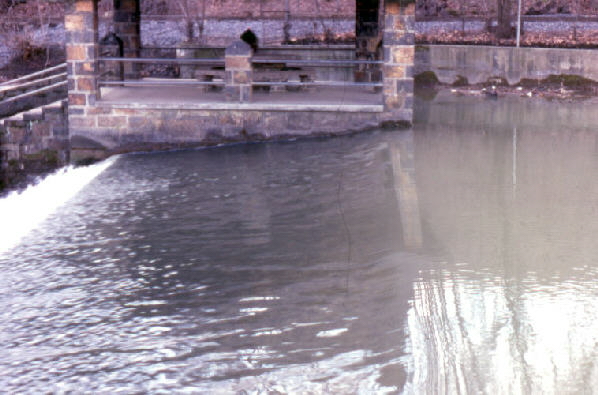
Water flows from right to left across the dam apron and down the stair cascade. The dam is perhaps 15 to 20 feet in height.
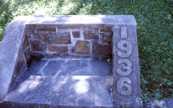
A plaque near the dam base gives the date of construction of the dam as 1936. At that time, residents of the city could dive and swim in the lake which formed upstream of the dam. The lake was sufficiently deep to support diving from the edge of the wall via two diving boards which were installed as part of the dam construction project. Because sedimentation made the lake too shallow to support diving, the two diving boards were removed from the wall of the lake between 1940 and 1945 (personal communication, Bethlehem Parks Department). Today the lake is a shallow mud flat. This is the eventual fate of all lakes, whether they are artificial or natural. Lakes are very temporary geomorphic features.
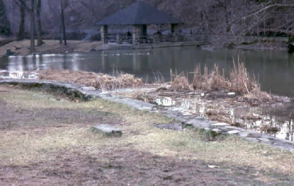
The lake above the dam is almost completely filled with sediment in which grasses and bushes now grow. The stone block in the foreground of the picture is the base of one of the two diving boards that were installed at this location in 1936 as part of the recreation area created by the dam. The diving board was removed between 1940 and 1945 due to excessive sedimentation. The pair of metal ladders (not visible in the above photograph, but see the photograph below) that had been used by divers for climbing out of the deep water today have only a rung or two exposed above a muddy and grassy ground surface. This lake had a useful recreational lifetime of less than 9 years!
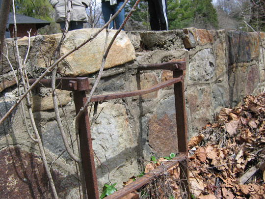
This is one of the two ladders at the swimming site for climbing out of the once-deep water at the diving boards. The ladders now extend only into mud from which various plants are now growing. They now stand in mute testimony to the diving and swimming that occurred at the lake.
End Stop #1 of Field Trip #3
(all photographs by J. Gerencher)