Lehigh Valley Geology Field Trips
Field Trip 1
Stop 1
South Mountain Summit:
Materials, Structure, and Topography of Lehigh Valley
(Click on images to enlarge)
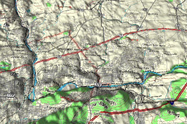
(Source: DeLorme 3-D TopoQuads)
There are three parts to stop 1:
part A to look at the rocks that make up South
Mountain,
part B to view the topography to the north, and, if possible,
part C to see the same topography from the tower of
Iacocca Hall.
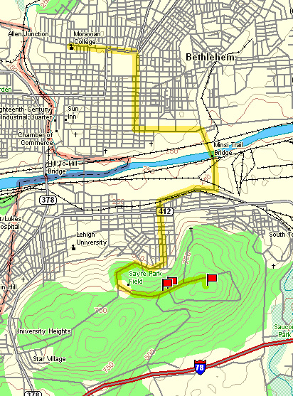
(Source: DeLorme 3-D TopoQuads)
The relief map above shows the topography within the Lehigh Valley. South Mountain is along the bottom
edge. The Lehigh River flows from the northwestern edge (top-left of map)
across the limestone/dolomite valley floor and, where it encounters the more resistant rocks of South
Mountain, turns abruptly to the east
(right).
Stop #1 is located near the summit, which is located near the bottom-center of the
map above.
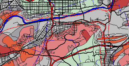
(Source: ArcView GIS Software)
The above map shows the geology of South Mountain and the surrounding area, as well as the streets of Bethlehem. Shades of red are Precambrian in age (older than 570 million years) and shades of gray are Cambrian in age (between 570 and 505 million years). The blue strip is the Lehigh River, which flows toward the east (right).
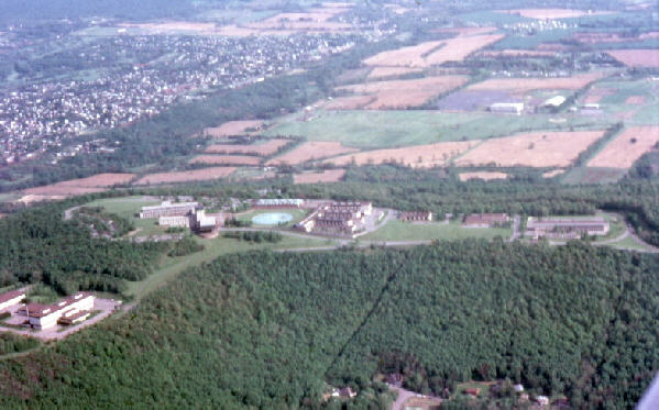
The picture above shows the former Bethlehem Steel Research Center, now the Lehigh University Mountain Top Campus, on South Mountain, which is wooded except for the developed summit area. The view is from the north to the south. Hellertown is in the distance. The low areas on the photograph are underlain by soluble limestone/dolomite.
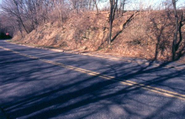
Part A of the three-part stop: the photograph above shows the road-cut that provides easy access for sampling the rocks of South Mountain. Slopes show the effects of creep by the bent tree trunks.
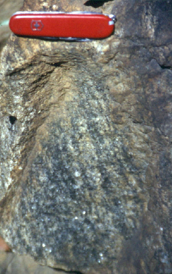
The above photograph shows a closer view of the outcrop in the previous picture. The rocks here may have the appearance of granite, but they are gneisses. Their metamorphic origin is revealed by their coarse-grained foliation, which can be seen in the picture above as the steeply inclined banding that is oriented from upper left to lower right. The date of the metamorphism of the South Mountain rocks was 1 billion (1000 million) years ago, which makes this the oldest rock in the region. It is the "basement" upon which all subsequent rocks were deposited. All these younger rocks were subsequently eroded from above the gneiss to expose it to view. The approximate thickness of the eroded material would total 40,000 feet (8 miles).
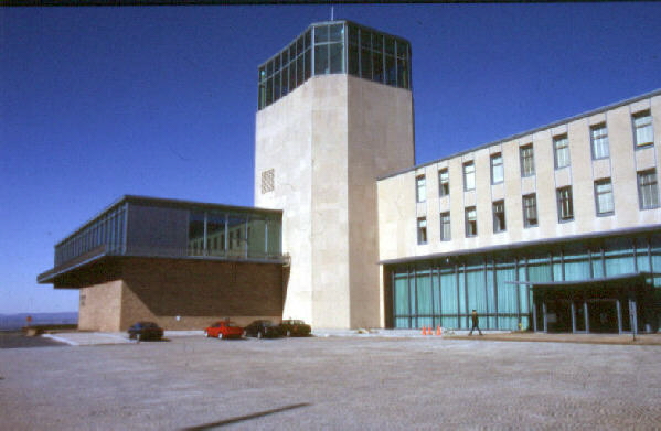
Part C of three-part stop: Iacocca Hall and its observation tower. Access to the tower requires permission, which is obtained at the front desk, just inside the main entrance. Call ahead for reservations, if possible.
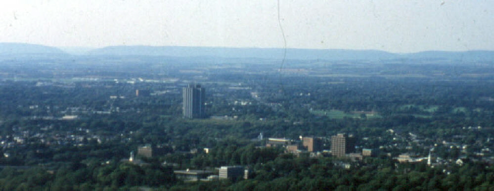
The photograph above shows the view from part B and/or Part C of this three-part stop. The left depression in Blue Ridge Mountain is Lehigh Gap and the right depression is Little Gap, which are stops 4 and 5, respectively, on field trip #2. The valley floor between Blue Ridge (in the distance) and South Mountain (from where the photograph was taken) is at two levels: the lower limestone/dolomite level in the nearer portion and the slightly higher shale level in the farther half of the valley floor.
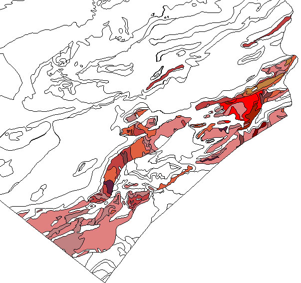
(Source: ArcView GIS Software)
The map above shows the distribution of Precambrian gneisses within the Lehigh County / Northampton County area of the Lehigh Valley. All other rocks are uncolored. Notice there are some small slices of Precambrian gneiss on the valley floor. Field trip #2 will visit the slice near the center of the map and field trip #3 will visit the slice near the upper right corner of the map.
End Stop #1 of Field Trip #1