Lehigh Valley Geology Field Trips
North Field Trip
Topography, Structure and History of Lehigh Valley Rocks of Intermediate Age
(Click on images to enlarge)
(Source: DeLorme 3-D TopoQuads)
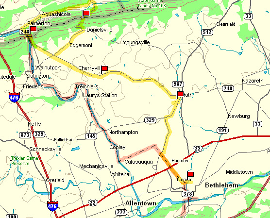
Field trip #2 explores the area to the northwest of Bethlehem.
The locations of the stops are indicated by the red flags on the above map.
Stop #1: Abandoned quarry near Monocacy
River floodplain
Stop #2: Inactive Quarry of Keystone
Portland Cement Co.
Stop #3: Exposure along PA route 248 near
Beersville
Stop #4: Gap of Lehigh River near Palmerton
Stop #5: Little Gap on Blue Ridge Mountain
near Danielsville
The main theme of Field Trip #2 is to determine the nature and timing of the deformation
of the Appalachian Mountains, based upon the exposures seen along the field trip
route. The
sub-themes are as follows:
Stop #1: Lerch's Quarry:
Structures Within The Allentown
Formation
Stop #2: Bath Quarry: Cement
Limestone and Its Deformation
Stop #3: Deformational Features
Within the Martinsburg Formation
Stop #4: Lehigh Water Gap:
Structure and Topography
Stop #5: Devil's Potato Patch in a
Wind Gap: A Geomorphic Extravaganza
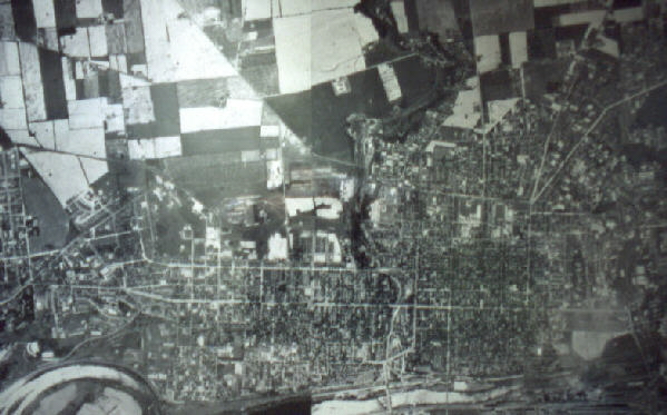
Earliest Aerial Photograph of Lehigh Valley, 1947.
(Source: National Archives)