Lehigh Valley Geology Field Trips
Field Trip 1, Stop 6
Allentown Formation: Soluble Limestones and Dolomites
Caution:
This land was owned by International Paper Corporation and
access was restricted, but in the spring of 2005 the land was sold to O. R. O'Neill, Inc. of Glenn Mills, PA. Access to this property requires permission of the current owners and the signing of a release-of-liability form. Do not go onto this property without previous permission!
(Click on images to enlarge)

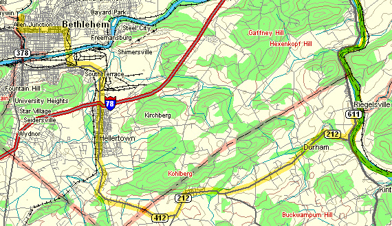
(Source: DeLorme 3-D TopoQuads)
The site is located along PA Route 611, just south of Riegelsville
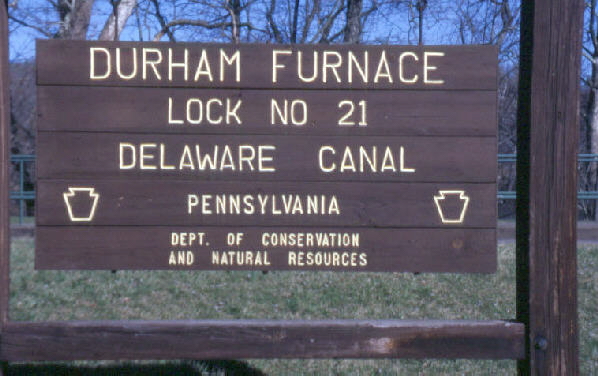
It is located just north of the park at "Lock 21" of the Delaware Canal. It is a lovely site for a picnic.
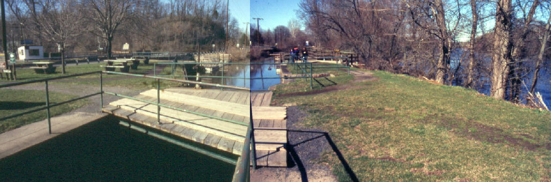
The composite photograph above shows Lock 21, with the Delaware River to the right. This view looks north, so the Delaware River is flowing at you.
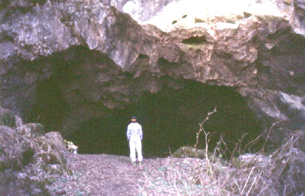
The photograph above shows the dolomite of the Allentown Formation, which is exposed at this site. This is the same rock unit that underlies most of Bethlehem and all of Moravian College's main campus. The Allentown Formation consists of limestone (CaCO3) and dolomite (CaMg(CO3)2), both of which formed as sediments in an ocean and both of which are soluble. In the humid climate of Pennsylvania, caves and other solution features form readily in it. Exposed here is the last chamber of a series of interconnected chambers that were, unfortunately, mined away as part of the local iron making operation during the Colonial American period.
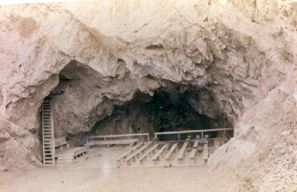
The cave, as it appeared in 1886, when it was used for either (the stories differ) church services or a professional geological meeting, or both.
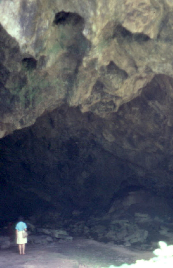
The photograph above is a deliberate overexposure to show portions of the cave interior and ceiling. Portions of the cave ceiling that have fallen onto the cave floor are called breakdown and can be seen on the cave floor to the right. Compare it to the 1886 view.
(Source: DeLorme 3-D TopoQuads)
The route for the trip back to Moravian goes through Springtown and Hellertown.
Related regional geological features NOT seen on this field trip.
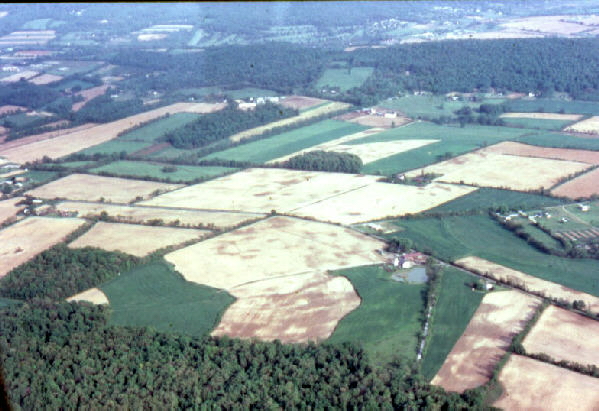
The above photograph, taken of the limestone/dolomite valley floor near the Lehigh Valley International Airport, shows dark mottling of the light fields due to the presence of sinkhole development. Water drains into the depressions and makes those area damper, so they appear darker than the better-drained areas surrounding them. There are no surface streams draining these fields; the water drains into and through the soluble bedrock, creating and expanding an integrated system of sinkholes and caves.
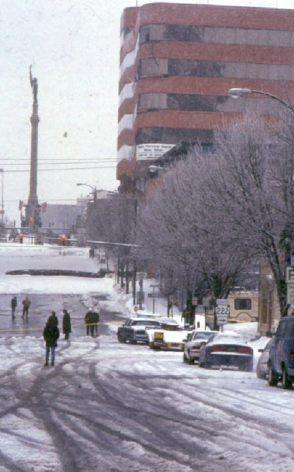
In 1994, the newest building in downtown Allentown, Corporate Plaza, was severely damaged by a sinkhole that developed beneath it. In the view above, a portion of the sinkhole can be seen in the street in front of the building, and the partial collapse of the front of the building has produced the wavy line of windows that look onto to main street. The building was only about 5 years old when this failure occurred.
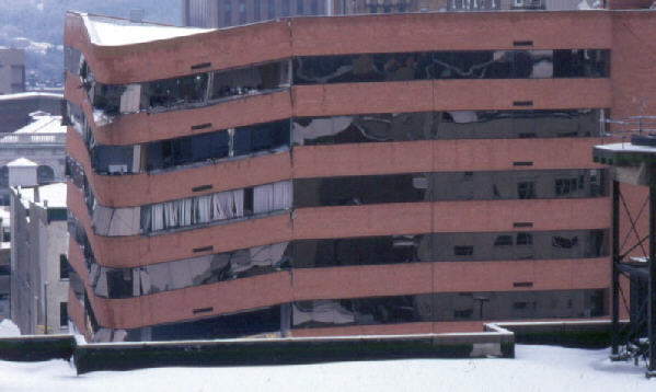
The damage to the Corporate Plaza building was so extensive that it had to be completely demolished. The area is now a parking lot. Soluble limestone/dolomite underlies most of the cities of Allentown, Bethlehem, and Easton.
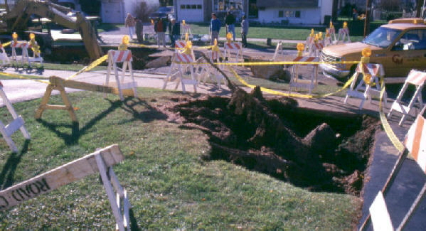
The photograph above shows a sinkhole that has formed in a suburban section of Bethlehem. The failure of the soil caused the tree at the edge of the sidewalk to slowly tilt 45 degrees from the vertical. Only the stump remained at the time the photograph was taken. Homeowner insurance usually does not include damage due to ground movements. Additional insurance specific to damage resulting from sinkhole development can be purchased as part of a homeowner's policy.

The photograph above shows a sinkhole that formed outside the north rear entrance to Comenius Hall in Moravian's main campus. Here workmen repair the sinkhole. Fortunately the sinkhole was not large. Limestone/dolomite underlies Moravian's main campus and the Hurd campus.
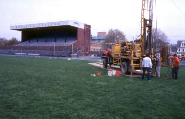
During the summer of 2004, drillers penetrated the soil above the limestone/dolomite bedrock to discover any sinkholes that may have formed beneath the soil cover of the Moravian College football field. None were found, although rock pinnacles were detected.
End Stop #6 of Field Trip #1
(all photographs by J. Gerencher)